Overview for Horrabridge, YELVERTON, PL20 7TN
Introduction
Yelverton is a large village on the south-western edge of Dartmoor, Devon, in England.
When Yelverton railway station (on the Great Western Railway (GWR) line from Plymouth to Tavistock) opened in the 19th century, the village became a popular residence for Plymouth commuters. The railway is now closed, but the Plym Valley Railway has reopened a section of it.
Yelverton is well known for Roborough Rock - a prominent mass of stone close to the Plymouth road on the fringe of nearby Roborough Down, near the southern end of the airfield. It gave its name to the Rock Hotel, built as a farm during the Elizabethan period, but converted in the 1850s to cater for growing tourism in the area. The area to the south and west of the roundabout at the centre of the village was settled in late Victorian and Edwardian times, with many grand and opulent villas. An area developed at about the same time on an odd shaped piece of land to the south of the Tavistock road is known as Leg o' Mutton Corner.
At the beginning of the Second World War, an airfield (RAF Harrowbeer) was constructed at adjacent Harrowbeer as a fighter station for the air defence of Devonport Dockyard and the Western Approaches. A 19th century terrace of houses, now mostly converted into shops, had to have its upper storey removed to provide an easier approach. One tall building which was not altered was St. Paul's Church, but the tower was hit by a plane, resulting in a warning light being fitted. The layout of the runways is still very clear and although they are substantially grassed over, the many earth and brick protective bunkers built to protect the fighters from attack on the ground are all still in place. Some American airmen and anti-aircraft battery units were stationed here during the second half of the war. A plane carrying President Roosevelt landed here when its original destination was fogbound.
To the south of the village is Langton Park, home of Yelverton Bohemians Cricket Club and about 0.5 km south is the accurately named Moorland Garden Hotel serving the Yelverton Golf Club where most of the holes run well down the open moorland to the east. There are several bed and breakfasts in Yelverton, serving the many walkers and visitors to National Trust properties in the area.
Seth Lakeman, the Mercury Music Prize nominee, comes from Yelverton.
Former Sadlers Wells Ballet star Maureen Bruce lives in Yelverton.
The present Ravenscroft Care Home was built as a private house but in the 1930s became Ravenscroft School and during the Second World War was the officers' mess of RAF Harrowbeer.
Summary for Horrabridge, YELVERTON, PL20 7TN
Roadworks near PL20 7TN
Road Safety near PL20 7TN
Details of personal injury accidents in and around PL20 7TN that have been reported to Devon & Cornwall Police over the past 20 years.
Traffic Levels near PL20 7TN
View traffic levels near PL20 7TN from official Department for Transport counts.
Images taken in and around the pl207tn area
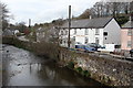
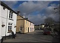
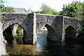
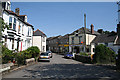
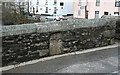
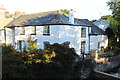
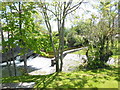
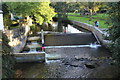
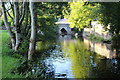
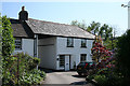
Please click the More button for more images, licensing and image copyright information.
Member of UK Parliament
This postcode is in the Torridge and West Devon parliamentary constituency.
Torridge and West Devon is a constituency in the South West region of England. The seat has been held by Sir Geoffrey Cox (Conservative) since May 2010.

Most Recent House Sales for PL20 7TN
8 Jul 2022
12 Dec 2002
Local Petrol Station Prices
Coordinates for PL20 7TN
Residents at PL20 7TN
Sunrise and Sunset at PL20 7TN
Traffic Emission and Congestion Zones
Historical Weather Summary
| Clear | 5.80% |
| Cloudy | 74.58% |
| Rain | 15.31% |
| Windy | 2.36% |
| Other | 1.95% |
Population
Deprivation Index
the more deprived the postcode
Average Energy Performance
Companies Registered at PL20 7TN
National Park for PL20 7TN
Postcode Details for PL20 7TN
Recent Updates
|
18 Apr 2024 Added Traffic Camera Views from Traffic Scotland to Roadworks within Scotland |
|
15 Apr 2024 Schools Data updated for April 2024 |
|
10 Apr 2024 Companies Data updated for March 2024 |
|
7 Apr 2024 New option to receive automatic updates to roadworks that affect you |
|
7 Apr 2024 Police and Crime data updated for February 2024 |
|
3 Apr 2024 Sold House Price data updated for February 2024 |
|
30 Mar 2024 Energy Performance Certificates (England and Wales) updated February 2024 |
|
28 Mar 2024 New feature to use Geolocating functions to detect your current location |
Random Postcodes
Want an idea of what is in our extensive website? Try somewhere completely random!
The Rural/Urban classification is based upon data collected during the 2011 Census and released in August 2013 and is categorised into 6 distinct classes.
[A] Urban Major conurbation: A built up area with a population of 10,000 (3,000 in Scotland) or more and is assigned to the major conurbation settlement category.
[B] Urban Minor conurbation: A built up area with a population of 10,000 (3,000 in Scotland) or more and is assigned to the minor conurbation settlement category.
[C] Urban City and town: A built up area with a population of 10,000 (3,000 in Scotland) or more and is assigned to the city and town settlement category.
[D] Rural Town and fringe
[E] Rural Village
[F] Rural Hamlet and isolated dwelling
The Index of Multiple Deprivation (IMD) is the official measure of relative deprivation.
The index is based on 39 separate indicators across seven distinct domains (Income; Employment; Health and Disability; Education, Skills and Training; Crime; Barriers to Housing and Services; Living Environment) to provide an overall measure of multiple deprivation and is calculated for every neighbourhood.
The index is relative rather than an absolute scale and so a neighbourhood with a score of 10 is more deprived than one rated 20, but this does not equate to being twice as deprived.
Please note: Different indices are used in England, Scotland, Wales and Northern Ireland and so comparison of scores from neighbourhoods in different countries should not be undertaken.
These figures report on incorporated UK companies only that are registered at this postcode and do not include sole-traders, partnerships or overseas organisations.
The population figure shown for your area are an estimate provided by the Office for National Statistics and is rounded to the nearest 1,000.
The estimates are derived from the Annual Population Survey (APS) which is the Labour Force Survey (LFS) plus various sample boosts.
There are 26 county councils in 2-tier areas, providing services such as education, social services and waste disposal.
In 2-tier areas, each county council area is subdivided into districts, for which there is an independent district council. There are 192 district councils.
District councils are responsible for local services such as rubbish collection, housing and planning applications.