Overview for Forest Approach, PETERBOROUGH, PE8 6XG
Introduction
Peterborough (PEE-tər-bər-ə, -burr-ə) is a cathedral city in the City of Peterborough district of Cambridgeshire, England. The city and its surroundings, the Soke of Peterborough, had an independent county council between 1889 and 1965. It formed part of the short-lived Huntingdon and Peterborough between 1965 and 1974. Before 1889, it was a liberty of Northamptonshire.
The city is 76 mi (122 km) north of London, on the River Nene which flows into the North Sea 30 mi (48 km) to the north-east. The local topography is flat, and in some places, the land lies below sea level, for example in parts of the Fens to the east and to the south of Peterborough. Human settlement in the area began before the Bronze Age, as can be seen at the Flag Fen archaeological site to the east of the current city centre, also with evidence of Roman occupation. The Anglo-Saxon period saw the establishment of a monastery, Medeshamstede, which later became Peterborough Cathedral.
In 2020 the built-up area subdivision had an estimated population of 179,349. In 2021 the Unitary Authority area had a population of 215,671. The population grew rapidly after the railways along with industry, the town became known for brick manufacture, arrived in the 19th century. After the Second World War, industrial employment fell and growth was limited until its designation as a New Town in the 1960s. The town's main economic sectors are financial services and distribution.
Summary for Forest Approach, PETERBOROUGH, PE8 6XG
Roadworks near PE8 6XG
Road Safety near PE8 6XG
Details of personal injury accidents in and around Forest Approach, PE8 6XG that have been reported to Northamptonshire Police over the past 20 years.
Traffic Levels near PE8 6XG
View traffic levels near Forest Approach, PE8 6XG from official Department for Transport counts.
Images taken near to Forest Approach, PE8 6XG and the surrounding area
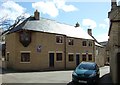
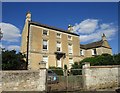
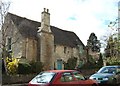
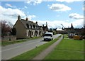
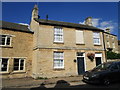
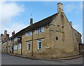
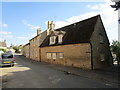
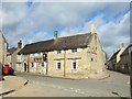
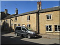
Please click the More button for more images, licensing and image copyright information.
Peterborough and nearby Videos From YouTube
Peterborough Cathedral 'Fly Up'
A drone fly up from the side to view Peterborough Cathedral!
Channel: Peterborough From Above (View Channel)
Published: 23 Nov 2022
Police
This area is policed by Northamptonshire Police.
Northamptonshire Police split their policing area into 34 separate neighbourhoods and this postcode is in the East Northants North neighbourhood.

East Northants North Neighbourhood Crime
Top 3 Categories
For full details of all categories together with more crime information, click on the Details button.
Member of UK Parliament
This postcode is in the Corby parliamentary constituency.
Corby is a constituency in the East Midlands region of England. The seat has been held by Tom Pursglove (Conservative) since May 2015.

Most Recent House Sales for Forest Approach, PE8 6XG
30 Sep 2021
14 Mar 2019
14 Feb 2019
24 Feb 2016
Local Petrol Station Prices
Coordinates for PE8 6XG
Residents at PE8 6XG
Sunrise and Sunset at PE8 6XG
Traffic Emission and Congestion Zones
Historical Weather Summary
| Clear | 21.02% |
| Cloudy | 60.65% |
| Rain | 6.07% |
| Windy | 12.18% |
| Other | 0.08% |
Deprivation Index
the more deprived the postcode
Average Energy Performance
Companies Registered at PE8 6XG
Postcode Details for PE8 6XG
Recent Updates
|
18 Apr 2024 Added Traffic Camera Views from Traffic Scotland to Roadworks within Scotland |
|
15 Apr 2024 Schools Data updated for April 2024 |
|
10 Apr 2024 Companies Data updated for March 2024 |
|
7 Apr 2024 New option to receive automatic updates to roadworks that affect you |
|
7 Apr 2024 Police and Crime data updated for February 2024 |
|
3 Apr 2024 Sold House Price data updated for February 2024 |
|
30 Mar 2024 Energy Performance Certificates (England and Wales) updated February 2024 |
|
28 Mar 2024 New feature to use Geolocating functions to detect your current location |
Random Postcodes
Want an idea of what is in our extensive website? Try somewhere completely random!
The Rural/Urban classification is based upon data collected during the 2011 Census and released in August 2013 and is categorised into 6 distinct classes.
[A] Urban Major conurbation: A built up area with a population of 10,000 (3,000 in Scotland) or more and is assigned to the major conurbation settlement category.
[B] Urban Minor conurbation: A built up area with a population of 10,000 (3,000 in Scotland) or more and is assigned to the minor conurbation settlement category.
[C] Urban City and town: A built up area with a population of 10,000 (3,000 in Scotland) or more and is assigned to the city and town settlement category.
[D] Rural Town and fringe
[E] Rural Village
[F] Rural Hamlet and isolated dwelling
The Index of Multiple Deprivation (IMD) is the official measure of relative deprivation.
The index is based on 39 separate indicators across seven distinct domains (Income; Employment; Health and Disability; Education, Skills and Training; Crime; Barriers to Housing and Services; Living Environment) to provide an overall measure of multiple deprivation and is calculated for every neighbourhood.
The index is relative rather than an absolute scale and so a neighbourhood with a score of 10 is more deprived than one rated 20, but this does not equate to being twice as deprived.
Please note: Different indices are used in England, Scotland, Wales and Northern Ireland and so comparison of scores from neighbourhoods in different countries should not be undertaken.
These figures report on incorporated UK companies only that are registered at this postcode and do not include sole-traders, partnerships or overseas organisations.
The population figure shown for your area are an estimate provided by the Office for National Statistics and is rounded to the nearest 1,000.
The estimates are derived from the Annual Population Survey (APS) which is the Labour Force Survey (LFS) plus various sample boosts.
There are 55 unitary authorities. They provide all local government services in their areas. These are mainly in the cities, urban areas and larger towns although there are now 6 shire county councils that are unitary (ie have no district councils beneath them).