Overview for Railway Road, DOWNHAM MARKET, PE38 9EB
Introduction
Downham Market, sometimes simply referred to as Downham, is a market town and civil parish in Norfolk, England. It lies on the edge of the Fens, on the River Great Ouse, approximately 11 miles south of King's Lynn, 39 miles west of Norwich and 30 miles north of Cambridge.
The civil parish has an area of 5.2 km² and in the 2011 census had a population of 9,994 in 4,637 households.
It was an agricultural centre, developing as a market for the produce of the Fens with a bridge across the Ouse. During the Middle Ages, it was famed for its butter market and also hosted a notable horse fair. The market is now held Fridays and Saturdays.
Notable buildings in the town include its medieval parish church, dedicated to St Edmund, and the Victorian clock tower, constructed in 1878. The town is also known as the place where Charles I hid after the Battle of Naseby. In 2004 the town completed a regeneration project on the Market Place, moving the market to the town hall car park. The decorative town sign depicts the crown and arrows of St Edmund with horses to show the importance of the horse fairs in the town's history.
A heritage centre, Discover Downham, opened in a former fire station in 2016. The town is twinned with Civray, Vienne, France.
Summary for Railway Road, DOWNHAM MARKET, PE38 9EB
Roadworks near PE38 9EB
Road Safety near PE38 9EB
Details of personal injury accidents in and around Railway Road, PE38 9EB that have been reported to Norfolk Constabulary over the past 20 years.
Traffic Levels near PE38 9EB
View traffic levels near Railway Road, PE38 9EB from official Department for Transport counts.
Images taken near to Railway Road, PE38 9EB and the surrounding area
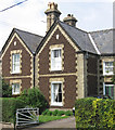
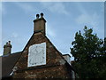
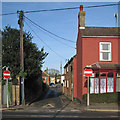
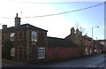
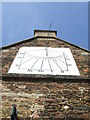
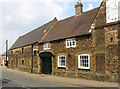
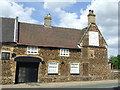
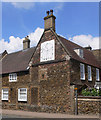
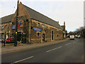
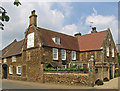
Please click the More button for more images, licensing and image copyright information.
Police
This area is policed by Norfolk Constabulary.
Norfolk Constabulary split their policing area into 49 separate neighbourhoods and this postcode is in the Downham Market neighbourhood.

Downham Market Neighbourhood Crime
Top 3 Categories
For full details of all categories together with more crime information, click on the Details button.
Member of UK Parliament
This postcode is in the South West Norfolk parliamentary constituency.
South West Norfolk is a constituency in the East of England region of England. The seat has been held by Elizabeth Truss (Conservative) since May 2010.

Most Recent House Sales for Railway Road, PE38 9EB
19 Nov 2021
28 Sep 2021
9 Sep 2021
16 Aug 2021
Local Petrol Station Prices
Coordinates for PE38 9EB
Residents at PE38 9EB
Sunrise and Sunset at PE38 9EB
Traffic Emission and Congestion Zones
Historical Weather Summary
| Clear | 9.66% |
| Cloudy | 60.31% |
| Rain | 7.47% |
| Windy | 22.55% |
| Other | 0.01% |
Population
Deprivation Index
the more deprived the postcode
Average Energy Performance
Companies Registered at PE38 9EB
Postcode Details for PE38 9EB
Recent Updates
|
18 Apr 2024 Added Traffic Camera Views from Traffic Scotland to Roadworks within Scotland |
|
15 Apr 2024 Schools Data updated for April 2024 |
|
10 Apr 2024 Companies Data updated for March 2024 |
|
7 Apr 2024 New option to receive automatic updates to roadworks that affect you |
|
7 Apr 2024 Police and Crime data updated for February 2024 |
|
3 Apr 2024 Sold House Price data updated for February 2024 |
|
30 Mar 2024 Energy Performance Certificates (England and Wales) updated February 2024 |
|
28 Mar 2024 New feature to use Geolocating functions to detect your current location |
Random Postcodes
Want an idea of what is in our extensive website? Try somewhere completely random!
The Rural/Urban classification is based upon data collected during the 2011 Census and released in August 2013 and is categorised into 6 distinct classes.
[A] Urban Major conurbation: A built up area with a population of 10,000 (3,000 in Scotland) or more and is assigned to the major conurbation settlement category.
[B] Urban Minor conurbation: A built up area with a population of 10,000 (3,000 in Scotland) or more and is assigned to the minor conurbation settlement category.
[C] Urban City and town: A built up area with a population of 10,000 (3,000 in Scotland) or more and is assigned to the city and town settlement category.
[D] Rural Town and fringe
[E] Rural Village
[F] Rural Hamlet and isolated dwelling
The Index of Multiple Deprivation (IMD) is the official measure of relative deprivation.
The index is based on 39 separate indicators across seven distinct domains (Income; Employment; Health and Disability; Education, Skills and Training; Crime; Barriers to Housing and Services; Living Environment) to provide an overall measure of multiple deprivation and is calculated for every neighbourhood.
The index is relative rather than an absolute scale and so a neighbourhood with a score of 10 is more deprived than one rated 20, but this does not equate to being twice as deprived.
Please note: Different indices are used in England, Scotland, Wales and Northern Ireland and so comparison of scores from neighbourhoods in different countries should not be undertaken.
These figures report on incorporated UK companies only that are registered at this postcode and do not include sole-traders, partnerships or overseas organisations.
The population figure shown for your area are an estimate provided by the Office for National Statistics and is rounded to the nearest 1,000.
The estimates are derived from the Annual Population Survey (APS) which is the Labour Force Survey (LFS) plus various sample boosts.
There are 26 county councils in 2-tier areas, providing services such as education, social services and waste disposal.
In 2-tier areas, each county council area is subdivided into districts, for which there is an independent district council. There are 192 district councils.
District councils are responsible for local services such as rubbish collection, housing and planning applications.