Overview for Glen Road, ISLE OF ISLAY, PA44 7PY
Introduction
Islay is the southernmost island of the Inner Hebrides of Scotland. Known as "The Queen of the Hebrides", it lies in Argyll just south west of Jura and around 40 kilometres (22 nautical miles) north of the Northern Irish coast. The island's capital is Bowmore where the distinctive round Kilarrow Parish Church and a distillery are located. Port Ellen is the main port.
Islay is the fifth-largest Scottish island and the eighth-largest island of the British Isles, with a total area of almost 620 square kilometres (240 sq mi). There is ample evidence of the prehistoric settlement of Islay and the first written reference may have come in the first century AD. The island had become part of the Gaelic Kingdom of Dál Riata during the Early Middle Ages before being absorbed into the Norse Kingdom of the Isles.
The later medieval period marked a "cultural high point" with the transfer of the Hebrides to the Kingdom of Scotland and the emergence of the Clan Donald Lordship of the Isles, originally centred at Finlaggan. During the 17th century the power of Clan Donald waned, but improvements to agriculture and transport led to a rising population, which peaked in the mid-19th century. This was followed by substantial forced displacements and declining resident numbers.
Today, it has over 3,000 inhabitants, and the main commercial activities are agriculture, malt whisky distillation and tourism. The island has a long history of religious observance, and Scottish Gaelic is spoken by about a quarter of the population. Its landscapes have been celebrated through various art forms, and there is a growing interest in renewable energy in the form of wave power. Islay is home to many bird species such as the wintering populations of Greenland white-fronted and barnacle goose, and is a popular destination throughout the year for birdwatchers. The climate is mild and ameliorated by the Gulf Stream.
Summary for Glen Road, ISLE OF ISLAY, PA44 7PY
Roadworks near PA44 7PY
Road Safety near PA44 7PY
Details of personal injury accidents in and around Glen Road, PA44 7PY that have been reported to over the past 20 years.
Traffic Levels near PA44 7PY
View traffic levels near Glen Road, PA44 7PY from official Department for Transport counts.
Images taken near to Glen Road, PA44 7PY and the surrounding area
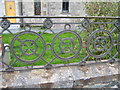
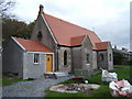
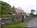
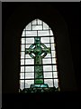
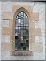
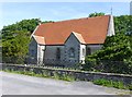
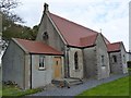
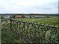
Please click the More button for more images, licensing and image copyright information.
Member of UK Parliament
This postcode is in the Argyll and Bute parliamentary constituency.
Argyll and Bute is a constituency in Scotland. The seat has been held by Brendan O'Hara (Scottish National Party) since May 2015.

Most Recent House Sales for Glen Road, PA44 7PY
No recorded house sales or transfers for this postcode.
Local Petrol Station Prices
Coordinates for PA44 7PY
Sunrise and Sunset at PA44 7PY
Traffic Emission and Congestion Zones
Historical Weather Summary
| Clear | 6.34% |
| Cloudy | 40.86% |
| Rain | 13.86% |
| Windy | 38.90% |
| Other | 0.04% |
Average Energy Performance
Companies Registered at PA44 7PY
Postcode Details for PA44 7PY
Recent Updates
|
18 Apr 2024 Added Traffic Camera Views from Traffic Scotland to Roadworks within Scotland |
|
15 Apr 2024 Schools Data updated for April 2024 |
|
10 Apr 2024 Companies Data updated for March 2024 |
|
7 Apr 2024 New option to receive automatic updates to roadworks that affect you |
|
7 Apr 2024 Police and Crime data updated for February 2024 |
|
3 Apr 2024 Sold House Price data updated for February 2024 |
|
30 Mar 2024 Energy Performance Certificates (England and Wales) updated February 2024 |
|
28 Mar 2024 New feature to use Geolocating functions to detect your current location |
Random Postcodes
Want an idea of what is in our extensive website? Try somewhere completely random!
The Rural/Urban classification is based upon data collected during the 2011 Census and released in August 2013 and is categorised into 6 distinct classes.
[A] Urban Major conurbation: A built up area with a population of 10,000 (3,000 in Scotland) or more and is assigned to the major conurbation settlement category.
[B] Urban Minor conurbation: A built up area with a population of 10,000 (3,000 in Scotland) or more and is assigned to the minor conurbation settlement category.
[C] Urban City and town: A built up area with a population of 10,000 (3,000 in Scotland) or more and is assigned to the city and town settlement category.
[D] Rural Town and fringe
[E] Rural Village
[F] Rural Hamlet and isolated dwelling
The Index of Multiple Deprivation (IMD) is the official measure of relative deprivation.
The index is based on 39 separate indicators across seven distinct domains (Income; Employment; Health and Disability; Education, Skills and Training; Crime; Barriers to Housing and Services; Living Environment) to provide an overall measure of multiple deprivation and is calculated for every neighbourhood.
The index is relative rather than an absolute scale and so a neighbourhood with a score of 10 is more deprived than one rated 20, but this does not equate to being twice as deprived.
Please note: Different indices are used in England, Scotland, Wales and Northern Ireland and so comparison of scores from neighbourhoods in different countries should not be undertaken.
These figures report on incorporated UK companies only that are registered at this postcode and do not include sole-traders, partnerships or overseas organisations.
The population figure shown for your area are an estimate provided by the Office for National Statistics and is rounded to the nearest 1,000.
The estimates are derived from the Annual Population Survey (APS) which is the Labour Force Survey (LFS) plus various sample boosts.
There are 55 unitary authorities. They provide all local government services in their areas. These are mainly in the cities, urban areas and larger towns although there are now 6 shire county councils that are unitary (ie have no district councils beneath them).