Overview for Langham Street, ASHTON-UNDER-LYNE, OL7 9EA
Introduction
Ashton-under-Lyne is a market town in Tameside, Greater Manchester, England. The population was 45,198 at the 2011 census. Historically in Lancashire, it is on the north bank of the River Tame, in the foothills of the Pennines, 6 miles (9.7 km) east of Manchester.
Evidence of Stone Age, Bronze Age, and Viking activity has been discovered in Ashton-under-Lyne. The "Ashton" part of the town's name probably dates from the Anglo-Saxon period, and derives from Old English meaning "settlement by ash trees". The origin of the "under-Lyne" suffix is less clear; it possibly derives from the Brittonic-originating word lemo meaning elm or from Ashton's proximity to the Pennines. In the Middle Ages, Ashton-under-Lyne was a parish and township and Ashton Old Hall was held by the de Asshetons, lords of the manor. Granted a royal charter in 1414, the manor spanned a rural area consisting of marshland, moorland, and a number of villages and hamlets.
Until the introduction of the cotton trade in 1769, Ashton was considered "bare, wet, and almost worthless". The factory system, and textile manufacture during the Industrial Revolution triggered a process of unplanned urbanisation in the area, and by the mid-19th century Ashton had emerged as an important mill town at a convergence of newly constructed canals and railways. Ashton-under-Lyne's transport network allowed for an economic boom in cotton spinning, weaving, and coal mining, which led to the granting of municipal borough status in 1847.
In the mid-20th century, imports of cheaper foreign goods led to the decline of Ashton's heavy industries but the town has continued to thrive as a centre of commerce and Ashton Market is one of the largest outdoor markets in the United Kingdom. Ashton Town Centre is now home to the 140,000-square-foot (13,000 m2), two-floored Ashton Arcades shopping centre (opened 1995), the outdoor shopping complex Ladysmith Shopping Centre, and a large IKEA store.
In 2018, a large new development opened in Ashton town centre including a new college campus for Tameside College, new council offices and a library. Improvements were also made to the open-air market, including new kiosks and stalls. In 2019, work began on a brand-new transport interchange for the town centre to make getting into the town much easier via bus and Metrolink. This opened in August 2020.
Summary for Langham Street, ASHTON-UNDER-LYNE, OL7 9EA
Roadworks near OL7 9EA
Road Safety near OL7 9EA
Details of personal injury accidents in and around Langham Street, OL7 9EA that have been reported to Greater Manchester Police over the past 20 years.
Traffic Levels near OL7 9EA
View traffic levels near Langham Street, OL7 9EA from official Department for Transport counts.
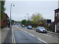
Images taken near to Langham Street, OL7 9EA and the surrounding area
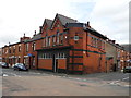
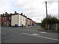
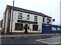
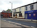
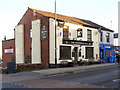
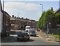
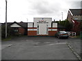
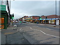

Please click the More button for more images, licensing and image copyright information.
Member of UK Parliament
This postcode is in the Ashton-under-Lyne parliamentary constituency.
Ashton-under-Lyne is a constituency in the North West region of England. The seat has been held by Angela Rayner (Labour) since May 2015.

Most Recent House Sales for Langham Street, OL7 9EA
12 Aug 2022
29 Oct 2021
26 Feb 2021
25 Jan 2019
Local Petrol Station Prices
Coordinates for OL7 9EA
Residents at OL7 9EA
Sunrise and Sunset at OL7 9EA
Traffic Emission and Congestion Zones
Historical Weather Summary
| Clear | 6.19% |
| Cloudy | 76.11% |
| Rain | 13.16% |
| Windy | 3.67% |
| Other | 0.87% |
Population
Deprivation Index
the more deprived the postcode
Average Energy Performance
Companies Registered at OL7 9EA
Postcode Details for OL7 9EA
Recent Updates
|
15 Apr 2024 Schools Data updated for April 2024 |
|
10 Apr 2024 Companies Data updated for March 2024 |
|
7 Apr 2024 New option to receive automatic updates to roadworks that affect you |
|
7 Apr 2024 Police and Crime data updated for February 2024 |
|
3 Apr 2024 Sold House Price data updated for February 2024 |
|
30 Mar 2024 Energy Performance Certificates (England and Wales) updated February 2024 |
|
28 Mar 2024 New feature to use Geolocating functions to detect your current location |
|
17 Mar 2024 Schools Data updated for March 2024 |
Random Postcodes
Want an idea of what is in our extensive website? Try somewhere completely random!
The Rural/Urban classification is based upon data collected during the 2011 Census and released in August 2013 and is categorised into 6 distinct classes.
[A] Urban Major conurbation: A built up area with a population of 10,000 (3,000 in Scotland) or more and is assigned to the major conurbation settlement category.
[B] Urban Minor conurbation: A built up area with a population of 10,000 (3,000 in Scotland) or more and is assigned to the minor conurbation settlement category.
[C] Urban City and town: A built up area with a population of 10,000 (3,000 in Scotland) or more and is assigned to the city and town settlement category.
[D] Rural Town and fringe
[E] Rural Village
[F] Rural Hamlet and isolated dwelling
The Index of Multiple Deprivation (IMD) is the official measure of relative deprivation.
The index is based on 39 separate indicators across seven distinct domains (Income; Employment; Health and Disability; Education, Skills and Training; Crime; Barriers to Housing and Services; Living Environment) to provide an overall measure of multiple deprivation and is calculated for every neighbourhood.
The index is relative rather than an absolute scale and so a neighbourhood with a score of 10 is more deprived than one rated 20, but this does not equate to being twice as deprived.
Please note: Different indices are used in England, Scotland, Wales and Northern Ireland and so comparison of scores from neighbourhoods in different countries should not be undertaken.
These figures report on incorporated UK companies only that are registered at this postcode and do not include sole-traders, partnerships or overseas organisations.
The population figure shown for your area are an estimate provided by the Office for National Statistics and is rounded to the nearest 1,000.
The estimates are derived from the Annual Population Survey (APS) which is the Labour Force Survey (LFS) plus various sample boosts.
There are 36 metropolitan district councils which together cover 6 large urban areas: the counties of Greater Manchester, Merseyside, South Yorkshire, Tyne and Wear, West Midlands, and West Yorkshire.
Metropolitan districts are responsible for all services in their area, although certain conurbation wide services such as fire and civil defence, police, waste disposal and passenger transport are provided through joint authorities (the districts acting jointly).