Overview for Burnedge Lane, OLDHAM, OL4 4EA
Introduction
Oldham is a town in Greater Manchester, England, it lies amongst the Pennines on elevated ground between the rivers Irk and Medlock, 5 miles (8.0 km) southeast of Rochdale and 7 miles (11.3 km) northeast of Manchester. It is the administrative centre of the Metropolitan Borough of Oldham, which had a population of 237,110 in 2019.
Within the boundaries of the historic county of Lancashire, and with little early history to speak of, Oldham rose to prominence in the 19th century as an international centre of textile manufacture. It was a boomtown of the Industrial Revolution, and among the first ever industrialised towns, rapidly becoming "one of the most important centres of cotton and textile industries in England." At its zenith, it was the most productive cotton spinning mill town in the world, producing more cotton than France and Germany combined. Oldham's textile industry fell into decline in the mid-20th century; the town's last mill closed in 1998.
The demise of textile processing in Oldham depressed and heavily affected the local economy. The town centre is the focus of a project that aims to transform Oldham into a centre for further education and the performing arts. It is, however, still distinguished architecturally by the surviving cotton mills and other buildings associated with that industry.
In the 2011 United Kingdom census Oldham Built-up area subdivision, as defined by the Office for National Statistics, had a population of 96,555 and an area of 1,687 hectares (6.51 sq mi), giving a population density of 57.2 inhabitants per hectare (14,800/sq mi), while the Borough of Oldham had a population of 224,897, an area of 14,236 hectares (54.97 sq mi), and a population density of 15.8 inhabitants per hectare (4,100/sq mi).
Summary for Burnedge Lane, OLDHAM, OL4 4EA
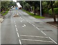
Roadworks near OL4 4EA
Road Safety near OL4 4EA
Details of personal injury accidents in and around Burnedge Lane, OL4 4EA that have been reported to Greater Manchester Police over the past 20 years.
Traffic Levels near OL4 4EA
View traffic levels near Burnedge Lane, OL4 4EA from official Department for Transport counts.
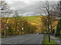
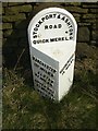
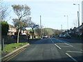
Images taken near to Burnedge Lane, OL4 4EA and the surrounding area
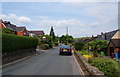
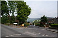
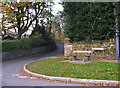
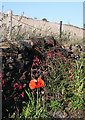
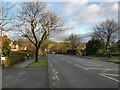
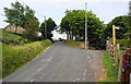
Please click the More button for more images, licensing and image copyright information.
Oldham and nearby Videos From YouTube
4K STOCK DRONE FOOTAGE MACHESTER UNITED, OLD TRAFFORD
Stock drone content available of most UK football stadiums, Manchester United Old Trafford is just one example of some of the ...
Channel: High Flying Drone Shots (View Channel)
Published: 7 Dec 2022
Member of UK Parliament
This postcode is in the Oldham East and Saddleworth parliamentary constituency.
Oldham East and Saddleworth is a constituency in the North West region of England. The seat has been held by Debbie Abrahams (Labour) since January 2011.

Most Recent House Sales for Burnedge Lane, OL4 4EA
13 Dec 2022
25 Nov 2022
17 Aug 2022
24 Feb 2022
Local Petrol Station Prices
Coordinates for OL4 4EA
Residents at OL4 4EA
Sunrise and Sunset at OL4 4EA
Traffic Emission and Congestion Zones
Historical Weather Summary
| Clear | 6.38% |
| Cloudy | 72.55% |
| Rain | 12.54% |
| Windy | 5.93% |
| Other | 2.60% |
Population
Deprivation Index
the more deprived the postcode
Average Energy Performance
Companies Registered at OL4 4EA
Postcode Details for OL4 4EA
Recent Updates
|
18 Apr 2024 Added Traffic Camera Views from Traffic Scotland to Roadworks within Scotland |
|
15 Apr 2024 Schools Data updated for April 2024 |
|
10 Apr 2024 Companies Data updated for March 2024 |
|
7 Apr 2024 New option to receive automatic updates to roadworks that affect you |
|
7 Apr 2024 Police and Crime data updated for February 2024 |
|
3 Apr 2024 Sold House Price data updated for February 2024 |
|
30 Mar 2024 Energy Performance Certificates (England and Wales) updated February 2024 |
|
28 Mar 2024 New feature to use Geolocating functions to detect your current location |
Random Postcodes
Want an idea of what is in our extensive website? Try somewhere completely random!
The Rural/Urban classification is based upon data collected during the 2011 Census and released in August 2013 and is categorised into 6 distinct classes.
[A] Urban Major conurbation: A built up area with a population of 10,000 (3,000 in Scotland) or more and is assigned to the major conurbation settlement category.
[B] Urban Minor conurbation: A built up area with a population of 10,000 (3,000 in Scotland) or more and is assigned to the minor conurbation settlement category.
[C] Urban City and town: A built up area with a population of 10,000 (3,000 in Scotland) or more and is assigned to the city and town settlement category.
[D] Rural Town and fringe
[E] Rural Village
[F] Rural Hamlet and isolated dwelling
The Index of Multiple Deprivation (IMD) is the official measure of relative deprivation.
The index is based on 39 separate indicators across seven distinct domains (Income; Employment; Health and Disability; Education, Skills and Training; Crime; Barriers to Housing and Services; Living Environment) to provide an overall measure of multiple deprivation and is calculated for every neighbourhood.
The index is relative rather than an absolute scale and so a neighbourhood with a score of 10 is more deprived than one rated 20, but this does not equate to being twice as deprived.
Please note: Different indices are used in England, Scotland, Wales and Northern Ireland and so comparison of scores from neighbourhoods in different countries should not be undertaken.
These figures report on incorporated UK companies only that are registered at this postcode and do not include sole-traders, partnerships or overseas organisations.
The population figure shown for your area are an estimate provided by the Office for National Statistics and is rounded to the nearest 1,000.
The estimates are derived from the Annual Population Survey (APS) which is the Labour Force Survey (LFS) plus various sample boosts.
There are 36 metropolitan district councils which together cover 6 large urban areas: the counties of Greater Manchester, Merseyside, South Yorkshire, Tyne and Wear, West Midlands, and West Yorkshire.
Metropolitan districts are responsible for all services in their area, although certain conurbation wide services such as fire and civil defence, police, waste disposal and passenger transport are provided through joint authorities (the districts acting jointly).