Overview for Edenfield Road, ROCHDALE, OL11 5TT
Introduction
Rochdale (ROTCH-dayl) is a town in Greater Manchester, England, and the administrative centre of the Metropolitan Borough of Rochdale. In the 2021 census the town had a population of 111,261, compared to 223,773 for the wider borough. Rochdale is in the foothills of the South Pennines and lies in the dale (valley) of the River Roch, 5 miles (8 km) northwest of Oldham and 10 miles (16 km) northeast of Manchester.
Rochdale's recorded history begins with an entry in the Domesday Book of 1086 as "Recedham Manor". The ancient parish of Rochdale was a division of the Salford Hundred and one of the larger ecclesiastical parishes in England, comprising several townships. By 1251, the town had become of such importance that it was granted a royal charter.
The town became a centre of northern England's woollen trade, and by the early 18th century was described as being "remarkable for its many wealthy merchants". In the 19th century it became a mill town and centre for textile manufacture during the Industrial Revolution. The town is historically within Lancashire, and was a county borough within the county prior to 1974.
Summary for Edenfield Road, ROCHDALE, OL11 5TT
Roadworks near OL11 5TT
Road Safety near OL11 5TT
Details of personal injury accidents in and around Edenfield Road, OL11 5TT that have been reported to Greater Manchester Police over the past 20 years.
Traffic Levels near OL11 5TT
View traffic levels near Edenfield Road, OL11 5TT from official Department for Transport counts.
Images taken near to Edenfield Road, OL11 5TT and the surrounding area
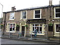
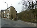
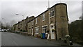
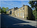
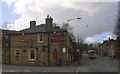
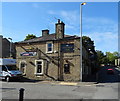
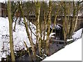
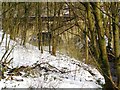
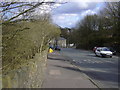
Please click the More button for more images, licensing and image copyright information.
Rochdale and nearby Videos From YouTube
Delph drone footage kings arms 4k DJI mini 2
some practice drone flying hope u like it.
Channel: jam201984 (View Channel)
Published: 15 Apr 2022
Member of UK Parliament
This postcode is in the Heywood and Middleton parliamentary constituency.
Heywood and Middleton is a constituency in the North West region of England. The seat has been held by Chris Clarkson (Conservative) since December 2019.

Most Recent House Sales for Edenfield Road, OL11 5TT
30 Sep 2021
29 Aug 2019
4 Nov 2011
27 Feb 2007
Local Petrol Station Prices
Coordinates for OL11 5TT
Residents at OL11 5TT
Sunrise and Sunset at OL11 5TT
Traffic Emission and Congestion Zones
Historical Weather Summary
| Clear | 5.96% |
| Cloudy | 76.18% |
| Rain | 12.97% |
| Windy | 4.43% |
| Other | 0.46% |
Population
Deprivation Index
the more deprived the postcode
Average Energy Performance
Companies Registered at OL11 5TT
Postcode Details for OL11 5TT
Recent Updates
|
15 Apr 2024 Schools Data updated for April 2024 |
|
10 Apr 2024 Companies Data updated for March 2024 |
|
7 Apr 2024 New option to receive automatic updates to roadworks that affect you |
|
7 Apr 2024 Police and Crime data updated for February 2024 |
|
3 Apr 2024 Sold House Price data updated for February 2024 |
|
30 Mar 2024 Energy Performance Certificates (England and Wales) updated February 2024 |
|
28 Mar 2024 New feature to use Geolocating functions to detect your current location |
|
17 Mar 2024 Schools Data updated for March 2024 |
Random Postcodes
Want an idea of what is in our extensive website? Try somewhere completely random!
The Rural/Urban classification is based upon data collected during the 2011 Census and released in August 2013 and is categorised into 6 distinct classes.
[A] Urban Major conurbation: A built up area with a population of 10,000 (3,000 in Scotland) or more and is assigned to the major conurbation settlement category.
[B] Urban Minor conurbation: A built up area with a population of 10,000 (3,000 in Scotland) or more and is assigned to the minor conurbation settlement category.
[C] Urban City and town: A built up area with a population of 10,000 (3,000 in Scotland) or more and is assigned to the city and town settlement category.
[D] Rural Town and fringe
[E] Rural Village
[F] Rural Hamlet and isolated dwelling
The Index of Multiple Deprivation (IMD) is the official measure of relative deprivation.
The index is based on 39 separate indicators across seven distinct domains (Income; Employment; Health and Disability; Education, Skills and Training; Crime; Barriers to Housing and Services; Living Environment) to provide an overall measure of multiple deprivation and is calculated for every neighbourhood.
The index is relative rather than an absolute scale and so a neighbourhood with a score of 10 is more deprived than one rated 20, but this does not equate to being twice as deprived.
Please note: Different indices are used in England, Scotland, Wales and Northern Ireland and so comparison of scores from neighbourhoods in different countries should not be undertaken.
These figures report on incorporated UK companies only that are registered at this postcode and do not include sole-traders, partnerships or overseas organisations.
The population figure shown for your area are an estimate provided by the Office for National Statistics and is rounded to the nearest 1,000.
The estimates are derived from the Annual Population Survey (APS) which is the Labour Force Survey (LFS) plus various sample boosts.
There are 36 metropolitan district councils which together cover 6 large urban areas: the counties of Greater Manchester, Merseyside, South Yorkshire, Tyne and Wear, West Midlands, and West Yorkshire.
Metropolitan districts are responsible for all services in their area, although certain conurbation wide services such as fire and civil defence, police, waste disposal and passenger transport are provided through joint authorities (the districts acting jointly).