Overview for Burnham Road, FAKENHAM, NR21 9LB
Introduction
Fakenham is a market town and civil parish in Norfolk, England. It is situated on the River Wensum, about 25 miles (40 kilometres) north west of Norwich. The town is the junction of several local roads, including the A148 from King's Lynn to Cromer, the A1067 to Norwich and the A1065 to Swaffham.
The civil parish has an area of 3.49 sq mi (9.0 km2) and in the 2001 census had a population of 7,357 in 3,292 households, the population increasing to 7,617 at the 2011 census. For the purposes of local government, the parish falls within the district of North Norfolk.
Fakenham has been a market town since 1250, particularly known for its corn, barley and wheat trading, and in the 19th century it became noted for its printing. Fakenham Racecourse is a thoroughbred horse racing venue to the south of Fakenham.
The town has a long name of Fakenham Lancaster which derives from the ownership of the manor in 1377 being transferred to John of Gaunt, the Duke of Lancaster. The name continues to be used today, including on recently placed history trail plaques around the town, and also the two wards that cover the town, for the purpose of electing councillors to North Norfolk District Council, are called Lancaster North and Lancaster South.
Summary for Burnham Road, FAKENHAM, NR21 9LB
Roadworks near NR21 9LB
Road Safety near NR21 9LB
Details of personal injury accidents in and around Burnham Road, NR21 9LB that have been reported to Norfolk Constabulary over the past 20 years.
Traffic Levels near NR21 9LB
View traffic levels near Burnham Road, NR21 9LB from official Department for Transport counts.
Images taken near to Burnham Road, NR21 9LB and the surrounding area
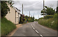
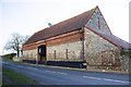
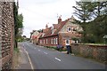
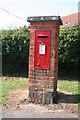
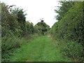
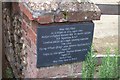
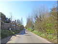
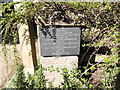
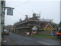
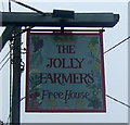
Please click the More button for more images, licensing and image copyright information.
Police
This area is policed by Norfolk Constabulary.
Norfolk Constabulary split their policing area into 49 separate neighbourhoods and this postcode is in the Hunstanton and Burnham neighbourhood.

Hunstanton and Burnham Neighbourhood Crime
Top 3 Categories
For full details of all categories together with more crime information, click on the Details button.
Member of UK Parliament
This postcode is in the North West Norfolk parliamentary constituency.
North West Norfolk is a constituency in the East of England region of England. The seat has been held by James Wild (Conservative) since December 2019.

Most Recent House Sales for Burnham Road, NR21 9LB
1 Aug 2022
9 Nov 2020
26 Apr 2019
25 May 2018
Local Petrol Station Prices
Coordinates for NR21 9LB
Residents at NR21 9LB
Sunrise and Sunset at NR21 9LB
Traffic Emission and Congestion Zones
Historical Weather Summary
| Clear | 8.89% |
| Cloudy | 49.05% |
| Rain | 7.09% |
| Windy | 34.92% |
| Other | 0.05% |
Population
Deprivation Index
the more deprived the postcode
Average Energy Performance
Companies Registered at NR21 9LB
Postcode Details for NR21 9LB
Recent Updates
|
18 Apr 2024 Added Traffic Camera Views from Traffic Scotland to Roadworks within Scotland |
|
15 Apr 2024 Schools Data updated for April 2024 |
|
10 Apr 2024 Companies Data updated for March 2024 |
|
7 Apr 2024 New option to receive automatic updates to roadworks that affect you |
|
7 Apr 2024 Police and Crime data updated for February 2024 |
|
3 Apr 2024 Sold House Price data updated for February 2024 |
|
30 Mar 2024 Energy Performance Certificates (England and Wales) updated February 2024 |
|
28 Mar 2024 New feature to use Geolocating functions to detect your current location |
Random Postcodes
Want an idea of what is in our extensive website? Try somewhere completely random!
The Rural/Urban classification is based upon data collected during the 2011 Census and released in August 2013 and is categorised into 6 distinct classes.
[A] Urban Major conurbation: A built up area with a population of 10,000 (3,000 in Scotland) or more and is assigned to the major conurbation settlement category.
[B] Urban Minor conurbation: A built up area with a population of 10,000 (3,000 in Scotland) or more and is assigned to the minor conurbation settlement category.
[C] Urban City and town: A built up area with a population of 10,000 (3,000 in Scotland) or more and is assigned to the city and town settlement category.
[D] Rural Town and fringe
[E] Rural Village
[F] Rural Hamlet and isolated dwelling
The Index of Multiple Deprivation (IMD) is the official measure of relative deprivation.
The index is based on 39 separate indicators across seven distinct domains (Income; Employment; Health and Disability; Education, Skills and Training; Crime; Barriers to Housing and Services; Living Environment) to provide an overall measure of multiple deprivation and is calculated for every neighbourhood.
The index is relative rather than an absolute scale and so a neighbourhood with a score of 10 is more deprived than one rated 20, but this does not equate to being twice as deprived.
Please note: Different indices are used in England, Scotland, Wales and Northern Ireland and so comparison of scores from neighbourhoods in different countries should not be undertaken.
These figures report on incorporated UK companies only that are registered at this postcode and do not include sole-traders, partnerships or overseas organisations.
The population figure shown for your area are an estimate provided by the Office for National Statistics and is rounded to the nearest 1,000.
The estimates are derived from the Annual Population Survey (APS) which is the Labour Force Survey (LFS) plus various sample boosts.
There are 26 county councils in 2-tier areas, providing services such as education, social services and waste disposal.
In 2-tier areas, each county council area is subdivided into districts, for which there is an independent district council. There are 192 district councils.
District councils are responsible for local services such as rubbish collection, housing and planning applications.