Overview for Newchurch, CHEPSTOW, NP16 6DA
Introduction
Chepstow is a town and community in Monmouthshire, Wales, adjoining the border with Gloucestershire, England. It is located on the tidal River Wye, about 2 miles (3 km) above its confluence with the River Severn, and adjoining the western end of the Severn Bridge. It is the easternmost settlement in Wales, situated 16 miles (26 km) east of Newport, 28 miles (45 km) east-northeast of Cardiff, 18 miles (29 km) northwest of Bristol and 110 miles (180 km) west of London.
Chepstow Castle, situated on a clifftop above the Wye and its bridge, is often cited as the oldest surviving stone castle in Britain. The castle was established by William FitzOsbern immediately after the Norman conquest, and was extended in later centuries before becoming ruined after the Civil War. A Benedictine priory was also established within the walled town, which was the centre of the Marcher lordship of Striguil. The port of Chepstow became noted in the Middle Ages for its imports of wine, and also became a major centre for the export of timber and bark, from nearby woodland in the Wye Valley and Forest of Dean. In the late eighteenth century the town was a focus of early tourism as part of the "Wye Tour", and the tourist industry remains important. Other important industries included shipbuilding – one of the First World War National Shipyards was established in the town – and heavy engineering, including the prefabrication of bridges and wind turbine towers. Chepstow is also well known for its racecourse, which has hosted the Welsh National each year since 1949.
The town had a population of 10,821 according to the 2001 census, increasing to 12,350 at the 2011 census. It is served by the M48 motorway, and its accessibility to the cities of Bristol, Newport and Cardiff means it has a large number of commuters. It is administered as part of Monmouthshire County Council, and is within the Monmouth UK parliamentary constituency and Senedd constituency. Chepstow is on the western bank of the Wye, while adjoining villages on the eastern bank of the river, Tutshill and Sedbury, are in England. The population of the built-up area including these villages was 16,169 in 2011.
Summary for Newchurch, CHEPSTOW, NP16 6DA
Roadworks near NP16 6DA
A local roadworks feed is not available for Wales at this time.
However, Traffic Wales/Traffig Cymru provide works details for motorways and major trunk roads in Wales on their website at traffic.wales/roadworks
Road Safety near NP16 6DA
Details of personal injury accidents in and around NP16 6DA that have been reported to Gwent Police over the past 20 years.
Traffic Levels near NP16 6DA
View traffic levels near NP16 6DA from official Department for Transport counts.
Images taken in and around the np166da area
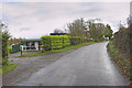
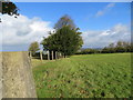
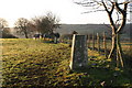
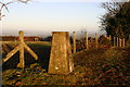
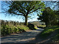
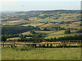
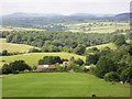
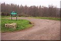
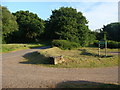
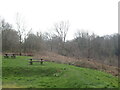
Please click the More button for more images, licensing and image copyright information.
Member of UK Parliament
This postcode is in the Monmouth parliamentary constituency.
Monmouth is a constituency in Wales. The seat has been held by David T C Davies (Conservative) since May 2010.

Most Recent House Sales for NP16 6DA
2 May 2018
30 Jun 2005
6 Jan 2004
12 Jul 2002
Local Petrol Station Prices
Coordinates for NP16 6DA
Residents at NP16 6DA
Sunrise and Sunset at NP16 6DA
Traffic Emission and Congestion Zones
Historical Weather Summary
| Clear | 19.49% |
| Cloudy | 65.05% |
| Rain | 7.52% |
| Windy | 7.79% |
| Other | 0.15% |
Population
Deprivation Index
the more deprived the postcode
Average Energy Performance
Companies Registered at NP16 6DA
Postcode Details for NP16 6DA
Recent Updates
|
18 Apr 2024 Added Traffic Camera Views from Traffic Scotland to Roadworks within Scotland |
|
15 Apr 2024 Schools Data updated for April 2024 |
|
10 Apr 2024 Companies Data updated for March 2024 |
|
7 Apr 2024 New option to receive automatic updates to roadworks that affect you |
|
7 Apr 2024 Police and Crime data updated for February 2024 |
|
3 Apr 2024 Sold House Price data updated for February 2024 |
|
30 Mar 2024 Energy Performance Certificates (England and Wales) updated February 2024 |
|
28 Mar 2024 New feature to use Geolocating functions to detect your current location |
Random Postcodes
Want an idea of what is in our extensive website? Try somewhere completely random!
The Rural/Urban classification is based upon data collected during the 2011 Census and released in August 2013 and is categorised into 6 distinct classes.
[A] Urban Major conurbation: A built up area with a population of 10,000 (3,000 in Scotland) or more and is assigned to the major conurbation settlement category.
[B] Urban Minor conurbation: A built up area with a population of 10,000 (3,000 in Scotland) or more and is assigned to the minor conurbation settlement category.
[C] Urban City and town: A built up area with a population of 10,000 (3,000 in Scotland) or more and is assigned to the city and town settlement category.
[D] Rural Town and fringe
[E] Rural Village
[F] Rural Hamlet and isolated dwelling
The Index of Multiple Deprivation (IMD) is the official measure of relative deprivation.
The index is based on 39 separate indicators across seven distinct domains (Income; Employment; Health and Disability; Education, Skills and Training; Crime; Barriers to Housing and Services; Living Environment) to provide an overall measure of multiple deprivation and is calculated for every neighbourhood.
The index is relative rather than an absolute scale and so a neighbourhood with a score of 10 is more deprived than one rated 20, but this does not equate to being twice as deprived.
Please note: Different indices are used in England, Scotland, Wales and Northern Ireland and so comparison of scores from neighbourhoods in different countries should not be undertaken.
These figures report on incorporated UK companies only that are registered at this postcode and do not include sole-traders, partnerships or overseas organisations.
The population figure shown for your area are an estimate provided by the Office for National Statistics and is rounded to the nearest 1,000.
The estimates are derived from the Annual Population Survey (APS) which is the Labour Force Survey (LFS) plus various sample boosts.
There are 55 unitary authorities. They provide all local government services in their areas. These are mainly in the cities, urban areas and larger towns although there are now 6 shire county councils that are unitary (ie have no district councils beneath them).