Overview for Adams Close, WELLINGBOROUGH, NN9 6TQ
Introduction
Wellingborough (WEL-ing-bər-ə) is a market town and civil parish in the North Northamptonshire unitary authority area of Northamptonshire, England. It is 65 miles (105 km) from London and 11 miles (18 km) from Northampton, and is on the north side of the River Nene.
Originally named "Wendelingburgh" (the stronghold of Wændel's people), the Anglo-Saxon settlement is mentioned in the Domesday Book of 1086 as "Wendelburie". The town's market was granted a royal charter in 1201 by King John. At the 2021 census, it had a population of 56,564. The built-up area also includes suburbs Wilby, Great Doddington, Little Irchester, Redhill Grange, Stanton Cross and Glenvale Park.
Summary for Adams Close, WELLINGBOROUGH, NN9 6TQ
Roadworks near NN9 6TQ
Road Safety near NN9 6TQ
Details of personal injury accidents in and around Adams Close, NN9 6TQ that have been reported to Northamptonshire Police over the past 20 years.
Traffic Levels near NN9 6TQ
View traffic levels near Adams Close, NN9 6TQ from official Department for Transport counts.
Images taken near to Adams Close, NN9 6TQ and the surrounding area
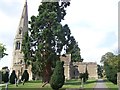
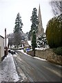
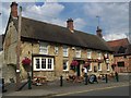
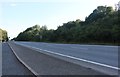
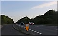
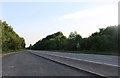

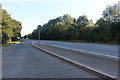
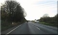
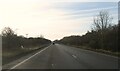
Please click the More button for more images, licensing and image copyright information.
Police
This area is policed by Northamptonshire Police.
Northamptonshire Police split their policing area into 34 separate neighbourhoods and this postcode is in the East Northants Central neighbourhood.

East Northants Central Neighbourhood Crime
Top 3 Categories
For full details of all categories together with more crime information, click on the Details button.
Member of UK Parliament
This postcode is in the Corby parliamentary constituency.
Corby is a constituency in the East Midlands region of England. The seat has been held by Tom Pursglove (Conservative) since May 2015.

Most Recent House Sales for Adams Close, NN9 6TQ
20 Dec 2022
19 Dec 2022
6 Nov 2020
18 Dec 2015
Local Petrol Station Prices
Coordinates for NN9 6TQ
Residents at NN9 6TQ
Sunrise and Sunset at NN9 6TQ
Traffic Emission and Congestion Zones
Historical Weather Summary
| Clear | 21.20% |
| Cloudy | 63.05% |
| Rain | 6.11% |
| Windy | 9.56% |
| Other | 0.08% |
Deprivation Index
the more deprived the postcode
Average Energy Performance
Companies Registered at NN9 6TQ
Postcode Details for NN9 6TQ
Recent Updates
|
18 Apr 2024 Added Traffic Camera Views from Traffic Scotland to Roadworks within Scotland |
|
15 Apr 2024 Schools Data updated for April 2024 |
|
10 Apr 2024 Companies Data updated for March 2024 |
|
7 Apr 2024 New option to receive automatic updates to roadworks that affect you |
|
7 Apr 2024 Police and Crime data updated for February 2024 |
|
3 Apr 2024 Sold House Price data updated for February 2024 |
|
30 Mar 2024 Energy Performance Certificates (England and Wales) updated February 2024 |
|
28 Mar 2024 New feature to use Geolocating functions to detect your current location |
Random Postcodes
Want an idea of what is in our extensive website? Try somewhere completely random!
The Rural/Urban classification is based upon data collected during the 2011 Census and released in August 2013 and is categorised into 6 distinct classes.
[A] Urban Major conurbation: A built up area with a population of 10,000 (3,000 in Scotland) or more and is assigned to the major conurbation settlement category.
[B] Urban Minor conurbation: A built up area with a population of 10,000 (3,000 in Scotland) or more and is assigned to the minor conurbation settlement category.
[C] Urban City and town: A built up area with a population of 10,000 (3,000 in Scotland) or more and is assigned to the city and town settlement category.
[D] Rural Town and fringe
[E] Rural Village
[F] Rural Hamlet and isolated dwelling
The Index of Multiple Deprivation (IMD) is the official measure of relative deprivation.
The index is based on 39 separate indicators across seven distinct domains (Income; Employment; Health and Disability; Education, Skills and Training; Crime; Barriers to Housing and Services; Living Environment) to provide an overall measure of multiple deprivation and is calculated for every neighbourhood.
The index is relative rather than an absolute scale and so a neighbourhood with a score of 10 is more deprived than one rated 20, but this does not equate to being twice as deprived.
Please note: Different indices are used in England, Scotland, Wales and Northern Ireland and so comparison of scores from neighbourhoods in different countries should not be undertaken.
These figures report on incorporated UK companies only that are registered at this postcode and do not include sole-traders, partnerships or overseas organisations.
The population figure shown for your area are an estimate provided by the Office for National Statistics and is rounded to the nearest 1,000.
The estimates are derived from the Annual Population Survey (APS) which is the Labour Force Survey (LFS) plus various sample boosts.
There are 55 unitary authorities. They provide all local government services in their areas. These are mainly in the cities, urban areas and larger towns although there are now 6 shire county councils that are unitary (ie have no district councils beneath them).