Overview for Westcott Way, NORTHAMPTON, NN3 3BE
Introduction
Northampton is a market town and civil parish in Northamptonshire, England. It is the county town of Northamptonshire and the administrative centre of the unitary authority of West Northamptonshire. The town is situated on the River Nene, 60 miles (97 km) north-west of London and 50 miles (80 km) south-east of Birmingham. Northampton is one of the largest towns in England; the population of its urban area was recorded as 245,899 in the 2021 census.
Archaeological evidence of settlement in the area dates to the Bronze Age, Romans and Anglo-Saxons. In the Middle Ages, the town rose to national significance with the establishment of Northampton Castle, an occasional royal residence which regularly hosted the Parliament of England. Medieval Northampton had many churches, monasteries and the University of Northampton, all enclosed by the town walls. It was granted a town charter by Richard I in 1189 and a mayor was appointed by King John in 1215. The town was also the site of two medieval battles, in 1264 and 1460.
The town largely supported the Parliamentary Roundheads during the English Civil War, which prompted Charles II to order the destruction of the town walls and most of the castle. The Great Fire of Northampton in 1675 also destroyed much of the historic town. Northampton was soon rebuilt and grew rapidly with the industrial development of the 18th century. The town continued to expand with the arrival of the Grand Union Canal and the railways in the 19th century, becoming a centre for footwear and leather manufacture.
Growth was limited following the World Wars until it was designated a New Town in 1968, accelerating development which has continued into the 21st century. Northampton unsuccessfully applied for city status three times; in 2000, 2002 and 2022.
Summary for Westcott Way, NORTHAMPTON, NN3 3BE
Roadworks near NN3 3BE
Road Safety near NN3 3BE
Details of personal injury accidents in and around Westcott Way, NN3 3BE that have been reported to Northamptonshire Police over the past 20 years.
Traffic Levels near NN3 3BE
View traffic levels near Westcott Way, NN3 3BE from official Department for Transport counts.
Images taken near to Westcott Way, NN3 3BE and the surrounding area
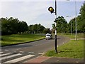
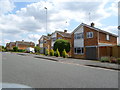
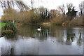
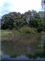
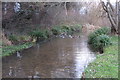
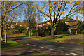
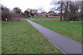
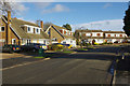
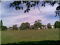
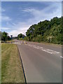
Please click the More button for more images, licensing and image copyright information.
Northampton and nearby Videos From YouTube
Countryside Walk 🚶♂️
Walking towards nice village in Northamptonshire. Hubsan zino mini pro drone video. Drone category less than 250 grams.
Channel: Drone Fun (View Channel)
Published: 25 Mar 2022
Police
This area is policed by Northamptonshire Police.
Northamptonshire Police split their policing area into 34 separate neighbourhoods and this postcode is in the Northampton North East neighbourhood.

Northampton North East Neighbourhood Crime
Top 3 Categories
For full details of all categories together with more crime information, click on the Details button.
Member of UK Parliament
This postcode is in the Northampton South parliamentary constituency.
Northampton South is a constituency in the East Midlands region of England. The seat has been held by Andrew Lewer (Conservative) since June 2017.

Most Recent House Sales for Westcott Way, NN3 3BE
25 May 2023
6 Apr 2023
9 Dec 2022
7 Jul 2022
Local Petrol Station Prices
Coordinates for NN3 3BE
Residents at NN3 3BE
Sunrise and Sunset at NN3 3BE
Traffic Emission and Congestion Zones
Historical Weather Summary
| Clear | 21.01% |
| Cloudy | 63.81% |
| Rain | 6.21% |
| Windy | 8.85% |
| Other | 0.12% |
Deprivation Index
the more deprived the postcode
Average Energy Performance
Companies Registered at NN3 3BE
Postcode Details for NN3 3BE
Recent Updates
|
18 Apr 2024 Added Traffic Camera Views from Traffic Scotland to Roadworks within Scotland |
|
15 Apr 2024 Schools Data updated for April 2024 |
|
10 Apr 2024 Companies Data updated for March 2024 |
|
7 Apr 2024 New option to receive automatic updates to roadworks that affect you |
|
7 Apr 2024 Police and Crime data updated for February 2024 |
|
3 Apr 2024 Sold House Price data updated for February 2024 |
|
30 Mar 2024 Energy Performance Certificates (England and Wales) updated February 2024 |
|
28 Mar 2024 New feature to use Geolocating functions to detect your current location |
Random Postcodes
Want an idea of what is in our extensive website? Try somewhere completely random!
The Rural/Urban classification is based upon data collected during the 2011 Census and released in August 2013 and is categorised into 6 distinct classes.
[A] Urban Major conurbation: A built up area with a population of 10,000 (3,000 in Scotland) or more and is assigned to the major conurbation settlement category.
[B] Urban Minor conurbation: A built up area with a population of 10,000 (3,000 in Scotland) or more and is assigned to the minor conurbation settlement category.
[C] Urban City and town: A built up area with a population of 10,000 (3,000 in Scotland) or more and is assigned to the city and town settlement category.
[D] Rural Town and fringe
[E] Rural Village
[F] Rural Hamlet and isolated dwelling
The Index of Multiple Deprivation (IMD) is the official measure of relative deprivation.
The index is based on 39 separate indicators across seven distinct domains (Income; Employment; Health and Disability; Education, Skills and Training; Crime; Barriers to Housing and Services; Living Environment) to provide an overall measure of multiple deprivation and is calculated for every neighbourhood.
The index is relative rather than an absolute scale and so a neighbourhood with a score of 10 is more deprived than one rated 20, but this does not equate to being twice as deprived.
Please note: Different indices are used in England, Scotland, Wales and Northern Ireland and so comparison of scores from neighbourhoods in different countries should not be undertaken.
These figures report on incorporated UK companies only that are registered at this postcode and do not include sole-traders, partnerships or overseas organisations.
The population figure shown for your area are an estimate provided by the Office for National Statistics and is rounded to the nearest 1,000.
The estimates are derived from the Annual Population Survey (APS) which is the Labour Force Survey (LFS) plus various sample boosts.
There are 55 unitary authorities. They provide all local government services in their areas. These are mainly in the cities, urban areas and larger towns although there are now 6 shire county councils that are unitary (ie have no district councils beneath them).