Overview for Southfields, SLEAFORD, NG34 7LB
Introduction
Sleaford is a market town and civil parish in the North Kesteven district of Lincolnshire, England. Centred on the former parish of New Sleaford, the modern boundaries and urban area include Quarrington to the south-west, Holdingham to the north and Old Sleaford to the east. The town is on the edge of the fertile Fenlands, 11 miles (18 kilometres) north-east of Grantham, 16 mi (26 km) west of Boston, and 17 mi (27 km) south of Lincoln. Its population of 17,671 at the 2011 Census made it the largest settlement in the North Kesteven district; it is the district's administrative centre. Bypassed by the A17 and the A15, it is linked to Lincoln, Newark, Peterborough, Grantham and King's Lynn.
The first settlement formed in the Iron Age where a prehistoric track crossed the River Slea. It was a tribal centre and home to a mint for the Corieltauvi in the 1st centuries BC and AD. Evidence of Roman and Anglo-Saxon settlement has been found. The medieval records differentiate between Old and New Sleaford, the latter emerging by the 12th century around the present-day market place and St Denys' Church; Sleaford Castle was also built at that time for the Bishops of Lincoln, who owned the manor. Granted the right to hold a market in the mid-12th century, New Sleaford developed into a market town and became locally important in the wool trade, while Old Sleaford declined.
From the 16th century, the landowning Carre family kept tight control over the town – it grew little in the early modern period. The manor passed from the Carre family to the Hervey family by the marriage of Isabella Carre to John Hervey, 1st Earl of Bristol in 1688. The town's common land and fields were legally enclosed by 1794, giving ownership mostly to the Hervey family. This coincided with canalisation of the Slea. The Sleaford Navigation brought economic growth until it was superseded by the railways in the mid-1850s. In the 20th century, the sale of farmland around Sleaford led to the development of large housing estates.
Sleaford was mainly an agricultural town until the 20th century with a cattle market. Seed companies such as Hubbard and Phillips and Sharpes International were established in the late 19th century. The arrival of the railway made the town favourable for malting, but the industry has since declined. In 2011, the commonest occupations were in wholesale and retail trading, health and social care, public administration, defence and manufacturing. Regeneration of the town centre has helped to regenerate the earlier industrial areas, including construction of the National Centre for Craft & Design (The Hub) on an old wharf.
Summary for Southfields, SLEAFORD, NG34 7LB
Roadworks near NG34 7LB
Road Safety near NG34 7LB
Details of personal injury accidents in and around Southfields, NG34 7LB that have been reported to Lincolnshire Police over the past 20 years.
Traffic Levels near NG34 7LB
View traffic levels near Southfields, NG34 7LB from official Department for Transport counts.
Images taken near to Southfields, NG34 7LB and the surrounding area
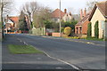
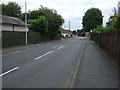
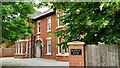
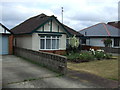
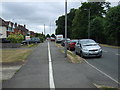
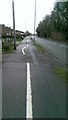
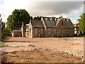
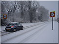
Please click the More button for more images, licensing and image copyright information.
Police
This area is policed by Lincolnshire Police.
Lincolnshire Police split their policing area into 58 separate neighbourhoods and this postcode is in the Sleaford Town neighbourhood.

Sleaford Town Neighbourhood Crime
Top 3 Categories
For full details of all categories together with more crime information, click on the Details button.
Member of UK Parliament
This postcode is in the Sleaford and North Hykeham parliamentary constituency.
Sleaford and North Hykeham is a constituency in the East Midlands region of England. The seat has been held by Dr Caroline Johnson (Conservative) since December 2016.

Most Recent House Sales for Southfields, NG34 7LB
7 Sep 2022
12 Jan 2022
12 Nov 2021
18 Jun 2021
Local Petrol Station Prices
Coordinates for NG34 7LB
Residents at NG34 7LB
Sunrise and Sunset at NG34 7LB
Traffic Emission and Congestion Zones
Historical Weather Summary
| Clear | 9.56% |
| Cloudy | 54.39% |
| Rain | 8.29% |
| Windy | 27.76% |
| Other | 0.00% |
Population
Deprivation Index
the more deprived the postcode
Average Energy Performance
Companies Registered at NG34 7LB
Postcode Details for NG34 7LB
Recent Updates
|
18 Apr 2024 Added Traffic Camera Views from Traffic Scotland to Roadworks within Scotland |
|
15 Apr 2024 Schools Data updated for April 2024 |
|
10 Apr 2024 Companies Data updated for March 2024 |
|
7 Apr 2024 New option to receive automatic updates to roadworks that affect you |
|
7 Apr 2024 Police and Crime data updated for February 2024 |
|
3 Apr 2024 Sold House Price data updated for February 2024 |
|
30 Mar 2024 Energy Performance Certificates (England and Wales) updated February 2024 |
|
28 Mar 2024 New feature to use Geolocating functions to detect your current location |
Random Postcodes
Want an idea of what is in our extensive website? Try somewhere completely random!
The Rural/Urban classification is based upon data collected during the 2011 Census and released in August 2013 and is categorised into 6 distinct classes.
[A] Urban Major conurbation: A built up area with a population of 10,000 (3,000 in Scotland) or more and is assigned to the major conurbation settlement category.
[B] Urban Minor conurbation: A built up area with a population of 10,000 (3,000 in Scotland) or more and is assigned to the minor conurbation settlement category.
[C] Urban City and town: A built up area with a population of 10,000 (3,000 in Scotland) or more and is assigned to the city and town settlement category.
[D] Rural Town and fringe
[E] Rural Village
[F] Rural Hamlet and isolated dwelling
The Index of Multiple Deprivation (IMD) is the official measure of relative deprivation.
The index is based on 39 separate indicators across seven distinct domains (Income; Employment; Health and Disability; Education, Skills and Training; Crime; Barriers to Housing and Services; Living Environment) to provide an overall measure of multiple deprivation and is calculated for every neighbourhood.
The index is relative rather than an absolute scale and so a neighbourhood with a score of 10 is more deprived than one rated 20, but this does not equate to being twice as deprived.
Please note: Different indices are used in England, Scotland, Wales and Northern Ireland and so comparison of scores from neighbourhoods in different countries should not be undertaken.
These figures report on incorporated UK companies only that are registered at this postcode and do not include sole-traders, partnerships or overseas organisations.
The population figure shown for your area are an estimate provided by the Office for National Statistics and is rounded to the nearest 1,000.
The estimates are derived from the Annual Population Survey (APS) which is the Labour Force Survey (LFS) plus various sample boosts.
There are 26 county councils in 2-tier areas, providing services such as education, social services and waste disposal.
In 2-tier areas, each county council area is subdivided into districts, for which there is an independent district council. There are 192 district councils.
District councils are responsible for local services such as rubbish collection, housing and planning applications.