Overview for Longhorsley, MORPETH, NE65 8RF
Introduction
Morpeth is a historic market town in Northumberland, North East England, lying on the River Wansbeck. Nearby towns include Ashington and Bedlington. In the 2011 census, the population of Morpeth was given as 14,017, up from 13,833 in the 2001 census. The earliest evidence of settlement is believed to be from the Neolithic period, and some Roman artifacts have also been found. The first written mention of the town is from 1080, when the de Merlay family was granted the barony of Morpeth. The meaning of the town's name is uncertain, but it may refer to its position on the road to Scotland and a murder which occurred on that road. The de Merlay family built two castles in the town in the late 11th century and the 13th century. The town was granted its coat of arms in 1552. By the mid-1700s it had become one of the main markets in England, having been granted a market charter in 1200, but the opening of the railways in the 1800s led the market to decline. The town's history is celebrated in the annual Northumbrian Gathering.
Morpeth is governed by Northumberland County Council and Morpeth Town Council. The town is split into three wards – North, Kirkhill and Stobhill – for the purposes of parish elections. In 2008 the town suffered a severe flood, which was repeated in 2012, resulting in the construction of new flood defences. Morpeth railway station is on the east coast line and a curve to the south of it has caused several rail crashes. Several sports teams compete in Morpeth, with Morpeth Town A.
F.
C. having been the winner of the FA Vase in 2016. The town hosted its own Olympics from 1873 to 1958. Two middle schools, a high school and seven first schools are situated in Morpeth, as well as several churches of Anglican, Roman Catholic, United Reformed and Methodist denominations. Morpeth's Carlisle Park, the recipient of several awards, contains one of the four floral clocks in England.
Summary for Longhorsley, MORPETH, NE65 8RF
Roadworks near NE65 8RF
Road Safety near NE65 8RF
Details of personal injury accidents in and around NE65 8RF that have been reported to Northumbria Police over the past 20 years.
Traffic Levels near NE65 8RF
View traffic levels near NE65 8RF from official Department for Transport counts.
Images taken in and around the ne658rf area
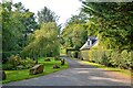
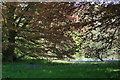
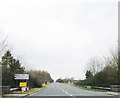
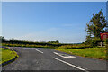
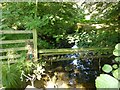
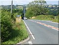
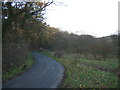
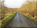
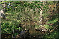
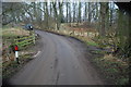
Please click the More button for more images, licensing and image copyright information.
Police
This area is policed by Northumbria Police.
Northumbria Police split their policing area into 35 separate neighbourhoods and this postcode is in the Morpeth neighbourhood.

Morpeth Neighbourhood Crime
Top 3 Categories
For full details of all categories together with more crime information, click on the Details button.
Member of UK Parliament
This postcode is in the Berwick-upon-Tweed parliamentary constituency.
Berwick-upon-Tweed is a constituency in the North East region of England. The seat has been held by Anne-Marie Trevelyan (Conservative) since May 2015.

Most Recent House Sales for NE65 8RF
5 Sep 2014
Local Petrol Station Prices
Coordinates for NE65 8RF
Residents at NE65 8RF
Sunrise and Sunset at NE65 8RF
Traffic Emission and Congestion Zones
Historical Weather Summary
| Clear | 8.31% |
| Cloudy | 51.30% |
| Rain | 10.18% |
| Windy | 29.58% |
| Other | 0.63% |
Population
Deprivation Index
the more deprived the postcode
Average Energy Performance
Companies Registered at NE65 8RF
Postcode Details for NE65 8RF
Recent Updates
|
18 Apr 2024 Added Traffic Camera Views from Traffic Scotland to Roadworks within Scotland |
|
15 Apr 2024 Schools Data updated for April 2024 |
|
10 Apr 2024 Companies Data updated for March 2024 |
|
7 Apr 2024 New option to receive automatic updates to roadworks that affect you |
|
7 Apr 2024 Police and Crime data updated for February 2024 |
|
3 Apr 2024 Sold House Price data updated for February 2024 |
|
30 Mar 2024 Energy Performance Certificates (England and Wales) updated February 2024 |
|
28 Mar 2024 New feature to use Geolocating functions to detect your current location |
Random Postcodes
Want an idea of what is in our extensive website? Try somewhere completely random!
The Rural/Urban classification is based upon data collected during the 2011 Census and released in August 2013 and is categorised into 6 distinct classes.
[A] Urban Major conurbation: A built up area with a population of 10,000 (3,000 in Scotland) or more and is assigned to the major conurbation settlement category.
[B] Urban Minor conurbation: A built up area with a population of 10,000 (3,000 in Scotland) or more and is assigned to the minor conurbation settlement category.
[C] Urban City and town: A built up area with a population of 10,000 (3,000 in Scotland) or more and is assigned to the city and town settlement category.
[D] Rural Town and fringe
[E] Rural Village
[F] Rural Hamlet and isolated dwelling
The Index of Multiple Deprivation (IMD) is the official measure of relative deprivation.
The index is based on 39 separate indicators across seven distinct domains (Income; Employment; Health and Disability; Education, Skills and Training; Crime; Barriers to Housing and Services; Living Environment) to provide an overall measure of multiple deprivation and is calculated for every neighbourhood.
The index is relative rather than an absolute scale and so a neighbourhood with a score of 10 is more deprived than one rated 20, but this does not equate to being twice as deprived.
Please note: Different indices are used in England, Scotland, Wales and Northern Ireland and so comparison of scores from neighbourhoods in different countries should not be undertaken.
These figures report on incorporated UK companies only that are registered at this postcode and do not include sole-traders, partnerships or overseas organisations.
The population figure shown for your area are an estimate provided by the Office for National Statistics and is rounded to the nearest 1,000.
The estimates are derived from the Annual Population Survey (APS) which is the Labour Force Survey (LFS) plus various sample boosts.
There are 55 unitary authorities. They provide all local government services in their areas. These are mainly in the cities, urban areas and larger towns although there are now 6 shire county councils that are unitary (ie have no district councils beneath them).