Overview for Coatbridge Road, COATBRIDGE, ML5 2PU
Introduction
Coatbridge is a town in North Lanarkshire, Scotland, about 8+1⁄2 miles (14 kilometres) east of Glasgow city centre, set in the central Lowlands. Along with neighbouring town Airdrie, Coatbridge forms the area known as the Monklands (population approximately 90,000 including outlying settlements), often considered to be part of the Greater Glasgow urban area – although officially they have not been included in population figures since 2016 due to small gaps between the Monklands and Glasgow built-up areas.
In the last years of the 18th century, the area developed from a loose collection of hamlets into the town of Coatbridge. The town's development and growth have been intimately connected with the technological advances of the Industrial Revolution, and in particular with the hot blast process. Coatbridge was a major Scottish centre for iron works and coal mining during the 19th century and was then described as 'the industrial heartland of Scotland' and the 'Iron Burgh'.
Coatbridge also had a notorious reputation for air pollution and the worst excesses of industry. However, by the 1920s, coal seams were exhausted and the iron industry in Coatbridge was in rapid decline. After the Great Depression, the Gartsherrie ironwork was the last remaining iron works in the town. One publication has commented that in modern-day Coatbridge "coal, iron and steel have all been consigned to the heritage scrap heap".
Summary for Coatbridge Road, COATBRIDGE, ML5 2PU
Roadworks near ML5 2PU
Road Safety near ML5 2PU
Details of personal injury accidents in and around Coatbridge Road, ML5 2PU that have been reported to over the past 20 years.
Traffic Levels near ML5 2PU
View traffic levels near Coatbridge Road, ML5 2PU from official Department for Transport counts.
Images taken near to Coatbridge Road, ML5 2PU and the surrounding area
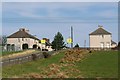
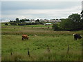
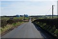
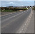
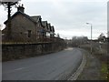
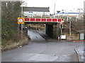
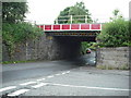
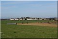
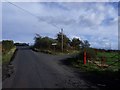
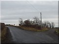
Please click the More button for more images, licensing and image copyright information.
Member of UK Parliament
This postcode is in the Coatbridge, Chryston and Bellshill parliamentary constituency.
Coatbridge, Chryston and Bellshill is a constituency in Scotland. The seat has been held by Steven Bonnar (Scottish National Party) since December 2019.

Most Recent House Sales for Coatbridge Road, ML5 2PU
No recorded house sales or transfers for this postcode.
Local Petrol Station Prices
Coordinates for ML5 2PU
Sunrise and Sunset at ML5 2PU
Traffic Emission and Congestion Zones
Historical Weather Summary
| Clear | 6.33% |
| Cloudy | 71.42% |
| Rain | 12.96% |
| Windy | 8.31% |
| Other | 0.98% |
Average Energy Performance
Companies Registered at ML5 2PU
Postcode Details for ML5 2PU
Recent Updates
|
18 Apr 2024 Added Traffic Camera Views from Traffic Scotland to Roadworks within Scotland |
|
15 Apr 2024 Schools Data updated for April 2024 |
|
10 Apr 2024 Companies Data updated for March 2024 |
|
7 Apr 2024 New option to receive automatic updates to roadworks that affect you |
|
7 Apr 2024 Police and Crime data updated for February 2024 |
|
3 Apr 2024 Sold House Price data updated for February 2024 |
|
30 Mar 2024 Energy Performance Certificates (England and Wales) updated February 2024 |
|
28 Mar 2024 New feature to use Geolocating functions to detect your current location |
Random Postcodes
Want an idea of what is in our extensive website? Try somewhere completely random!
The Rural/Urban classification is based upon data collected during the 2011 Census and released in August 2013 and is categorised into 6 distinct classes.
[A] Urban Major conurbation: A built up area with a population of 10,000 (3,000 in Scotland) or more and is assigned to the major conurbation settlement category.
[B] Urban Minor conurbation: A built up area with a population of 10,000 (3,000 in Scotland) or more and is assigned to the minor conurbation settlement category.
[C] Urban City and town: A built up area with a population of 10,000 (3,000 in Scotland) or more and is assigned to the city and town settlement category.
[D] Rural Town and fringe
[E] Rural Village
[F] Rural Hamlet and isolated dwelling
The Index of Multiple Deprivation (IMD) is the official measure of relative deprivation.
The index is based on 39 separate indicators across seven distinct domains (Income; Employment; Health and Disability; Education, Skills and Training; Crime; Barriers to Housing and Services; Living Environment) to provide an overall measure of multiple deprivation and is calculated for every neighbourhood.
The index is relative rather than an absolute scale and so a neighbourhood with a score of 10 is more deprived than one rated 20, but this does not equate to being twice as deprived.
Please note: Different indices are used in England, Scotland, Wales and Northern Ireland and so comparison of scores from neighbourhoods in different countries should not be undertaken.
These figures report on incorporated UK companies only that are registered at this postcode and do not include sole-traders, partnerships or overseas organisations.
The population figure shown for your area are an estimate provided by the Office for National Statistics and is rounded to the nearest 1,000.
The estimates are derived from the Annual Population Survey (APS) which is the Labour Force Survey (LFS) plus various sample boosts.
There are 55 unitary authorities. They provide all local government services in their areas. These are mainly in the cities, urban areas and larger towns although there are now 6 shire county councils that are unitary (ie have no district councils beneath them).