Overview for McCourt Gardens, BELLSHILL, ML4 1QB
Introduction
Bellshill is a town in North Lanarkshire in Scotland, ten miles (sixteen kilometres) southeast of Glasgow city centre and 37 mi (60 km) west of Edinburgh. Other nearby localities are Motherwell 2 mi (3 km) to the south, Hamilton 3 mi (5 km) to the southwest, Viewpark 1+1⁄2 mi (2.5 km) to the west, Holytown 2 mi (3 km) to the east and Coatbridge 3 mi (5 km) to the north. The town of Bellshill itself (including the villages of Orbiston and Mossend) has a population of about 20,650. From 1996 to 2016, it was considered to be part of the Greater Glasgow metropolitan area; since then it is counted as part of a continuous suburban settlement anchored by Motherwell with a total population of around 125,000.
Summary for McCourt Gardens, BELLSHILL, ML4 1QB
Roadworks near ML4 1QB
Road Safety near ML4 1QB
Details of personal injury accidents in and around McCourt Gardens, ML4 1QB that have been reported to over the past 20 years.
Traffic Levels near ML4 1QB
View traffic levels near McCourt Gardens, ML4 1QB from official Department for Transport counts.
Images taken near to McCourt Gardens, ML4 1QB and the surrounding area
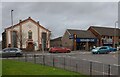
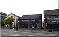
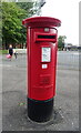
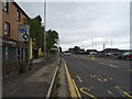
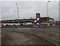

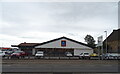
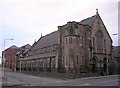
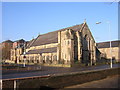

Please click the More button for more images, licensing and image copyright information.
Member of UK Parliament
This postcode is in the Motherwell and Wishaw parliamentary constituency.
Motherwell and Wishaw is a constituency in Scotland. The seat has been held by Marion Fellows (Scottish National Party) since May 2015.

Most Recent House Sales for McCourt Gardens, ML4 1QB
No recorded house sales or transfers for this postcode.
Local Petrol Station Prices
Coordinates for ML4 1QB
Sunrise and Sunset at ML4 1QB
Traffic Emission and Congestion Zones
Historical Weather Summary
| Clear | 7.40% |
| Cloudy | 74.68% |
| Rain | 12.61% |
| Windy | 4.26% |
| Other | 1.05% |
Average Energy Performance
Companies Registered at ML4 1QB
Postcode Details for ML4 1QB
Recent Updates
|
18 Apr 2024 Added Traffic Camera Views from Traffic Scotland to Roadworks within Scotland |
|
15 Apr 2024 Schools Data updated for April 2024 |
|
10 Apr 2024 Companies Data updated for March 2024 |
|
7 Apr 2024 New option to receive automatic updates to roadworks that affect you |
|
7 Apr 2024 Police and Crime data updated for February 2024 |
|
3 Apr 2024 Sold House Price data updated for February 2024 |
|
30 Mar 2024 Energy Performance Certificates (England and Wales) updated February 2024 |
|
28 Mar 2024 New feature to use Geolocating functions to detect your current location |
Random Postcodes
Want an idea of what is in our extensive website? Try somewhere completely random!
The Rural/Urban classification is based upon data collected during the 2011 Census and released in August 2013 and is categorised into 6 distinct classes.
[A] Urban Major conurbation: A built up area with a population of 10,000 (3,000 in Scotland) or more and is assigned to the major conurbation settlement category.
[B] Urban Minor conurbation: A built up area with a population of 10,000 (3,000 in Scotland) or more and is assigned to the minor conurbation settlement category.
[C] Urban City and town: A built up area with a population of 10,000 (3,000 in Scotland) or more and is assigned to the city and town settlement category.
[D] Rural Town and fringe
[E] Rural Village
[F] Rural Hamlet and isolated dwelling
The Index of Multiple Deprivation (IMD) is the official measure of relative deprivation.
The index is based on 39 separate indicators across seven distinct domains (Income; Employment; Health and Disability; Education, Skills and Training; Crime; Barriers to Housing and Services; Living Environment) to provide an overall measure of multiple deprivation and is calculated for every neighbourhood.
The index is relative rather than an absolute scale and so a neighbourhood with a score of 10 is more deprived than one rated 20, but this does not equate to being twice as deprived.
Please note: Different indices are used in England, Scotland, Wales and Northern Ireland and so comparison of scores from neighbourhoods in different countries should not be undertaken.
These figures report on incorporated UK companies only that are registered at this postcode and do not include sole-traders, partnerships or overseas organisations.
The population figure shown for your area are an estimate provided by the Office for National Statistics and is rounded to the nearest 1,000.
The estimates are derived from the Annual Population Survey (APS) which is the Labour Force Survey (LFS) plus various sample boosts.
There are 55 unitary authorities. They provide all local government services in their areas. These are mainly in the cities, urban areas and larger towns although there are now 6 shire county councils that are unitary (ie have no district councils beneath them).