Overview for Deeping Gate, MILTON KEYNES, MK13 0DE
Introduction
Milton Keynes (KEENZ) is a city and the largest settlement in Buckinghamshire, England, about 50 miles (80 km) north-west of London. At the 2021 Census, the population of its urban area was 264,349. The River Great Ouse forms the northern boundary of the urban area; a tributary, the River Ouzel, meanders through its linear parks and balancing lakes. Approximately 25% of the urban area is parkland or woodland and includes two Sites of Special Scientific Interest (SSSIs).
In the 1960s, the UK government decided that a further generation of new towns in the South East of England was needed to relieve housing congestion in London. This new town (in planning documents, 'new city'), Milton Keynes, was to be the biggest yet, with a target population of 250,000 and a 'designated area' of about 22,000 acres (9,000 ha). At designation, its area incorporated the existing towns of Bletchley, Fenny Stratford, Wolverton and Stony Stratford, along with another fifteen villages and farmland in between. These settlements had an extensive historical record since the Norman conquest; detailed archaeological investigations prior to development revealed evidence of human occupation from the Neolithic period to modern times, including in particular the Milton Keynes Hoard of Bronze Age gold jewellery. The government established Milton Keynes Development Corporation (MKDC) to design and deliver this new city. The Corporation decided on a softer, more human-scaled landscape than in the earlier English new towns but with an emphatically modernist architecture. Recognising how traditional towns and cities had become choked in traffic, they established a 'relaxed' grid of distributor roads about 1 kilometre (0.62 mi) between edges, leaving the spaces between to develop more organically. An extensive network of shared paths for leisure cyclists and pedestrians criss-crosses through and between them. Again rejecting the residential tower blocks that had been so recently fashionable but unloved, they set a height limit of three storeys outside the planned centre.
Facilities include a 1,400-seat theatre, a municipal art gallery, two multiplex cinemas, an ecumenical central church, a 400-seat concert hall, a teaching hospital, a 30,500-seat football stadium, an indoor ski-slope and a 65,000-capacity open-air concert venue. Seven railway stations serve the Milton Keynes urban area (one inter-city). The Open University is based here and there is a small campus of the University of Bedfordshire. Most major sports are represented at amateur level; Red Bull Racing (Formula One), MK Dons (association football), and Milton Keynes Lightning (ice hockey) are its professional teams. The Peace Pagoda overlooking Willen Lake was the first such to be built in Europe. The many works of sculpture in parks and public spaces include the iconic Concrete Cows at Milton Keynes Museum.
Milton Keynes is among the most economically productive localities in the UK, ranking highly against a number of criteria. It has the UK's fifth-highest number of business startups per capita (but equally of business failures). It is home to several major national and international companies. Despite economic success and personal wealth for some, there are pockets of nationally significant poverty. The employment profile is composed of about 90% service industries and 9% manufacturing.
On 15 August 2022, the Crown Office announced that the Queen had ordained by letters patent that the (then) Borough of Milton Keynes should have city status.
Summary for Deeping Gate, MILTON KEYNES, MK13 0DE
Roadworks near MK13 0DE
Road Safety near MK13 0DE
Details of personal injury accidents in and around Deeping Gate, MK13 0DE that have been reported to Thames Valley Police over the past 20 years.
Traffic Levels near MK13 0DE
View traffic levels near Deeping Gate, MK13 0DE from official Department for Transport counts.
Images taken near to Deeping Gate, MK13 0DE and the surrounding area
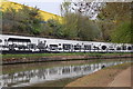
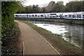
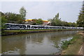

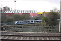
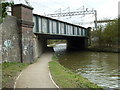
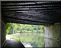
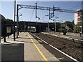
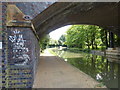
Please click the More button for more images, licensing and image copyright information.
Milton Keynes and nearby Videos From YouTube
Campbell Park Xiaomi Mi 4K Drone Flight
The Weather was beautiful so I took the Drone for a spin. Xiaomi Mi 4K GPS Drone. Campbell Park,Milton Keynes,United ...
Channel: Nik Shand (View Channel)
Published: 21 Apr 2018
Police
This area is policed by Thames Valley Police.
Thames Valley Police split their policing area into 108 separate neighbourhoods and this postcode is in the Stony Stratford and Wolverton neighbourhood.

Stony Stratford and Wolverton Neighbourhood Crime
Top 3 Categories
For full details of all categories together with more crime information, click on the Details button.
Member of UK Parliament
This postcode is in the Milton Keynes North parliamentary constituency.
Milton Keynes North is a constituency in the South East region of England. The seat has been held by Ben Everitt (Conservative) since December 2019.

Most Recent House Sales for Deeping Gate, MK13 0DE
No recorded house sales or transfers for this postcode.
Local Petrol Station Prices
Coordinates for MK13 0DE
Residents at MK13 0DE
Sunrise and Sunset at MK13 0DE
Traffic Emission and Congestion Zones
Historical Weather Summary
| Clear | 21.94% |
| Cloudy | 65.87% |
| Rain | 6.21% |
| Windy | 5.90% |
| Other | 0.08% |
Population
Deprivation Index
the more deprived the postcode
Companies Registered at MK13 0DE
Postcode Details for MK13 0DE
Recent Updates
|
18 Apr 2024 Added Traffic Camera Views from Traffic Scotland to Roadworks within Scotland |
|
15 Apr 2024 Schools Data updated for April 2024 |
|
10 Apr 2024 Companies Data updated for March 2024 |
|
7 Apr 2024 New option to receive automatic updates to roadworks that affect you |
|
7 Apr 2024 Police and Crime data updated for February 2024 |
|
3 Apr 2024 Sold House Price data updated for February 2024 |
|
30 Mar 2024 Energy Performance Certificates (England and Wales) updated February 2024 |
|
28 Mar 2024 New feature to use Geolocating functions to detect your current location |
Random Postcodes
Want an idea of what is in our extensive website? Try somewhere completely random!
The Rural/Urban classification is based upon data collected during the 2011 Census and released in August 2013 and is categorised into 6 distinct classes.
[A] Urban Major conurbation: A built up area with a population of 10,000 (3,000 in Scotland) or more and is assigned to the major conurbation settlement category.
[B] Urban Minor conurbation: A built up area with a population of 10,000 (3,000 in Scotland) or more and is assigned to the minor conurbation settlement category.
[C] Urban City and town: A built up area with a population of 10,000 (3,000 in Scotland) or more and is assigned to the city and town settlement category.
[D] Rural Town and fringe
[E] Rural Village
[F] Rural Hamlet and isolated dwelling
The Index of Multiple Deprivation (IMD) is the official measure of relative deprivation.
The index is based on 39 separate indicators across seven distinct domains (Income; Employment; Health and Disability; Education, Skills and Training; Crime; Barriers to Housing and Services; Living Environment) to provide an overall measure of multiple deprivation and is calculated for every neighbourhood.
The index is relative rather than an absolute scale and so a neighbourhood with a score of 10 is more deprived than one rated 20, but this does not equate to being twice as deprived.
Please note: Different indices are used in England, Scotland, Wales and Northern Ireland and so comparison of scores from neighbourhoods in different countries should not be undertaken.
These figures report on incorporated UK companies only that are registered at this postcode and do not include sole-traders, partnerships or overseas organisations.
The population figure shown for your area are an estimate provided by the Office for National Statistics and is rounded to the nearest 1,000.
The estimates are derived from the Annual Population Survey (APS) which is the Labour Force Survey (LFS) plus various sample boosts.
There are 55 unitary authorities. They provide all local government services in their areas. These are mainly in the cities, urban areas and larger towns although there are now 6 shire county councils that are unitary (ie have no district councils beneath them).