Overview for Faversham Road, FAVERSHAM, ME13 0JW
Introduction
Faversham is a market town in Kent, England, 8 miles (13 km) from Sittingbourne, 48 miles (77 km) from London and 10 miles (16 km) from Canterbury, next to the Swale, a strip of sea separating mainland Kent from the Isle of Sheppey in the Thames Estuary. It is close to the A2, which follows an ancient British trackway which was used by the Romans and the Anglo-Saxons, and known as Watling Street. The name is of Old English origin, meaning "the metal-worker's village".
There has been a settlement at Faversham since pre-Roman times, next to the ancient sea port on Faversham Creek. It was inhabited by the Saxons and mentioned in the Domesday Book of 1086 as Favreshant. The town was favoured by King Stephen who established Faversham Abbey, which survived until the Dissolution of the Monasteries in 1538. Subsequently, the town became an important seaport and established itself as a centre for brewing, and the Shepherd Neame Brewery, founded in 1698, remains a significant major employer.
The town was also the centre of the explosives industry between the 17th and early 20th century, before a decline following an accident in 1916 which killed over 100 workers. This coincided with a revival of the shipping industry in the town. Faversham has a number of landmarks, with several historic churches including St Mary of Charity, Faversham Parish Church, the Maison Dieu and Faversham Recreation Ground. Faversham Market has been established for over 900 years and is still based in the town centre. There are good road and rail links, including a Southeastern service to the High Speed 1 line at Ebbsfleet International and London.
Summary for Faversham Road, FAVERSHAM, ME13 0JW
Roadworks near ME13 0JW
Road Safety near ME13 0JW
Details of personal injury accidents in and around Faversham Road, ME13 0JW that have been reported to Kent Police over the past 20 years.
Traffic Levels near ME13 0JW
View traffic levels near Faversham Road, ME13 0JW from official Department for Transport counts.
Images taken near to Faversham Road, ME13 0JW and the surrounding area
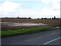
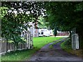
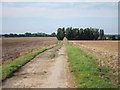
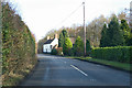
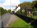
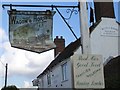
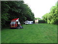
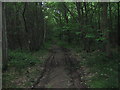
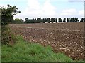
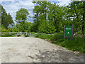
Please click the More button for more images, licensing and image copyright information.
Police
This area is policed by Kent Police.
Kent Police split their policing area into 293 separate neighbourhoods and this postcode is in the Charing neighbourhood.

Charing Neighbourhood Crime
Top 3 Categories
For full details of all categories together with more crime information, click on the Details button.
Member of UK Parliament
This postcode is in the Ashford parliamentary constituency.
Ashford is a constituency in the South East region of England. The seat has been held by Damian Green (Conservative) since May 2010.

Most Recent House Sales for Faversham Road, ME13 0JW
5 Dec 2022
22 Aug 2013
24 Jun 2011
4 Jun 2008
Local Petrol Station Prices
Coordinates for ME13 0JW
Residents at ME13 0JW
Sunrise and Sunset at ME13 0JW
Traffic Emission and Congestion Zones
Historical Weather Summary
| Clear | 9.32% |
| Cloudy | 65.68% |
| Rain | 8.96% |
| Windy | 15.91% |
| Other | 0.13% |
Population
Deprivation Index
the more deprived the postcode
Average Energy Performance
Companies Registered at ME13 0JW
Postcode Details for ME13 0JW
Recent Updates
|
18 Apr 2024 Added Traffic Camera Views from Traffic Scotland to Roadworks within Scotland |
|
15 Apr 2024 Schools Data updated for April 2024 |
|
10 Apr 2024 Companies Data updated for March 2024 |
|
7 Apr 2024 New option to receive automatic updates to roadworks that affect you |
|
7 Apr 2024 Police and Crime data updated for February 2024 |
|
3 Apr 2024 Sold House Price data updated for February 2024 |
|
30 Mar 2024 Energy Performance Certificates (England and Wales) updated February 2024 |
|
28 Mar 2024 New feature to use Geolocating functions to detect your current location |
Random Postcodes
Want an idea of what is in our extensive website? Try somewhere completely random!
The Rural/Urban classification is based upon data collected during the 2011 Census and released in August 2013 and is categorised into 6 distinct classes.
[A] Urban Major conurbation: A built up area with a population of 10,000 (3,000 in Scotland) or more and is assigned to the major conurbation settlement category.
[B] Urban Minor conurbation: A built up area with a population of 10,000 (3,000 in Scotland) or more and is assigned to the minor conurbation settlement category.
[C] Urban City and town: A built up area with a population of 10,000 (3,000 in Scotland) or more and is assigned to the city and town settlement category.
[D] Rural Town and fringe
[E] Rural Village
[F] Rural Hamlet and isolated dwelling
The Index of Multiple Deprivation (IMD) is the official measure of relative deprivation.
The index is based on 39 separate indicators across seven distinct domains (Income; Employment; Health and Disability; Education, Skills and Training; Crime; Barriers to Housing and Services; Living Environment) to provide an overall measure of multiple deprivation and is calculated for every neighbourhood.
The index is relative rather than an absolute scale and so a neighbourhood with a score of 10 is more deprived than one rated 20, but this does not equate to being twice as deprived.
Please note: Different indices are used in England, Scotland, Wales and Northern Ireland and so comparison of scores from neighbourhoods in different countries should not be undertaken.
These figures report on incorporated UK companies only that are registered at this postcode and do not include sole-traders, partnerships or overseas organisations.
The population figure shown for your area are an estimate provided by the Office for National Statistics and is rounded to the nearest 1,000.
The estimates are derived from the Annual Population Survey (APS) which is the Labour Force Survey (LFS) plus various sample boosts.
There are 26 county councils in 2-tier areas, providing services such as education, social services and waste disposal.
In 2-tier areas, each county council area is subdivided into districts, for which there is an independent district council. There are 192 district councils.
District councils are responsible for local services such as rubbish collection, housing and planning applications.