Overview for Lowe Grove, MANCHESTER, M28 1GN
Introduction
Manchester is a city and metropolitan borough in the county of Greater Manchester, England; it had a population of 552,000 at the 2021 census. It is bordered by the Cheshire Plain to the south, the Pennines to the north and east, and the neighbouring city of Salford to the west. The two cities and the surrounding towns form one of the United Kingdom's most populous conurbations, the Greater Manchester Built-up Area, which has a population of 2.87 million. The city borders the boroughs of Trafford, Stockport, Tameside, Oldham, Rochdale, Bury and Salford.
The history of Manchester began with the civilian settlement associated with the Roman fort (castra) of Mamucium or Mancunium, established in about AD 79 on a sandstone bluff near the confluence of the rivers Medlock and Irwell. Throughout the Middle Ages, Manchester remained a manorial township but began to expand "at an astonishing rate" around the turn of the 19th century. Manchester's unplanned urbanisation was brought on by a boom in textile manufacture during the Industrial Revolution and resulted in it becoming the world's first industrialised city. Historically part of Lancashire, areas of Cheshire south of the River Mersey were incorporated into Manchester in the 20th century, including Wythenshawe in 1931. Manchester achieved city status in 1853. The Manchester Ship Canal opened in 1894, creating the Port of Manchester and linking the city to the Irish Sea, 36 miles (58 km) to the west. Its fortune declined after the Second World War, owing to deindustrialisation, and the IRA bombing in 1996 led to extensive investment and regeneration. Following considerable redevelopment, Manchester was the host city for the 2002 Commonwealth Games.
The city is notable for its architecture, culture, musical exports, media links, scientific and engineering output, social impact, sports clubs and transport connections. Manchester Liverpool Road railway station is the world's oldest surviving inter-city passenger railway station. At the University of Manchester, Ernest Rutherford first split the atom in 1917; Frederic C. Williams, Tom Kilburn and Geoff Tootill developed the world's first stored-program computer in 1948; and Andre Geim and Konstantin Novoselov first isolated graphene in 2004.
Manchester has a large urban sprawl, which forms from the city centre into the other neighbouring authorities; these include The Four Heatons, Failsworth, Prestwich, Stretford, Sale, Droylsden, Old Trafford and Reddish. The city is also contiguous with Salford and its borough, but is separated from it by the River Irwell. This urban area is cut off by the M60, also known as the Manchester Outer Ring Road, which runs in a circular around the city and these areas. It joins the M62 to the north-east and the M602 to the west, as well as the East Lancashire Road and A6.
Summary for Lowe Grove, MANCHESTER, M28 1GN
Roadworks near M28 1GN
Road Safety near M28 1GN
Details of personal injury accidents in and around Lowe Grove, M28 1GN that have been reported to Greater Manchester Police over the past 20 years.
Traffic Levels near M28 1GN
View traffic levels near Lowe Grove, M28 1GN from official Department for Transport counts.
Images taken near to Lowe Grove, M28 1GN and the surrounding area

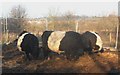
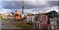
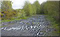
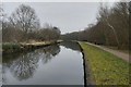
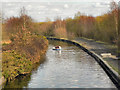
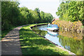


Please click the More button for more images, licensing and image copyright information.
Manchester and nearby Videos From YouTube
Oldham Town Centre drone view
arslansabirvlogs #oldham #drone #england #uk.
Channel: arslan sabir vlogs (View Channel)
Published: 9 Nov 2022
Member of UK Parliament
This postcode is in the Worsley and Eccles South parliamentary constituency.
Worsley and Eccles South is a constituency in the North West region of England. The seat has been held by Barbara Keeley (Labour) since May 2010.

Most Recent House Sales for Lowe Grove, M28 1GN
12 May 2023
29 Sep 2021
30 Oct 2020
26 Jun 2020
Local Petrol Station Prices
Coordinates for M28 1GN
Residents at M28 1GN
Sunrise and Sunset at M28 1GN
Traffic Emission and Congestion Zones
Historical Weather Summary
| Clear | 17.72% |
| Cloudy | 59.84% |
| Rain | 7.92% |
| Windy | 14.33% |
| Other | 0.19% |
Population
Deprivation Index
the more deprived the postcode
Average Energy Performance
Companies Registered at M28 1GN
Postcode Details for M28 1GN
Recent Updates
|
15 Apr 2024 Schools Data updated for April 2024 |
|
10 Apr 2024 Companies Data updated for March 2024 |
|
7 Apr 2024 New option to receive automatic updates to roadworks that affect you |
|
7 Apr 2024 Police and Crime data updated for February 2024 |
|
3 Apr 2024 Sold House Price data updated for February 2024 |
|
30 Mar 2024 Energy Performance Certificates (England and Wales) updated February 2024 |
|
28 Mar 2024 New feature to use Geolocating functions to detect your current location |
|
17 Mar 2024 Schools Data updated for March 2024 |
Random Postcodes
Want an idea of what is in our extensive website? Try somewhere completely random!
The Rural/Urban classification is based upon data collected during the 2011 Census and released in August 2013 and is categorised into 6 distinct classes.
[A] Urban Major conurbation: A built up area with a population of 10,000 (3,000 in Scotland) or more and is assigned to the major conurbation settlement category.
[B] Urban Minor conurbation: A built up area with a population of 10,000 (3,000 in Scotland) or more and is assigned to the minor conurbation settlement category.
[C] Urban City and town: A built up area with a population of 10,000 (3,000 in Scotland) or more and is assigned to the city and town settlement category.
[D] Rural Town and fringe
[E] Rural Village
[F] Rural Hamlet and isolated dwelling
The Index of Multiple Deprivation (IMD) is the official measure of relative deprivation.
The index is based on 39 separate indicators across seven distinct domains (Income; Employment; Health and Disability; Education, Skills and Training; Crime; Barriers to Housing and Services; Living Environment) to provide an overall measure of multiple deprivation and is calculated for every neighbourhood.
The index is relative rather than an absolute scale and so a neighbourhood with a score of 10 is more deprived than one rated 20, but this does not equate to being twice as deprived.
Please note: Different indices are used in England, Scotland, Wales and Northern Ireland and so comparison of scores from neighbourhoods in different countries should not be undertaken.
These figures report on incorporated UK companies only that are registered at this postcode and do not include sole-traders, partnerships or overseas organisations.
The population figure shown for your area are an estimate provided by the Office for National Statistics and is rounded to the nearest 1,000.
The estimates are derived from the Annual Population Survey (APS) which is the Labour Force Survey (LFS) plus various sample boosts.
There are 36 metropolitan district councils which together cover 6 large urban areas: the counties of Greater Manchester, Merseyside, South Yorkshire, Tyne and Wear, West Midlands, and West Yorkshire.
Metropolitan districts are responsible for all services in their area, although certain conurbation wide services such as fire and civil defence, police, waste disposal and passenger transport are provided through joint authorities (the districts acting jointly).