Overview for Emmerson Spur, LEEDS, LS26 9FJ
Introduction
Leeds is a city in West Yorkshire, England. It is governed by a metropolitan borough named after the city, the wider county having devolved powers. It is built around the River Aire and is in the eastern foothills of the Pennines.
The city was a small manorial borough in the 13th century and a market town in the 16th century. It expanded by becoming a major production centre, including of carbonated water where it was invented in the 1760s, and trading centre (mainly with wool) for the 17th and 18th centuries. It was a major mill town during the Industrial Revolution. It was also known for its flax industry, iron foundries, engineering and printing, as well as shopping, with several surviving Victorian era arcades, such as Kirkgate Market. City status was awarded in 1893, and a populous urban centre formed in the following century which absorbed surrounding villages and overtook the population of nearby York.
Leeds is about halfway between London and Edinburgh and has multiple motorway links; the M1, M62 and A1(M). The city's railway station is, alongside Manchester Piccadilly, the busiest of its kind in Northern England. It is the county's largest settlement with a population of 536,280, while the larger City of Leeds district has a population of 812,000 (2021 census). The city is part of the fourth-largest built-up area by population in the United Kingdom, West Yorkshire Built-up Area, with a 2011 census population of 1.7 million.
Summary for Emmerson Spur, LEEDS, LS26 9FJ
Roadworks near LS26 9FJ
Road Safety near LS26 9FJ
Details of personal injury accidents in and around Emmerson Spur, LS26 9FJ that have been reported to West Yorkshire Police over the past 20 years.
Traffic Levels near LS26 9FJ
View traffic levels near Emmerson Spur, LS26 9FJ from official Department for Transport counts.
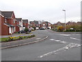
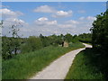
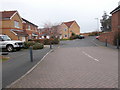
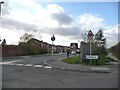
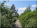
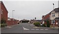
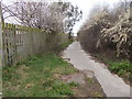
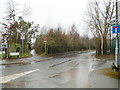
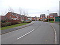
Images taken near to Emmerson Spur, LS26 9FJ and the surrounding area
Please click the More button for more images, licensing and image copyright information.
Leeds and nearby Videos From YouTube
Dji Mavic Drone shot over Morley, Leeds. Amazing Cityscape - 4k Resolution
Short flight, good weather, nice views over Morley / Cottingley area. Captured with the Mavic Air. Edited on Premiere Pro Polar Pro ...
Channel: Shane D (View Channel)
Published: 23 Apr 2020
Police
This area is policed by West Yorkshire Police.
West Yorkshire Police split their policing area into 21 separate neighbourhoods and this postcode is in the Leeds East neighbourhood.

Leeds East Neighbourhood Crime
Top 3 Categories
For full details of all categories together with more crime information, click on the Details button.
Member of UK Parliament
This postcode is in the Elmet and Rothwell parliamentary constituency.
Elmet and Rothwell is a constituency in the Yorkshire and The Humber region of England. The seat has been held by Sir Alec Shelbrooke (Conservative) since May 2010.

Most Recent House Sales for Emmerson Spur, LS26 9FJ
9 Dec 2022
23 Jun 2022
30 Jun 2021
29 Jun 2018
Local Petrol Station Prices
Coordinates for LS26 9FJ
Residents at LS26 9FJ
Sunrise and Sunset at LS26 9FJ
Traffic Emission and Congestion Zones
Historical Weather Summary
| Clear | 10.90% |
| Cloudy | 76.13% |
| Rain | 9.02% |
| Windy | 3.86% |
| Other | 0.09% |
Population
Deprivation Index
the more deprived the postcode
Average Energy Performance
Companies Registered at LS26 9FJ
Postcode Details for LS26 9FJ
Recent Updates
|
15 Apr 2024 Schools Data updated for April 2024 |
|
10 Apr 2024 Companies Data updated for March 2024 |
|
7 Apr 2024 New option to receive automatic updates to roadworks that affect you |
|
7 Apr 2024 Police and Crime data updated for February 2024 |
|
3 Apr 2024 Sold House Price data updated for February 2024 |
|
30 Mar 2024 Energy Performance Certificates (England and Wales) updated February 2024 |
|
28 Mar 2024 New feature to use Geolocating functions to detect your current location |
|
17 Mar 2024 Schools Data updated for March 2024 |
Random Postcodes
Want an idea of what is in our extensive website? Try somewhere completely random!
The Rural/Urban classification is based upon data collected during the 2011 Census and released in August 2013 and is categorised into 6 distinct classes.
[A] Urban Major conurbation: A built up area with a population of 10,000 (3,000 in Scotland) or more and is assigned to the major conurbation settlement category.
[B] Urban Minor conurbation: A built up area with a population of 10,000 (3,000 in Scotland) or more and is assigned to the minor conurbation settlement category.
[C] Urban City and town: A built up area with a population of 10,000 (3,000 in Scotland) or more and is assigned to the city and town settlement category.
[D] Rural Town and fringe
[E] Rural Village
[F] Rural Hamlet and isolated dwelling
The Index of Multiple Deprivation (IMD) is the official measure of relative deprivation.
The index is based on 39 separate indicators across seven distinct domains (Income; Employment; Health and Disability; Education, Skills and Training; Crime; Barriers to Housing and Services; Living Environment) to provide an overall measure of multiple deprivation and is calculated for every neighbourhood.
The index is relative rather than an absolute scale and so a neighbourhood with a score of 10 is more deprived than one rated 20, but this does not equate to being twice as deprived.
Please note: Different indices are used in England, Scotland, Wales and Northern Ireland and so comparison of scores from neighbourhoods in different countries should not be undertaken.
These figures report on incorporated UK companies only that are registered at this postcode and do not include sole-traders, partnerships or overseas organisations.
The population figure shown for your area are an estimate provided by the Office for National Statistics and is rounded to the nearest 1,000.
The estimates are derived from the Annual Population Survey (APS) which is the Labour Force Survey (LFS) plus various sample boosts.
There are 36 metropolitan district councils which together cover 6 large urban areas: the counties of Greater Manchester, Merseyside, South Yorkshire, Tyne and Wear, West Midlands, and West Yorkshire.
Metropolitan districts are responsible for all services in their area, although certain conurbation wide services such as fire and civil defence, police, waste disposal and passenger transport are provided through joint authorities (the districts acting jointly).