Overview for Spendluffe Avenue, ALFORD, LN13 9EJ
Introduction
Alford is a large village in Aberdeenshire, north-east Scotland, lying just south of the River Don. It lies within the Howe of Alford (also called the Vale of Alford) which occupies the middle reaches of the River Don.
The place-name is thought to come from the Scots auld ford; its original position being on the banks of the Don. The "L" sound in the word has, over time, been dropped, and is silent. Alternatively, the name could be a tautology; a combination of ath and ford, both meaning 'ford' in Gaelic and Scots respectively. Alford gave its name to a battle of the Battle of Alford (1645). It is also the home of the Aberdeen Angus cattle breed, which is celebrated by a life-sized model of a bull on the edge of the village, which the Queen Mother inaugurated in 2001. It is believed that the original breeding ground of the cattle was Buffal, located between Tough (Tulloch) and Craigievar nearby Alford. Another claim to fame for the town is Alford Oatmeal, ground at Montgarrie, just outside the town. Alford also sports the Alford Community Campus, with a library and pool.
The Alford Valley Railway, Grampian Transport Museum, Alford Heritage Museum and Craigievar Castle are popular visitor attractions, with a range of other archaeological sites, stone circles, and castles (including Balfluig Castle, Castle Fraser and Drum Castle) being within easy reach by road. One stone circle, originally believed to be prehistoric, turned out to be a 20-year-old replica. Situated in Alford, Haughton Country Park is a large and popular green space with a caravan park and woodland walks.
Summary for Spendluffe Avenue, ALFORD, LN13 9EJ
Roadworks near LN13 9EJ
Road Safety near LN13 9EJ
Details of personal injury accidents in and around Spendluffe Avenue, LN13 9EJ that have been reported to Lincolnshire Police over the past 20 years.
Traffic Levels near LN13 9EJ
View traffic levels near Spendluffe Avenue, LN13 9EJ from official Department for Transport counts.
Images taken near to Spendluffe Avenue, LN13 9EJ and the surrounding area
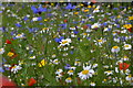
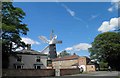
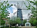
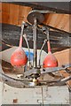
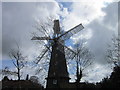
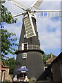
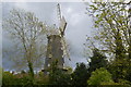
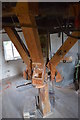
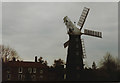
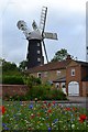
Please click the More button for more images, licensing and image copyright information.
Police
This area is policed by Lincolnshire Police.
Lincolnshire Police split their policing area into 58 separate neighbourhoods and this postcode is in the Alford neighbourhood.

Alford Neighbourhood Crime
Top 3 Categories
For full details of all categories together with more crime information, click on the Details button.
Member of UK Parliament
This postcode is in the Louth and Horncastle parliamentary constituency.
Louth and Horncastle is a constituency in the East Midlands region of England. The seat has been held by Victoria Atkins (Conservative) since May 2015.

Most Recent House Sales for Spendluffe Avenue, LN13 9EJ
10 Aug 2012
31 Jul 2012
2 May 2012
7 Apr 2010
Local Petrol Station Prices
Coordinates for LN13 9EJ
Residents at LN13 9EJ
Sunrise and Sunset at LN13 9EJ
Traffic Emission and Congestion Zones
Historical Weather Summary
| Clear | 10.42% |
| Cloudy | 47.15% |
| Rain | 8.42% |
| Windy | 34.01% |
| Other | 0.00% |
Population
Deprivation Index
the more deprived the postcode
Average Energy Performance
Companies Registered at LN13 9EJ
Postcode Details for LN13 9EJ
Recent Updates
|
18 Apr 2024 Added Traffic Camera Views from Traffic Scotland to Roadworks within Scotland |
|
15 Apr 2024 Schools Data updated for April 2024 |
|
10 Apr 2024 Companies Data updated for March 2024 |
|
7 Apr 2024 New option to receive automatic updates to roadworks that affect you |
|
7 Apr 2024 Police and Crime data updated for February 2024 |
|
3 Apr 2024 Sold House Price data updated for February 2024 |
|
30 Mar 2024 Energy Performance Certificates (England and Wales) updated February 2024 |
|
28 Mar 2024 New feature to use Geolocating functions to detect your current location |
Random Postcodes
Want an idea of what is in our extensive website? Try somewhere completely random!
The Rural/Urban classification is based upon data collected during the 2011 Census and released in August 2013 and is categorised into 6 distinct classes.
[A] Urban Major conurbation: A built up area with a population of 10,000 (3,000 in Scotland) or more and is assigned to the major conurbation settlement category.
[B] Urban Minor conurbation: A built up area with a population of 10,000 (3,000 in Scotland) or more and is assigned to the minor conurbation settlement category.
[C] Urban City and town: A built up area with a population of 10,000 (3,000 in Scotland) or more and is assigned to the city and town settlement category.
[D] Rural Town and fringe
[E] Rural Village
[F] Rural Hamlet and isolated dwelling
The Index of Multiple Deprivation (IMD) is the official measure of relative deprivation.
The index is based on 39 separate indicators across seven distinct domains (Income; Employment; Health and Disability; Education, Skills and Training; Crime; Barriers to Housing and Services; Living Environment) to provide an overall measure of multiple deprivation and is calculated for every neighbourhood.
The index is relative rather than an absolute scale and so a neighbourhood with a score of 10 is more deprived than one rated 20, but this does not equate to being twice as deprived.
Please note: Different indices are used in England, Scotland, Wales and Northern Ireland and so comparison of scores from neighbourhoods in different countries should not be undertaken.
These figures report on incorporated UK companies only that are registered at this postcode and do not include sole-traders, partnerships or overseas organisations.
The population figure shown for your area are an estimate provided by the Office for National Statistics and is rounded to the nearest 1,000.
The estimates are derived from the Annual Population Survey (APS) which is the Labour Force Survey (LFS) plus various sample boosts.
There are 26 county councils in 2-tier areas, providing services such as education, social services and waste disposal.
In 2-tier areas, each county council area is subdivided into districts, for which there is an independent district council. There are 192 district councils.
District councils are responsible for local services such as rubbish collection, housing and planning applications.