Overview for Penrhosgarnedd, BANGOR, LL57 2NA
Introduction
Bangor is a city and seaside resort in County Down, Northern Ireland, on the southern side of Belfast Lough. It is within the Belfast metropolitan area and is 13 miles (22 km) east of Belfast city centre, to which it is linked by the A2 road and the Belfast–Bangor railway line. The population was 64,596 at the 2021 Census. Bangor was granted city status in 2022, becoming Northern Ireland's sixth city.
Bangor Abbey was an important and influential monastery founded in the 6th century by Saint Comgall. Bangor grew during the 17th century Plantation of Ulster, when many Scottish settlers arrived. Today, tourism is important to the local economy, particularly in the summer months, and plans are being made for the long-delayed redevelopment of the seafront; a notable historical building in the city is Bangor Old Custom House. The largest plot of private land in the area, the Clandeboye Estate, which is a few miles from the city centre, belonged to the Marchioness of Dufferin and Ava. Bangor hosts the Royal Ulster and Ballyholme yacht clubs. Bangor Marina is one of the largest in Ireland, and holds Blue Flag status.
Summary for Penrhosgarnedd, BANGOR, LL57 2NA
Roadworks near LL57 2NA
A local roadworks feed is not available for Wales at this time.
However, Traffic Wales/Traffig Cymru provide works details for motorways and major trunk roads in Wales on their website at traffic.wales/roadworks
Road Safety near LL57 2NA
Details of personal injury accidents in and around LL57 2NA that have been reported to North Wales Police over the past 20 years.
Traffic Levels near LL57 2NA
View traffic levels near LL57 2NA from official Department for Transport counts.
Images taken in and around the ll572na area
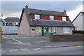
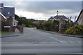
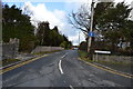
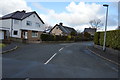
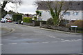
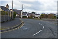
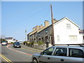
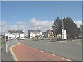
Please click the More button for more images, licensing and image copyright information.
Member of UK Parliament
This postcode is in the Arfon parliamentary constituency.
Arfon is a constituency in Wales. The seat has been held by Hywel Williams (Plaid Cymru) since May 2010.

Most Recent House Sales for LL57 2NA
22 Oct 2021
8 Nov 2019
5 May 2017
12 Aug 2016
Local Petrol Station Prices
Coordinates for LL57 2NA
Residents at LL57 2NA
Sunrise and Sunset at LL57 2NA
Traffic Emission and Congestion Zones
Historical Weather Summary
| Clear | 13.95% |
| Cloudy | 66.03% |
| Rain | 10.79% |
| Windy | 8.00% |
| Other | 1.23% |
Population
Deprivation Index
the more deprived the postcode
Average Energy Performance
Companies Registered at LL57 2NA
Postcode Details for LL57 2NA
Recent Updates
|
18 Apr 2024 Added Traffic Camera Views from Traffic Scotland to Roadworks within Scotland |
|
15 Apr 2024 Schools Data updated for April 2024 |
|
10 Apr 2024 Companies Data updated for March 2024 |
|
7 Apr 2024 New option to receive automatic updates to roadworks that affect you |
|
7 Apr 2024 Police and Crime data updated for February 2024 |
|
3 Apr 2024 Sold House Price data updated for February 2024 |
|
30 Mar 2024 Energy Performance Certificates (England and Wales) updated February 2024 |
|
28 Mar 2024 New feature to use Geolocating functions to detect your current location |
Random Postcodes
Want an idea of what is in our extensive website? Try somewhere completely random!
The Rural/Urban classification is based upon data collected during the 2011 Census and released in August 2013 and is categorised into 6 distinct classes.
[A] Urban Major conurbation: A built up area with a population of 10,000 (3,000 in Scotland) or more and is assigned to the major conurbation settlement category.
[B] Urban Minor conurbation: A built up area with a population of 10,000 (3,000 in Scotland) or more and is assigned to the minor conurbation settlement category.
[C] Urban City and town: A built up area with a population of 10,000 (3,000 in Scotland) or more and is assigned to the city and town settlement category.
[D] Rural Town and fringe
[E] Rural Village
[F] Rural Hamlet and isolated dwelling
The Index of Multiple Deprivation (IMD) is the official measure of relative deprivation.
The index is based on 39 separate indicators across seven distinct domains (Income; Employment; Health and Disability; Education, Skills and Training; Crime; Barriers to Housing and Services; Living Environment) to provide an overall measure of multiple deprivation and is calculated for every neighbourhood.
The index is relative rather than an absolute scale and so a neighbourhood with a score of 10 is more deprived than one rated 20, but this does not equate to being twice as deprived.
Please note: Different indices are used in England, Scotland, Wales and Northern Ireland and so comparison of scores from neighbourhoods in different countries should not be undertaken.
These figures report on incorporated UK companies only that are registered at this postcode and do not include sole-traders, partnerships or overseas organisations.
The population figure shown for your area are an estimate provided by the Office for National Statistics and is rounded to the nearest 1,000.
The estimates are derived from the Annual Population Survey (APS) which is the Labour Force Survey (LFS) plus various sample boosts.
There are 55 unitary authorities. They provide all local government services in their areas. These are mainly in the cities, urban areas and larger towns although there are now 6 shire county councils that are unitary (ie have no district councils beneath them).