Overview for Woodland Grove, WREXHAM, LL11 4TT
Introduction
Wrexham is a city and the administrative centre of Wrexham County Borough in Wales. It is located between the Welsh mountains and the lower Dee Valley, near the border with Cheshire in England. Historically in the county of Denbighshire, and later the county of Clwyd in 1974, it has been the principal settlement of Wrexham County Borough since 1996.
Wrexham has historically been one of the primary settlements of Wales. At the 2021 Census, it had an urban population of 44,785. The core of the city comprises the local government communities of Acton, Caia Park, Offa and Rhosddu. In the 2011 census, Wrexham's built-up area was determined to extend further into villages like Brymbo, Brynteg, Gwersyllt, New Broughton and Pentre Broughton with a population of 61,603, while also including nearby Bradley and Rhostyllen for a population of 65,692 in 2011.
Wrexham was likely founded prior to the 11th century and developed in the Middle Ages as a regional centre for trade and administration. The city became the most populous settlement in Wales in the 17th century and was at the forefront of the Industrial Revolution from the 18th century. Prior to de-industrialisation in the 20th century, the city and surrounding area were a hub of coal and lead mining; the production of iron, steel and leather; and brewing.
Today, Wrexham continues to serve north Wales and the Welsh borderlands as a centre for manufacturing, retail, education and administration. The city is noted for hosting Wrexham A.
F.
C. (one of the oldest professional football teams in the world); the nationally significant industrial heritage of the Clywedog Valley; the National Trust Property of Erddig; and the fine Tudor church of St Giles, which towers over the historic Wrexham city centre.
Summary for Woodland Grove, WREXHAM, LL11 4TT
Roadworks near LL11 4TT
A local roadworks feed is not available for Wales at this time.
However, Traffic Wales/Traffig Cymru provide works details for motorways and major trunk roads in Wales on their website at traffic.wales/roadworks
Road Safety near LL11 4TT
Details of personal injury accidents in and around Woodland Grove, LL11 4TT that have been reported to North Wales Police over the past 20 years.
Traffic Levels near LL11 4TT
View traffic levels near Woodland Grove, LL11 4TT from official Department for Transport counts.
Images taken near to Woodland Grove, LL11 4TT and the surrounding area

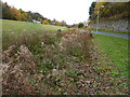
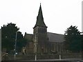
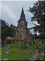
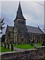
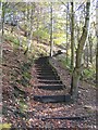
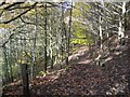
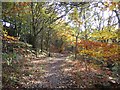

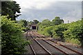
Please click the More button for more images, licensing and image copyright information.
Wrexham and nearby Videos From YouTube
Wrexham and Coedpoeth skyline by drone 2020
Wrexham and Coedpoeth skyline by drone, just a quick video.
Channel: Duncan Stewart (View Channel)
Published: 16 Apr 2020
Member of UK Parliament
This postcode is in the Wrexham parliamentary constituency.
Wrexham is a constituency in Wales. The seat has been held by Sarah Atherton (Conservative) since December 2019.

Most Recent House Sales for Woodland Grove, LL11 4TT
25 Feb 2022
23 Jul 2021
30 Sep 2016
24 Aug 2005
Local Petrol Station Prices
Coordinates for LL11 4TT
Residents at LL11 4TT
Sunrise and Sunset at LL11 4TT
Traffic Emission and Congestion Zones
Historical Weather Summary
| Clear | 19.57% |
| Cloudy | 66.97% |
| Rain | 7.04% |
| Windy | 6.31% |
| Other | 0.11% |
Population
Deprivation Index
the more deprived the postcode
Average Energy Performance
Companies Registered at LL11 4TT
Postcode Details for LL11 4TT
Recent Updates
|
18 Apr 2024 Added Traffic Camera Views from Traffic Scotland to Roadworks within Scotland |
|
15 Apr 2024 Schools Data updated for April 2024 |
|
10 Apr 2024 Companies Data updated for March 2024 |
|
7 Apr 2024 New option to receive automatic updates to roadworks that affect you |
|
7 Apr 2024 Police and Crime data updated for February 2024 |
|
3 Apr 2024 Sold House Price data updated for February 2024 |
|
30 Mar 2024 Energy Performance Certificates (England and Wales) updated February 2024 |
|
28 Mar 2024 New feature to use Geolocating functions to detect your current location |
Random Postcodes
Want an idea of what is in our extensive website? Try somewhere completely random!
The Rural/Urban classification is based upon data collected during the 2011 Census and released in August 2013 and is categorised into 6 distinct classes.
[A] Urban Major conurbation: A built up area with a population of 10,000 (3,000 in Scotland) or more and is assigned to the major conurbation settlement category.
[B] Urban Minor conurbation: A built up area with a population of 10,000 (3,000 in Scotland) or more and is assigned to the minor conurbation settlement category.
[C] Urban City and town: A built up area with a population of 10,000 (3,000 in Scotland) or more and is assigned to the city and town settlement category.
[D] Rural Town and fringe
[E] Rural Village
[F] Rural Hamlet and isolated dwelling
The Index of Multiple Deprivation (IMD) is the official measure of relative deprivation.
The index is based on 39 separate indicators across seven distinct domains (Income; Employment; Health and Disability; Education, Skills and Training; Crime; Barriers to Housing and Services; Living Environment) to provide an overall measure of multiple deprivation and is calculated for every neighbourhood.
The index is relative rather than an absolute scale and so a neighbourhood with a score of 10 is more deprived than one rated 20, but this does not equate to being twice as deprived.
Please note: Different indices are used in England, Scotland, Wales and Northern Ireland and so comparison of scores from neighbourhoods in different countries should not be undertaken.
These figures report on incorporated UK companies only that are registered at this postcode and do not include sole-traders, partnerships or overseas organisations.
The population figure shown for your area are an estimate provided by the Office for National Statistics and is rounded to the nearest 1,000.
The estimates are derived from the Annual Population Survey (APS) which is the Labour Force Survey (LFS) plus various sample boosts.
There are 55 unitary authorities. They provide all local government services in their areas. These are mainly in the cities, urban areas and larger towns although there are now 6 shire county councils that are unitary (ie have no district councils beneath them).