Overview for Rushley Drive, LANCASTER, LA2 6EF
Introduction
Lancaster is a city in Lancashire, England and the main cultural hub, economic and commercial centre of City of Lancaster district. The city is on the River Lune and directly inland from Morecambe Bay. Lancaster was the county town of Lancashire until the county council's administrative headquarters moved to Preston in 1974. The city's long history is marked by Lancaster Roman Fort, Lancaster Castle, Lancaster Priory Church, Lancaster Cathedral and the Ashton Memorial. It is the seat of Lancaster University and has a campus of the University of Cumbria. It had a population of 52,234 in the 2011 census compared to the district which had a population of 138,375. The city is an economic hub for the surrounding districts of Ribble Valley and Wyre as well as the Westmorland and Furness unitary area of Cumbria.
The House of Lancaster was a branch of the English royal family. The Duchy of Lancaster still holds large estates on behalf of Charles III, who is the Duke of Lancaster.
The Port of Lancaster and the 18th-century Lancaster slave trade played a major role in the city's growth, but for many years the outport of Glasson Dock, downstream, has been the main shipping facility.
Summary for Rushley Drive, LANCASTER, LA2 6EF
Roadworks near LA2 6EF
Road Safety near LA2 6EF
Details of personal injury accidents in and around Rushley Drive, LA2 6EF that have been reported to Lancashire Constabulary over the past 20 years.
Traffic Levels near LA2 6EF
View traffic levels near Rushley Drive, LA2 6EF from official Department for Transport counts.
Images taken near to Rushley Drive, LA2 6EF and the surrounding area
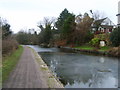
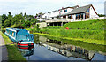
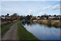
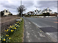
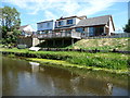
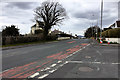
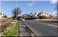
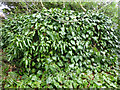
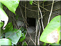
Please click the More button for more images, licensing and image copyright information.
Police
This area is policed by Lancashire Constabulary.
Lancashire Constabulary split their policing area into 236 separate neighbourhoods and this postcode is in the Slyne with Hest neighbourhood.

Slyne with Hest Neighbourhood Crime
Top 3 Categories
For full details of all categories together with more crime information, click on the Details button.
Member of UK Parliament
This postcode is in the Morecambe and Lunesdale parliamentary constituency.
Morecambe and Lunesdale is a constituency in the North West region of England. The seat has been held by David Morris (Conservative) since May 2010.

Most Recent House Sales for Rushley Drive, LA2 6EF
12 Jul 2023
11 Feb 2022
15 Oct 2018
1 Aug 2017
Local Petrol Station Prices
Coordinates for LA2 6EF
Residents at LA2 6EF
Sunrise and Sunset at LA2 6EF
Traffic Emission and Congestion Zones
Historical Weather Summary
| Clear | 15.39% |
| Cloudy | 45.02% |
| Rain | 8.44% |
| Windy | 30.86% |
| Other | 0.29% |
Population
Deprivation Index
the more deprived the postcode
Average Energy Performance
Companies Registered at LA2 6EF
Postcode Details for LA2 6EF
Recent Updates
|
18 Apr 2024 Added Traffic Camera Views from Traffic Scotland to Roadworks within Scotland |
|
15 Apr 2024 Schools Data updated for April 2024 |
|
10 Apr 2024 Companies Data updated for March 2024 |
|
7 Apr 2024 New option to receive automatic updates to roadworks that affect you |
|
7 Apr 2024 Police and Crime data updated for February 2024 |
|
3 Apr 2024 Sold House Price data updated for February 2024 |
|
30 Mar 2024 Energy Performance Certificates (England and Wales) updated February 2024 |
|
28 Mar 2024 New feature to use Geolocating functions to detect your current location |
Random Postcodes
Want an idea of what is in our extensive website? Try somewhere completely random!
The Rural/Urban classification is based upon data collected during the 2011 Census and released in August 2013 and is categorised into 6 distinct classes.
[A] Urban Major conurbation: A built up area with a population of 10,000 (3,000 in Scotland) or more and is assigned to the major conurbation settlement category.
[B] Urban Minor conurbation: A built up area with a population of 10,000 (3,000 in Scotland) or more and is assigned to the minor conurbation settlement category.
[C] Urban City and town: A built up area with a population of 10,000 (3,000 in Scotland) or more and is assigned to the city and town settlement category.
[D] Rural Town and fringe
[E] Rural Village
[F] Rural Hamlet and isolated dwelling
The Index of Multiple Deprivation (IMD) is the official measure of relative deprivation.
The index is based on 39 separate indicators across seven distinct domains (Income; Employment; Health and Disability; Education, Skills and Training; Crime; Barriers to Housing and Services; Living Environment) to provide an overall measure of multiple deprivation and is calculated for every neighbourhood.
The index is relative rather than an absolute scale and so a neighbourhood with a score of 10 is more deprived than one rated 20, but this does not equate to being twice as deprived.
Please note: Different indices are used in England, Scotland, Wales and Northern Ireland and so comparison of scores from neighbourhoods in different countries should not be undertaken.
These figures report on incorporated UK companies only that are registered at this postcode and do not include sole-traders, partnerships or overseas organisations.
The population figure shown for your area are an estimate provided by the Office for National Statistics and is rounded to the nearest 1,000.
The estimates are derived from the Annual Population Survey (APS) which is the Labour Force Survey (LFS) plus various sample boosts.
There are 26 county councils in 2-tier areas, providing services such as education, social services and waste disposal.
In 2-tier areas, each county council area is subdivided into districts, for which there is an independent district council. There are 192 district councils.
District councils are responsible for local services such as rubbish collection, housing and planning applications.