Overview for Baltimore Road, GLENROTHES, KY6 2PJ
Introduction
Glenrothes is a town situated in the heart of Fife, in east-central Scotland. It is about 30 miles (48 km) north of Edinburgh and 30 miles (48 km) south of Dundee. The town had a population of 39,277 in the 2011 census, making it the third largest settlement in Fife and the 19th most populous settlement in Scotland. The name Glenrothes comes from its historical link with the Earl of Rothes, who owned much of the land on which the new town has been built; Glen (Scottish for valley) was added to the name to avoid confusion with Rothes in Moray and in recognition that the town lies in a river valley. The motto of Glenrothes is Ex terra vis, meaning "From the earth strength", which dates back to the founding of the town.
Planned in the late 1940s as one of Scotland's first post-second world war new towns, its original purpose was to support a newly established coal mine, the Rothes Colliery. The mine closed early in its life and the town's economy transitioned and diversified establishing it as an important centre for industry. It played a significant role in establishing Scotland's Silicon Glen between 1961 and 2000 with several major electronics and hi-tech companies setting up facilities in the town. The Glenrothes Development Corporation (GDC), a quasi-autonomous non-governmental organisation, was established to develop, manage and promote the new town. The GDC, supported by the local authority, oversaw the governance of Glenrothes until the GDC was wound up in 1995, after which all responsibility was transferred to Fife Council.
Glenrothes is the administrative capital of Fife, containing the headquarters of both Fife Council and Police Scotland Fife Division and is a major service centre within the area. It is also a centre for excellence within the high-tech electronics and manufacturing industry sectors; several organisations have their global headquarters in Glenrothes. Major employers include Bosch Rexroth (hydraulics manufacturing), Fife College (education), Leviton (fibre optics manufacturing) and Raytheon (defence and electronics). Glenrothes is unique in Fife as much of the town centre floorspace is internalised within Fife's largest shopping centre, the Kingdom Shopping Centre. Public facilities include a regional sports and leisure centre, two golf courses, major parks, a civic centre and theatre and a college campus.
The town has won multiple horticultural awards in the Beautiful Scotland and Britain in Bloom contests for the quality of its parks and landscaping. It has numerous outdoor sculptures and artworks, a result of the appointment of town artists in the early development of the town. The A92 trunk road provides the principal access to the town, passing through Glenrothes and connecting it to the wider Scottish motorway and trunk road network. A major bus station is located in the town centre, providing regional and local bus services to surrounding settlements.
Summary for Baltimore Road, GLENROTHES, KY6 2PJ
Roadworks near KY6 2PJ
Road Safety near KY6 2PJ
Details of personal injury accidents in and around Baltimore Road, KY6 2PJ that have been reported to over the past 20 years.
Traffic Levels near KY6 2PJ
View traffic levels near Baltimore Road, KY6 2PJ from official Department for Transport counts.
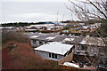
Images taken near to Baltimore Road, KY6 2PJ and the surrounding area

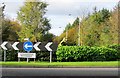
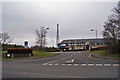
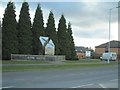
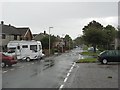
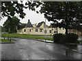
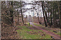
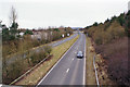
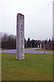
Please click the More button for more images, licensing and image copyright information.
Member of UK Parliament
This postcode is in the Glenrothes parliamentary constituency.
Glenrothes is a constituency in Scotland. The seat has been held by Peter Grant (Scottish National Party) since May 2015.

Most Recent House Sales for Baltimore Road, KY6 2PJ
No recorded house sales or transfers for this postcode.
Local Petrol Station Prices
Coordinates for KY6 2PJ
Sunrise and Sunset at KY6 2PJ
Traffic Emission and Congestion Zones
Historical Weather Summary
| Clear | 10.58% |
| Cloudy | 73.52% |
| Rain | 10.19% |
| Windy | 5.33% |
| Other | 0.38% |
Companies Registered at KY6 2PJ
Postcode Details for KY6 2PJ
Recent Updates
|
18 Apr 2024 Added Traffic Camera Views from Traffic Scotland to Roadworks within Scotland |
|
15 Apr 2024 Schools Data updated for April 2024 |
|
10 Apr 2024 Companies Data updated for March 2024 |
|
7 Apr 2024 New option to receive automatic updates to roadworks that affect you |
|
7 Apr 2024 Police and Crime data updated for February 2024 |
|
3 Apr 2024 Sold House Price data updated for February 2024 |
|
30 Mar 2024 Energy Performance Certificates (England and Wales) updated February 2024 |
|
28 Mar 2024 New feature to use Geolocating functions to detect your current location |
Random Postcodes
Want an idea of what is in our extensive website? Try somewhere completely random!
The Rural/Urban classification is based upon data collected during the 2011 Census and released in August 2013 and is categorised into 6 distinct classes.
[A] Urban Major conurbation: A built up area with a population of 10,000 (3,000 in Scotland) or more and is assigned to the major conurbation settlement category.
[B] Urban Minor conurbation: A built up area with a population of 10,000 (3,000 in Scotland) or more and is assigned to the minor conurbation settlement category.
[C] Urban City and town: A built up area with a population of 10,000 (3,000 in Scotland) or more and is assigned to the city and town settlement category.
[D] Rural Town and fringe
[E] Rural Village
[F] Rural Hamlet and isolated dwelling
The Index of Multiple Deprivation (IMD) is the official measure of relative deprivation.
The index is based on 39 separate indicators across seven distinct domains (Income; Employment; Health and Disability; Education, Skills and Training; Crime; Barriers to Housing and Services; Living Environment) to provide an overall measure of multiple deprivation and is calculated for every neighbourhood.
The index is relative rather than an absolute scale and so a neighbourhood with a score of 10 is more deprived than one rated 20, but this does not equate to being twice as deprived.
Please note: Different indices are used in England, Scotland, Wales and Northern Ireland and so comparison of scores from neighbourhoods in different countries should not be undertaken.
These figures report on incorporated UK companies only that are registered at this postcode and do not include sole-traders, partnerships or overseas organisations.
The population figure shown for your area are an estimate provided by the Office for National Statistics and is rounded to the nearest 1,000.
The estimates are derived from the Annual Population Survey (APS) which is the Labour Force Survey (LFS) plus various sample boosts.
There are 55 unitary authorities. They provide all local government services in their areas. These are mainly in the cities, urban areas and larger towns although there are now 6 shire county councils that are unitary (ie have no district councils beneath them).