Overview for Sandyhill Road, ST. ANDREWS, KY16 8EG
Introduction
St Andrews is a town on the east coast of Fife in Scotland, 10 miles (16 kilometres) southeast of Dundee and 30 miles (50 kilometres) northeast of Edinburgh. St Andrews had a recorded population of 16,800 as of 2011, making it Fife's fourth-largest settlement and 45th most populous settlement in Scotland.
The town is home to the University of St Andrews, the third oldest university in the English-speaking world and the oldest in Scotland. It was ranked as the best university in the UK by the 2022 Good University Guide, which is published by The Times and The Sunday Times. According to other rankings, it is ranked as one of the best universities in the United Kingdom.
The town is named after Saint Andrew the Apostle. The settlement grew to the west of St Andrews Cathedral, with the southern side of the Scores to the north and the Kinness Burn to the south. The burgh soon became the ecclesiastical capital of Scotland, a position which was held until the Scottish Reformation. The famous cathedral, the largest in Scotland, now lies in ruins.
St Andrews is also known globally as the "home of golf". This is in part because of The Royal and Ancient Golf Club of St Andrews, founded in 1754, which until 2004 exercised legislative authority over the game worldwide (except in the United States and Mexico). It is also because the famous Old Course of St Andrews Links (acquired by the town in 1894) is the most frequent venue for The Open Championship, the oldest of golf's four major championships. Visitors travel to St Andrews in great numbers for several courses ranked amongst the finest in the world, as well as for the sandy beaches.
The Martyrs Memorial, erected to the honour of Patrick Hamilton, George Wishart, and other martyrs of the Reformation epoch, stands at the west end of the Scores on a cliff overlooking the sea. The civil parish has a population of 18,421 (in 2011).
The town also contains numerous museums, a botanic garden and an aquarium.
Summary for Sandyhill Road, ST. ANDREWS, KY16 8EG
Roadworks near KY16 8EG
Road Safety near KY16 8EG
Details of personal injury accidents in and around Sandyhill Road, KY16 8EG that have been reported to over the past 20 years.
Traffic Levels near KY16 8EG
View traffic levels near Sandyhill Road, KY16 8EG from official Department for Transport counts.
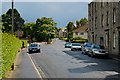
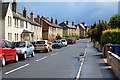
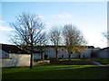
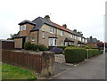
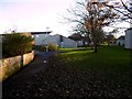
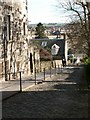
Images taken near to Sandyhill Road, KY16 8EG and the surrounding area


Please click the More button for more images, licensing and image copyright information.
Member of UK Parliament
This postcode is in the North East Fife parliamentary constituency.
North East Fife is a constituency in Scotland. The seat has been held by Wendy Chamberlain (Liberal Democrat) since December 2019.

Most Recent House Sales for Sandyhill Road, KY16 8EG
No recorded house sales or transfers for this postcode.
Local Petrol Station Prices
Coordinates for KY16 8EG
Sunrise and Sunset at KY16 8EG
Traffic Emission and Congestion Zones
Historical Weather Summary
| Clear | 9.60% |
| Cloudy | 40.72% |
| Rain | 9.28% |
| Windy | 40.31% |
| Other | 0.09% |
Average Energy Performance
Companies Registered at KY16 8EG
Postcode Details for KY16 8EG
Recent Updates
|
18 Apr 2024 Added Traffic Camera Views from Traffic Scotland to Roadworks within Scotland |
|
15 Apr 2024 Schools Data updated for April 2024 |
|
10 Apr 2024 Companies Data updated for March 2024 |
|
7 Apr 2024 New option to receive automatic updates to roadworks that affect you |
|
7 Apr 2024 Police and Crime data updated for February 2024 |
|
3 Apr 2024 Sold House Price data updated for February 2024 |
|
30 Mar 2024 Energy Performance Certificates (England and Wales) updated February 2024 |
|
28 Mar 2024 New feature to use Geolocating functions to detect your current location |
Random Postcodes
Want an idea of what is in our extensive website? Try somewhere completely random!
The Rural/Urban classification is based upon data collected during the 2011 Census and released in August 2013 and is categorised into 6 distinct classes.
[A] Urban Major conurbation: A built up area with a population of 10,000 (3,000 in Scotland) or more and is assigned to the major conurbation settlement category.
[B] Urban Minor conurbation: A built up area with a population of 10,000 (3,000 in Scotland) or more and is assigned to the minor conurbation settlement category.
[C] Urban City and town: A built up area with a population of 10,000 (3,000 in Scotland) or more and is assigned to the city and town settlement category.
[D] Rural Town and fringe
[E] Rural Village
[F] Rural Hamlet and isolated dwelling
The Index of Multiple Deprivation (IMD) is the official measure of relative deprivation.
The index is based on 39 separate indicators across seven distinct domains (Income; Employment; Health and Disability; Education, Skills and Training; Crime; Barriers to Housing and Services; Living Environment) to provide an overall measure of multiple deprivation and is calculated for every neighbourhood.
The index is relative rather than an absolute scale and so a neighbourhood with a score of 10 is more deprived than one rated 20, but this does not equate to being twice as deprived.
Please note: Different indices are used in England, Scotland, Wales and Northern Ireland and so comparison of scores from neighbourhoods in different countries should not be undertaken.
These figures report on incorporated UK companies only that are registered at this postcode and do not include sole-traders, partnerships or overseas organisations.
The population figure shown for your area are an estimate provided by the Office for National Statistics and is rounded to the nearest 1,000.
The estimates are derived from the Annual Population Survey (APS) which is the Labour Force Survey (LFS) plus various sample boosts.
There are 55 unitary authorities. They provide all local government services in their areas. These are mainly in the cities, urban areas and larger towns although there are now 6 shire county councils that are unitary (ie have no district councils beneath them).