Overview for High Street, KIRKCALDY, KY1 1JW
Introduction
Kirkcaldy is a town and former royal burgh in Fife, on the east coast of Scotland. It is about 11.6 miles (19 km) north of Edinburgh and 27.6 miles (44 km) south-southwest of Dundee. The town had a recorded population of 49,460 in 2011, making it Fife's second-largest settlement and the 12th most populous settlement in Scotland.
Kirkcaldy has long been nicknamed the Lang Toun (Scots for "long town") in reference to the early town's 0.9-mile (1.4 km) main street, as indicated on maps from the 16th and 17th centuries. The street would finally reach a length of nearly 4 miles (6.4 km), connecting the burgh to the neighbouring settlements of Linktown, Pathhead, Sinclairtown and Gallatown, which became part of the town in 1876. The formerly separate burgh of Dysart was also later absorbed into Kirkcaldy in 1930 under an act of Parliament.
The area around Kirkcaldy has been inhabited since the Bronze Age. The first document to refer to the town is from 1075, when Malcolm III granted the settlement to the church of Dunfermline. David I later gave the burgh to Dunfermline Abbey, which had succeeded the church: a status which was officially recognised by Robert I in 1327. The town only gained its independence from Abbey rule when it was created a royal burgh by Charles I in 1644.
From the early 16th century, the establishment of a harbour at the East Burn confirmed the town's early role as an important trading port. The town also began to develop around the salt, coal mining and nail making industries. The production of linen which followed in 1672 was later instrumental in the introduction of floorcloth in 1847 by linen manufacturer, Michael Nairn. In 1877 this in turn contributed to linoleum, which became the town's most successful industry: Kirkcaldy was a world producer until well into the mid-1960s. The town expanded considerably in the 1950s and 1960s, though the decline of the linoleum industry and other manufacturing restricted its growth thereafter.
Today, the town is a major service centre for the central Fife area. Public facilities include a main leisure centre, theatre, museum and art gallery, three public parks and an ice rink. Kirkcaldy is also known as the birthplace of social philosopher and economist Adam Smith who wrote his magnum opus The Wealth of Nations in the town. In the early 21st century, employment is dominated by the service sector: the biggest employer in the town is PayWizard, formerly known as MGT plc (call centre). Other main employers include NHS Fife, Forbo (linoleum and vinyl floor coverings), Fife College, Whitworths (flour millers) and Smith Anderson (paper making).
Summary for High Street, KIRKCALDY, KY1 1JW
Roadworks near KY1 1JW
Road Safety near KY1 1JW
Details of personal injury accidents in and around High Street, KY1 1JW that have been reported to over the past 20 years.
Traffic Levels near KY1 1JW
View traffic levels near High Street, KY1 1JW from official Department for Transport counts.
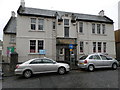
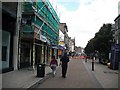
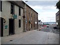
Images taken near to High Street, KY1 1JW and the surrounding area
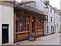
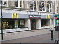
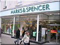
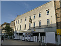
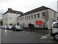
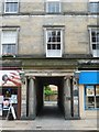
Please click the More button for more images, licensing and image copyright information.
Member of UK Parliament
This postcode is in the Kirkcaldy and Cowdenbeath parliamentary constituency.
Kirkcaldy and Cowdenbeath is a constituency in Scotland. The seat has been held by Neale Hanvey (Alba Party) since December 2019.

Most Recent House Sales for High Street, KY1 1JW
No recorded house sales or transfers for this postcode.
Local Petrol Station Prices
Coordinates for KY1 1JW
Sunrise and Sunset at KY1 1JW
Traffic Emission and Congestion Zones
Historical Weather Summary
| Clear | 10.14% |
| Cloudy | 58.88% |
| Rain | 10.44% |
| Windy | 20.20% |
| Other | 0.34% |
Companies Registered at KY1 1JW
Postcode Details for KY1 1JW
Recent Updates
|
18 Apr 2024 Added Traffic Camera Views from Traffic Scotland to Roadworks within Scotland |
|
15 Apr 2024 Schools Data updated for April 2024 |
|
10 Apr 2024 Companies Data updated for March 2024 |
|
7 Apr 2024 New option to receive automatic updates to roadworks that affect you |
|
7 Apr 2024 Police and Crime data updated for February 2024 |
|
3 Apr 2024 Sold House Price data updated for February 2024 |
|
30 Mar 2024 Energy Performance Certificates (England and Wales) updated February 2024 |
|
28 Mar 2024 New feature to use Geolocating functions to detect your current location |
Random Postcodes
Want an idea of what is in our extensive website? Try somewhere completely random!
The Rural/Urban classification is based upon data collected during the 2011 Census and released in August 2013 and is categorised into 6 distinct classes.
[A] Urban Major conurbation: A built up area with a population of 10,000 (3,000 in Scotland) or more and is assigned to the major conurbation settlement category.
[B] Urban Minor conurbation: A built up area with a population of 10,000 (3,000 in Scotland) or more and is assigned to the minor conurbation settlement category.
[C] Urban City and town: A built up area with a population of 10,000 (3,000 in Scotland) or more and is assigned to the city and town settlement category.
[D] Rural Town and fringe
[E] Rural Village
[F] Rural Hamlet and isolated dwelling
The Index of Multiple Deprivation (IMD) is the official measure of relative deprivation.
The index is based on 39 separate indicators across seven distinct domains (Income; Employment; Health and Disability; Education, Skills and Training; Crime; Barriers to Housing and Services; Living Environment) to provide an overall measure of multiple deprivation and is calculated for every neighbourhood.
The index is relative rather than an absolute scale and so a neighbourhood with a score of 10 is more deprived than one rated 20, but this does not equate to being twice as deprived.
Please note: Different indices are used in England, Scotland, Wales and Northern Ireland and so comparison of scores from neighbourhoods in different countries should not be undertaken.
These figures report on incorporated UK companies only that are registered at this postcode and do not include sole-traders, partnerships or overseas organisations.
The population figure shown for your area are an estimate provided by the Office for National Statistics and is rounded to the nearest 1,000.
The estimates are derived from the Annual Population Survey (APS) which is the Labour Force Survey (LFS) plus various sample boosts.
There are 55 unitary authorities. They provide all local government services in their areas. These are mainly in the cities, urban areas and larger towns although there are now 6 shire county councils that are unitary (ie have no district councils beneath them).