Overview for Langwood Close, ASHTEAD, KT21 1RL
Introduction
Ashtead is a large village in the Mole Valley district of Surrey, England, approximately 15.5 mi (25 km) south of central London. Primarily a commuter settlement, Ashtead is on the single-carriageway A24 between Epsom and Leatherhead. The village is on the northern slopes of the North Downs and is in the catchment area of The Rye, a tributary of the River Mole.
The earliest archaeological evidence for human activity in the village is from the Stone Age. At several points in its history, including during the early Roman period, Ashtead has been a centre for brick and tile manufacture. From medieval times until the late 19th century, Ashtead was primarily an agricultural settlement. Residential development was catalysed by the opening of the railway line between Epsom and Leatherhead in 1859 and by the breakup of the Ashtead Park estate in the 1880s. Housebuilding continued into the 20th century, reaching a peak in the 1930s. Future expansion is now constrained by the Metropolitan Green Belt, which encircles the village.
There are two nature reserves in the village: Ashtead Common, to the north west of the centre, forms part of a Site of Special Scientific Interest and is owned by the Corporation of London; Ashtead Park, to the east of the centre is a Local Nature Reserve owned by the District Council.
Summary for Langwood Close, ASHTEAD, KT21 1RL
Roadworks near KT21 1RL
Road Safety near KT21 1RL
Details of personal injury accidents in and around Langwood Close, KT21 1RL that have been reported to Surrey Police over the past 20 years.
Traffic Levels near KT21 1RL
View traffic levels near Langwood Close, KT21 1RL from official Department for Transport counts.
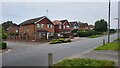
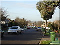
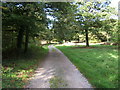
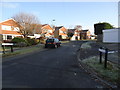
Images taken near to Langwood Close, KT21 1RL and the surrounding area
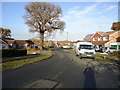
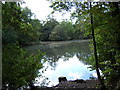
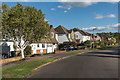
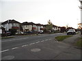
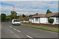
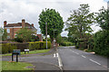
Please click the More button for more images, licensing and image copyright information.
Member of UK Parliament
This postcode is in the Epsom and Ewell parliamentary constituency.
Epsom and Ewell is a constituency in the South East region of England. The seat has been held by Chris Grayling (Conservative) since May 2010.

Most Recent House Sales for Langwood Close, KT21 1RL
19 Mar 2021
24 Sep 2014
20 Jun 2013
12 Jul 2010
Local Petrol Station Prices
Coordinates for KT21 1RL
Residents at KT21 1RL
Sunrise and Sunset at KT21 1RL
Traffic Emission and Congestion Zones
Historical Weather Summary
| Clear | 23.16% |
| Cloudy | 66.79% |
| Rain | 6.70% |
| Windy | 3.22% |
| Other | 0.13% |
Population
Deprivation Index
the more deprived the postcode
Average Energy Performance
Companies Registered at KT21 1RL
Postcode Details for KT21 1RL
Recent Updates
|
18 Apr 2024 Added Traffic Camera Views from Traffic Scotland to Roadworks within Scotland |
|
15 Apr 2024 Schools Data updated for April 2024 |
|
10 Apr 2024 Companies Data updated for March 2024 |
|
7 Apr 2024 New option to receive automatic updates to roadworks that affect you |
|
7 Apr 2024 Police and Crime data updated for February 2024 |
|
3 Apr 2024 Sold House Price data updated for February 2024 |
|
30 Mar 2024 Energy Performance Certificates (England and Wales) updated February 2024 |
|
28 Mar 2024 New feature to use Geolocating functions to detect your current location |
Random Postcodes
Want an idea of what is in our extensive website? Try somewhere completely random!
The Rural/Urban classification is based upon data collected during the 2011 Census and released in August 2013 and is categorised into 6 distinct classes.
[A] Urban Major conurbation: A built up area with a population of 10,000 (3,000 in Scotland) or more and is assigned to the major conurbation settlement category.
[B] Urban Minor conurbation: A built up area with a population of 10,000 (3,000 in Scotland) or more and is assigned to the minor conurbation settlement category.
[C] Urban City and town: A built up area with a population of 10,000 (3,000 in Scotland) or more and is assigned to the city and town settlement category.
[D] Rural Town and fringe
[E] Rural Village
[F] Rural Hamlet and isolated dwelling
The Index of Multiple Deprivation (IMD) is the official measure of relative deprivation.
The index is based on 39 separate indicators across seven distinct domains (Income; Employment; Health and Disability; Education, Skills and Training; Crime; Barriers to Housing and Services; Living Environment) to provide an overall measure of multiple deprivation and is calculated for every neighbourhood.
The index is relative rather than an absolute scale and so a neighbourhood with a score of 10 is more deprived than one rated 20, but this does not equate to being twice as deprived.
Please note: Different indices are used in England, Scotland, Wales and Northern Ireland and so comparison of scores from neighbourhoods in different countries should not be undertaken.
These figures report on incorporated UK companies only that are registered at this postcode and do not include sole-traders, partnerships or overseas organisations.
The population figure shown for your area are an estimate provided by the Office for National Statistics and is rounded to the nearest 1,000.
The estimates are derived from the Annual Population Survey (APS) which is the Labour Force Survey (LFS) plus various sample boosts.
There are 26 county councils in 2-tier areas, providing services such as education, social services and waste disposal.
In 2-tier areas, each county council area is subdivided into districts, for which there is an independent district council. There are 192 district councils.
District councils are responsible for local services such as rubbish collection, housing and planning applications.