Overview for Parvis Road, WEST BYFLEET, KT14 6HA
Introduction
West Byfleet is a village in Surrey which grew up around its relatively minor stop on the London & South Western Railway: the station, originally Byfleet and Woodham, opened in 1887. More than 1 mile (1.6 km) from the medieval village of Byfleet, the initial concentration of a new development soon established its own economy apart from that of a dependent London commuter village and spread in most directions to its borders including to the border of the old settlement, divided by the shielded M25 motorway today. The first place of worship was dedicated in 1912, the parish of West Byfleet associated with it was established in 1917. The village is bounded to the north by the Basingstoke Canal and to the east by the M25 and the Wey Navigation Canal. Forming part of the contiguous development centred on London and its stockbroker belt just outside the M25 motorway, it is 18 miles from London Heathrow and equidistant between the business parks of Woking and Brooklands. In local government it forms a ward on the same basis as its parish in the Borough of Woking.
Summary for Parvis Road, WEST BYFLEET, KT14 6HA
Roadworks near KT14 6HA
Road Safety near KT14 6HA
Details of personal injury accidents in and around Parvis Road, KT14 6HA that have been reported to Surrey Police over the past 20 years.
Traffic Levels near KT14 6HA
View traffic levels near Parvis Road, KT14 6HA from official Department for Transport counts.
Images taken near to Parvis Road, KT14 6HA and the surrounding area
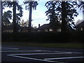
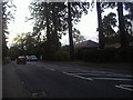
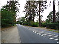
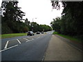
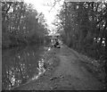
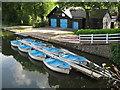
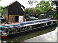
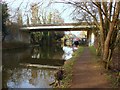
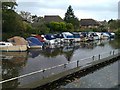
Please click the More button for more images, licensing and image copyright information.
Member of UK Parliament
This postcode is in the Woking parliamentary constituency.
Woking is a constituency in the South East region of England. The seat has been held by Mr Jonathan Lord (Conservative) since May 2010.

Most Recent House Sales for Parvis Road, KT14 6HA
21 Jul 2023
25 Mar 2022
27 Nov 2020
14 Feb 2014
Local Petrol Station Prices
Coordinates for KT14 6HA
Residents at KT14 6HA
Sunrise and Sunset at KT14 6HA
Traffic Emission and Congestion Zones
Historical Weather Summary
| Clear | 21.29% |
| Cloudy | 62.38% |
| Rain | 6.57% |
| Windy | 9.65% |
| Other | 0.11% |
Population
Deprivation Index
the more deprived the postcode
Average Energy Performance
Companies Registered at KT14 6HA
Postcode Details for KT14 6HA
Recent Updates
|
18 Apr 2024 Added Traffic Camera Views from Traffic Scotland to Roadworks within Scotland |
|
15 Apr 2024 Schools Data updated for April 2024 |
|
10 Apr 2024 Companies Data updated for March 2024 |
|
7 Apr 2024 New option to receive automatic updates to roadworks that affect you |
|
7 Apr 2024 Police and Crime data updated for February 2024 |
|
3 Apr 2024 Sold House Price data updated for February 2024 |
|
30 Mar 2024 Energy Performance Certificates (England and Wales) updated February 2024 |
|
28 Mar 2024 New feature to use Geolocating functions to detect your current location |
Random Postcodes
Want an idea of what is in our extensive website? Try somewhere completely random!
The Rural/Urban classification is based upon data collected during the 2011 Census and released in August 2013 and is categorised into 6 distinct classes.
[A] Urban Major conurbation: A built up area with a population of 10,000 (3,000 in Scotland) or more and is assigned to the major conurbation settlement category.
[B] Urban Minor conurbation: A built up area with a population of 10,000 (3,000 in Scotland) or more and is assigned to the minor conurbation settlement category.
[C] Urban City and town: A built up area with a population of 10,000 (3,000 in Scotland) or more and is assigned to the city and town settlement category.
[D] Rural Town and fringe
[E] Rural Village
[F] Rural Hamlet and isolated dwelling
The Index of Multiple Deprivation (IMD) is the official measure of relative deprivation.
The index is based on 39 separate indicators across seven distinct domains (Income; Employment; Health and Disability; Education, Skills and Training; Crime; Barriers to Housing and Services; Living Environment) to provide an overall measure of multiple deprivation and is calculated for every neighbourhood.
The index is relative rather than an absolute scale and so a neighbourhood with a score of 10 is more deprived than one rated 20, but this does not equate to being twice as deprived.
Please note: Different indices are used in England, Scotland, Wales and Northern Ireland and so comparison of scores from neighbourhoods in different countries should not be undertaken.
These figures report on incorporated UK companies only that are registered at this postcode and do not include sole-traders, partnerships or overseas organisations.
The population figure shown for your area are an estimate provided by the Office for National Statistics and is rounded to the nearest 1,000.
The estimates are derived from the Annual Population Survey (APS) which is the Labour Force Survey (LFS) plus various sample boosts.
There are 26 county councils in 2-tier areas, providing services such as education, social services and waste disposal.
In 2-tier areas, each county council area is subdivided into districts, for which there is an independent district council. There are 192 district councils.
District councils are responsible for local services such as rubbish collection, housing and planning applications.