Overview for Caenshill Place, WEYBRIDGE, KT13 0SQ
Introduction
Weybridge is a town in the Borough of Elmbridge in Surrey, England, around 17 mi (27 km) southwest of central London. The settlement is recorded as Waigebrugge and Weibrugge in the 7th century and the name derives from a crossing point of the River Wey, which flows into the River Thames to the north of the town centre. The earliest evidence of human activity is from the Bronze Age. During the Anglo-Saxon and medieval periods, Weybridge was held by Chertsey Abbey.
In the 1530s, Henry VIII constructed Oatlands Palace to the north of the town centre, which he intended to be the residence of his fourth wife, Anne of Cleves. He married Catherine Howard there in July 1540 and the palace remained a royal residence until the Civil War. The buildings were demolished in the early 1650s and a new mansion, Oatlands House, was constructed to the east of Weybridge later the same century. Prince Frederick, Duke of York and Albany owned the mansion in the 18th century.
The town began to expand beyond its medieval footprint in the early 19th century, catalysed by the initial breakup of the Oatlands House estate, the enclosure of Weybridge Heath and the opening of the railway station in 1838. The developer, W. G. Tarrant, was responsible for the construction of housing on St George's Hill in the first half of the 20th century.
The world's first purpose-built racing circuit was constructed at Brooklands in 1907. The track hosted the first British Grand Prix in 1926 and was used by Malcolm Campbell to develop his final land speed record car, Campbell-Railton Blue Bird. Throughout the 20th century, Brooklands was an important location for the aerospace industry and aircraft developed and tested there included the Sopwith Camel, the Wellington bomber and the Hurricane fighter. Vickers established a factory at the circuit in 1915 and aircraft manufacturing continued at the site until 1988.
Summary for Caenshill Place, WEYBRIDGE, KT13 0SQ
Roadworks near KT13 0SQ
Road Safety near KT13 0SQ
Details of personal injury accidents in and around Caenshill Place, KT13 0SQ that have been reported to Surrey Police over the past 20 years.
Traffic Levels near KT13 0SQ
View traffic levels near Caenshill Place, KT13 0SQ from official Department for Transport counts.
Images taken near to Caenshill Place, KT13 0SQ and the surrounding area
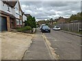
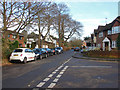
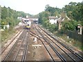
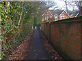
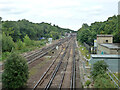
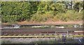
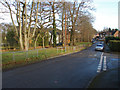
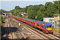
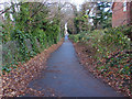
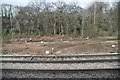
Please click the More button for more images, licensing and image copyright information.
Member of UK Parliament
This postcode is in the Runnymede and Weybridge parliamentary constituency.
Runnymede and Weybridge is a constituency in the South East region of England. The seat has been held by Dr Ben Spencer (Conservative) since December 2019.

Most Recent House Sales for Caenshill Place, KT13 0SQ
21 May 2020
18 Jul 2017
5 Aug 2016
20 Jul 2009
Local Petrol Station Prices
Coordinates for KT13 0SQ
Residents at KT13 0SQ
Sunrise and Sunset at KT13 0SQ
Traffic Emission and Congestion Zones
Historical Weather Summary
| Clear | 20.82% |
| Cloudy | 59.90% |
| Rain | 6.60% |
| Windy | 12.56% |
| Other | 0.12% |
Population
Deprivation Index
the more deprived the postcode
Average Energy Performance
Companies Registered at KT13 0SQ
Postcode Details for KT13 0SQ
Recent Updates
|
18 Apr 2024 Added Traffic Camera Views from Traffic Scotland to Roadworks within Scotland |
|
15 Apr 2024 Schools Data updated for April 2024 |
|
10 Apr 2024 Companies Data updated for March 2024 |
|
7 Apr 2024 New option to receive automatic updates to roadworks that affect you |
|
7 Apr 2024 Police and Crime data updated for February 2024 |
|
3 Apr 2024 Sold House Price data updated for February 2024 |
|
30 Mar 2024 Energy Performance Certificates (England and Wales) updated February 2024 |
|
28 Mar 2024 New feature to use Geolocating functions to detect your current location |
Random Postcodes
Want an idea of what is in our extensive website? Try somewhere completely random!
The Rural/Urban classification is based upon data collected during the 2011 Census and released in August 2013 and is categorised into 6 distinct classes.
[A] Urban Major conurbation: A built up area with a population of 10,000 (3,000 in Scotland) or more and is assigned to the major conurbation settlement category.
[B] Urban Minor conurbation: A built up area with a population of 10,000 (3,000 in Scotland) or more and is assigned to the minor conurbation settlement category.
[C] Urban City and town: A built up area with a population of 10,000 (3,000 in Scotland) or more and is assigned to the city and town settlement category.
[D] Rural Town and fringe
[E] Rural Village
[F] Rural Hamlet and isolated dwelling
The Index of Multiple Deprivation (IMD) is the official measure of relative deprivation.
The index is based on 39 separate indicators across seven distinct domains (Income; Employment; Health and Disability; Education, Skills and Training; Crime; Barriers to Housing and Services; Living Environment) to provide an overall measure of multiple deprivation and is calculated for every neighbourhood.
The index is relative rather than an absolute scale and so a neighbourhood with a score of 10 is more deprived than one rated 20, but this does not equate to being twice as deprived.
Please note: Different indices are used in England, Scotland, Wales and Northern Ireland and so comparison of scores from neighbourhoods in different countries should not be undertaken.
These figures report on incorporated UK companies only that are registered at this postcode and do not include sole-traders, partnerships or overseas organisations.
The population figure shown for your area are an estimate provided by the Office for National Statistics and is rounded to the nearest 1,000.
The estimates are derived from the Annual Population Survey (APS) which is the Labour Force Survey (LFS) plus various sample boosts.
There are 26 county councils in 2-tier areas, providing services such as education, social services and waste disposal.
In 2-tier areas, each county council area is subdivided into districts, for which there is an independent district council. There are 192 district councils.
District councils are responsible for local services such as rubbish collection, housing and planning applications.