Overview for CUMNOCK, KA18 2RD
Introduction
Cumnock is a town and former civil parish located in East Ayrshire, Scotland. The town sits at the confluence of the Glaisnock Water and the Lugar Water. There are three neighbouring housing projects which lie just outside the town boundaries, Craigens, Logan and Netherthird, with the former ironworks settlement of Lugar also just outside the town, contributing to a population of around 13,000 in the immediate locale. A new housing development, Knockroon, was granted planning permission on 9 December 2009 by East Ayrshire Council.
The town is home to the Robert Burns Academy, a new educational campus housing the main Robert Burns Academy secondary school following the merger of Cumnock Academy and Auchinleck Academy, Lochnorris Primary School and Cherry Trees Early Childhood Centre. The campus is the largest educational establishment in Scotland.
The 2011 UK Census revealed that the Ayr, Carrick and Cumnock constituency, of which Cumnock is part, had an above-average unemployment rate at 5.6% compared to the Scottish average of 4.8%, with a significant proportion of residents living in local authority housing at 20.2% compared to the Scottish average of 13.2%. The constituency also had a high proportion of retired people and Church of Scotland Protestants at the Census relative to elsewhere in Scotland, with 19% of those living in the constituency retired (14.9% across Scotland) and 43.3% of constituents recognising their religion as Church of Scotland (32.4% across Scotland). 90% of residents identified their ethnicity as White British, with 99% recognising their ethnicity as White. On indicators such as health, educational attainment, income and social class however the area is more deprived than the national average.
Summary for CUMNOCK, KA18 2RD
Roadworks near KA18 2RD
Road Safety near KA18 2RD
Details of personal injury accidents in and around KA18 2RD that have been reported to over the past 20 years.
Traffic Levels near KA18 2RD
View traffic levels near KA18 2RD from official Department for Transport counts.
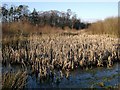
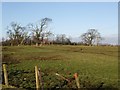
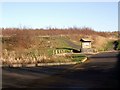
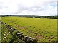
Images taken in and around the ka182rd area
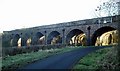
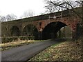

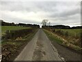
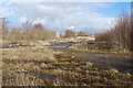

Please click the More button for more images, licensing and image copyright information.
Member of UK Parliament
This postcode is in the Ayr, Carrick and Cumnock parliamentary constituency.
Ayr, Carrick and Cumnock is a constituency in Scotland. The seat has been held by Allan Dorans (Scottish National Party) since December 2019.

Most Recent House Sales for KA18 2RD
No recorded house sales or transfers for this postcode.
Local Petrol Station Prices
Coordinates for KA18 2RD
Sunrise and Sunset at KA18 2RD
Traffic Emission and Congestion Zones
Historical Weather Summary
| Clear | 5.15% |
| Cloudy | 51.66% |
| Rain | 14.53% |
| Windy | 27.79% |
| Other | 0.87% |
Average Energy Performance
Companies Registered at KA18 2RD
Postcode Details for KA18 2RD
Recent Updates
|
18 Apr 2024 Added Traffic Camera Views from Traffic Scotland to Roadworks within Scotland |
|
15 Apr 2024 Schools Data updated for April 2024 |
|
10 Apr 2024 Companies Data updated for March 2024 |
|
7 Apr 2024 New option to receive automatic updates to roadworks that affect you |
|
7 Apr 2024 Police and Crime data updated for February 2024 |
|
3 Apr 2024 Sold House Price data updated for February 2024 |
|
30 Mar 2024 Energy Performance Certificates (England and Wales) updated February 2024 |
|
28 Mar 2024 New feature to use Geolocating functions to detect your current location |
Random Postcodes
Want an idea of what is in our extensive website? Try somewhere completely random!
The Rural/Urban classification is based upon data collected during the 2011 Census and released in August 2013 and is categorised into 6 distinct classes.
[A] Urban Major conurbation: A built up area with a population of 10,000 (3,000 in Scotland) or more and is assigned to the major conurbation settlement category.
[B] Urban Minor conurbation: A built up area with a population of 10,000 (3,000 in Scotland) or more and is assigned to the minor conurbation settlement category.
[C] Urban City and town: A built up area with a population of 10,000 (3,000 in Scotland) or more and is assigned to the city and town settlement category.
[D] Rural Town and fringe
[E] Rural Village
[F] Rural Hamlet and isolated dwelling
The Index of Multiple Deprivation (IMD) is the official measure of relative deprivation.
The index is based on 39 separate indicators across seven distinct domains (Income; Employment; Health and Disability; Education, Skills and Training; Crime; Barriers to Housing and Services; Living Environment) to provide an overall measure of multiple deprivation and is calculated for every neighbourhood.
The index is relative rather than an absolute scale and so a neighbourhood with a score of 10 is more deprived than one rated 20, but this does not equate to being twice as deprived.
Please note: Different indices are used in England, Scotland, Wales and Northern Ireland and so comparison of scores from neighbourhoods in different countries should not be undertaken.
These figures report on incorporated UK companies only that are registered at this postcode and do not include sole-traders, partnerships or overseas organisations.
The population figure shown for your area are an estimate provided by the Office for National Statistics and is rounded to the nearest 1,000.
The estimates are derived from the Annual Population Survey (APS) which is the Labour Force Survey (LFS) plus various sample boosts.
There are 55 unitary authorities. They provide all local government services in their areas. These are mainly in the cities, urban areas and larger towns although there are now 6 shire county councils that are unitary (ie have no district councils beneath them).