Overview for Annie Reed Road, BEVERLEY, HU17 0LF
Introduction
Beverley is a market and minster town and a civil parish in the East Riding of Yorkshire, England, of which it is the county town. It is located 27 miles (43 km) south-east of York and 15 miles (24 km) north-west of Hull.
The town is known for Beverley Minster, Beverley Westwood, North Bar (a 15th-century gate) and Beverley Racecourse. It inspired the naming of the city of Beverly, Massachusetts, which in turn was the impetus for Beverly Hills, California. The town was listed in the 2018 Sunday Times report on Best Places to Live in northern England.
The town was originally known as Inderawuda and was founded around 700 AD by Saint John of Beverley during the time of the Anglian kingdom of Northumbria. After a period of Viking control, it passed to the Cerdic dynasty, a period during which it gained prominence in terms of religious importance in Great Britain. It continued to grow especially under the Normans when its trading industry was first established. A place of pilgrimage throughout the Middle Ages due to its founder, it eventually became a significant wool-trading town. Beverley was once the tenth-largest town in England, as well as one of the richest, because of its wool and the pilgrims who came to venerate its founding saint, John of Beverley. After the Reformation, the stature of Beverley was much reduced.
In the 20th century, Beverley was the administrative centre of the local government district of the Borough of Beverley (1974–1996). It is now the county town of the East Riding, located 8 miles (13 km) north-west of Hull, 10 miles (16 km) east of Market Weighton and 12 miles (19 km) west of Hornsea. According to the 2001 United Kingdom census the total population of the urban area of Beverley was 29,110 – of whom 17,549 live within the historic parish boundaries. The population of the parish had risen to 18,624 at the time of the UK's 2011 census.
Summary for Annie Reed Road, BEVERLEY, HU17 0LF
Roadworks near HU17 0LF
Road Safety near HU17 0LF
Details of personal injury accidents in and around Annie Reed Road, HU17 0LF that have been reported to Humberside Police over the past 20 years.
Traffic Levels near HU17 0LF
View traffic levels near Annie Reed Road, HU17 0LF from official Department for Transport counts.
Images taken near to Annie Reed Road, HU17 0LF and the surrounding area
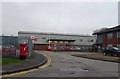
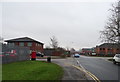
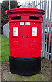
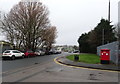

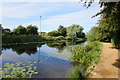
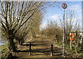
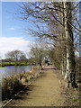

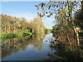
Please click the More button for more images, licensing and image copyright information.
Police
This area is policed by Humberside Police.
Humberside Police split their policing area into 81 separate neighbourhoods and this postcode is in the Minster and Woodmansey neighbourhood.

Minster and Woodmansey Neighbourhood Crime
Top 3 Categories
For full details of all categories together with more crime information, click on the Details button.
Member of UK Parliament
This postcode is in the Beverley and Holderness parliamentary constituency.
Beverley and Holderness is a constituency in the Yorkshire and The Humber region of England. The seat has been held by Graham Stuart (Conservative) since May 2010.

Most Recent House Sales for Annie Reed Road, HU17 0LF
14 Dec 2006
31 Jul 1996
Local Petrol Station Prices
Coordinates for HU17 0LF
Residents at HU17 0LF
Sunrise and Sunset at HU17 0LF
Traffic Emission and Congestion Zones
Historical Weather Summary
| Clear | 10.80% |
| Cloudy | 57.84% |
| Rain | 8.69% |
| Windy | 22.67% |
| Other | 0.00% |
Population
Deprivation Index
the more deprived the postcode
Companies Registered at HU17 0LF
Postcode Details for HU17 0LF
Recent Updates
|
18 Apr 2024 Added Traffic Camera Views from Traffic Scotland to Roadworks within Scotland |
|
15 Apr 2024 Schools Data updated for April 2024 |
|
10 Apr 2024 Companies Data updated for March 2024 |
|
7 Apr 2024 New option to receive automatic updates to roadworks that affect you |
|
7 Apr 2024 Police and Crime data updated for February 2024 |
|
3 Apr 2024 Sold House Price data updated for February 2024 |
|
30 Mar 2024 Energy Performance Certificates (England and Wales) updated February 2024 |
|
28 Mar 2024 New feature to use Geolocating functions to detect your current location |
Random Postcodes
Want an idea of what is in our extensive website? Try somewhere completely random!
The Rural/Urban classification is based upon data collected during the 2011 Census and released in August 2013 and is categorised into 6 distinct classes.
[A] Urban Major conurbation: A built up area with a population of 10,000 (3,000 in Scotland) or more and is assigned to the major conurbation settlement category.
[B] Urban Minor conurbation: A built up area with a population of 10,000 (3,000 in Scotland) or more and is assigned to the minor conurbation settlement category.
[C] Urban City and town: A built up area with a population of 10,000 (3,000 in Scotland) or more and is assigned to the city and town settlement category.
[D] Rural Town and fringe
[E] Rural Village
[F] Rural Hamlet and isolated dwelling
The Index of Multiple Deprivation (IMD) is the official measure of relative deprivation.
The index is based on 39 separate indicators across seven distinct domains (Income; Employment; Health and Disability; Education, Skills and Training; Crime; Barriers to Housing and Services; Living Environment) to provide an overall measure of multiple deprivation and is calculated for every neighbourhood.
The index is relative rather than an absolute scale and so a neighbourhood with a score of 10 is more deprived than one rated 20, but this does not equate to being twice as deprived.
Please note: Different indices are used in England, Scotland, Wales and Northern Ireland and so comparison of scores from neighbourhoods in different countries should not be undertaken.
These figures report on incorporated UK companies only that are registered at this postcode and do not include sole-traders, partnerships or overseas organisations.
The population figure shown for your area are an estimate provided by the Office for National Statistics and is rounded to the nearest 1,000.
The estimates are derived from the Annual Population Survey (APS) which is the Labour Force Survey (LFS) plus various sample boosts.
There are 55 unitary authorities. They provide all local government services in their areas. These are mainly in the cities, urban areas and larger towns although there are now 6 shire county councils that are unitary (ie have no district councils beneath them).