Overview for Cearn Ronaidh, STORNOWAY, HS1 2YG
Introduction
Stornoway is the main town of the Western Isles and the capital of Lewis and Harris in Scotland.
The town's population is around 6,953, making it by far the largest town in the Outer Hebrides, as well as the third largest island town in Scotland after Kirkwall in Orkney and Lerwick in Shetland. The traditional civil parish of Stornoway, which includes various nearby villages, has a combined population of just over 10,000. The Comhairle nan Eilean Siar measures population in a different area: the Stornoway settlement area, Laxdale, Sandwick and Newmarket; in 2019, the estimated population for this area was 6,953.
Stornoway is an important port and the major town and administrative centre of the Outer Hebrides. It is home to Comhairle nan Eilean Siar (the Western Isles Council) and a variety of educational, sporting and media establishments. Until relatively recently, observance of the Christian Sabbath (Sunday) has been associated with Hebridean culture. Recent changes mean that Sundays on Lewis now more closely resemble those in most parts of the Southern Isles, i.e., Benbecula, South Uist, Barra, and Vatersay, or on mainland Scotland.
Summary for Cearn Ronaidh, STORNOWAY, HS1 2YG
Roadworks near HS1 2YG
Road Safety near HS1 2YG
Details of personal injury accidents in and around Cearn Ronaidh, HS1 2YG that have been reported to over the past 20 years.
Traffic Levels near HS1 2YG
View traffic levels near Cearn Ronaidh, HS1 2YG from official Department for Transport counts.
Images taken near to Cearn Ronaidh, HS1 2YG and the surrounding area
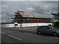

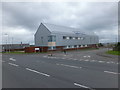
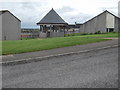
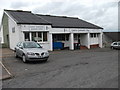
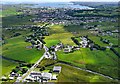
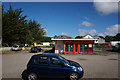
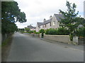
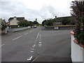
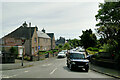
Please click the More button for more images, licensing and image copyright information.
Member of UK Parliament
This postcode is in the Na h-Eileanan an Iar parliamentary constituency.
Na h-Eileanan an Iar is a constituency in Scotland. The seat has been held by Angus Brendan MacNeil (Independent) since May 2005.

Most Recent House Sales for Cearn Ronaidh, HS1 2YG
No recorded house sales or transfers for this postcode.
Local Petrol Station Prices
Coordinates for HS1 2YG
Sunrise and Sunset at HS1 2YG
Traffic Emission and Congestion Zones
Historical Weather Summary
| Clear | 7.49% |
| Cloudy | 45.32% |
| Rain | 11.63% |
| Windy | 35.47% |
| Other | 0.09% |
Average Energy Performance
Companies Registered at HS1 2YG
Postcode Details for HS1 2YG
Recent Updates
|
18 Apr 2024 Added Traffic Camera Views from Traffic Scotland to Roadworks within Scotland |
|
15 Apr 2024 Schools Data updated for April 2024 |
|
10 Apr 2024 Companies Data updated for March 2024 |
|
7 Apr 2024 New option to receive automatic updates to roadworks that affect you |
|
7 Apr 2024 Police and Crime data updated for February 2024 |
|
3 Apr 2024 Sold House Price data updated for February 2024 |
|
30 Mar 2024 Energy Performance Certificates (England and Wales) updated February 2024 |
|
28 Mar 2024 New feature to use Geolocating functions to detect your current location |
Random Postcodes
Want an idea of what is in our extensive website? Try somewhere completely random!
The Rural/Urban classification is based upon data collected during the 2011 Census and released in August 2013 and is categorised into 6 distinct classes.
[A] Urban Major conurbation: A built up area with a population of 10,000 (3,000 in Scotland) or more and is assigned to the major conurbation settlement category.
[B] Urban Minor conurbation: A built up area with a population of 10,000 (3,000 in Scotland) or more and is assigned to the minor conurbation settlement category.
[C] Urban City and town: A built up area with a population of 10,000 (3,000 in Scotland) or more and is assigned to the city and town settlement category.
[D] Rural Town and fringe
[E] Rural Village
[F] Rural Hamlet and isolated dwelling
The Index of Multiple Deprivation (IMD) is the official measure of relative deprivation.
The index is based on 39 separate indicators across seven distinct domains (Income; Employment; Health and Disability; Education, Skills and Training; Crime; Barriers to Housing and Services; Living Environment) to provide an overall measure of multiple deprivation and is calculated for every neighbourhood.
The index is relative rather than an absolute scale and so a neighbourhood with a score of 10 is more deprived than one rated 20, but this does not equate to being twice as deprived.
Please note: Different indices are used in England, Scotland, Wales and Northern Ireland and so comparison of scores from neighbourhoods in different countries should not be undertaken.
These figures report on incorporated UK companies only that are registered at this postcode and do not include sole-traders, partnerships or overseas organisations.
The population figure shown for your area are an estimate provided by the Office for National Statistics and is rounded to the nearest 1,000.
The estimates are derived from the Annual Population Survey (APS) which is the Labour Force Survey (LFS) plus various sample boosts.
There are 55 unitary authorities. They provide all local government services in their areas. These are mainly in the cities, urban areas and larger towns although there are now 6 shire county councils that are unitary (ie have no district councils beneath them).