Overview for School Lane, BEACONSFIELD, HP9 2UN
Introduction
Beaconsfield (BEK-ənz-feeld) is a market town and civil parish within the unitary authority of Buckinghamshire, England, 23+1⁄2 miles (38 kilometres) west-northwest of central London and 16 miles (26 kilometres) south-southeast of Aylesbury. Three other towns are within five miles (eight kilometres): Gerrards Cross, Amersham and High Wycombe.
The town is adjacent to the Chiltern Hills Area of Outstanding Natural Beauty and has a wide area of Georgian, neo-Georgian and Tudor revival high street architecture, known as the Old Town. It is known for the first model village in the world and the National Film and Television School.
Beaconsfield was named 'Britain's richest town' (based on an average house price of £684,474) by The Daily Telegraph in 2008. In 2011 the post town had the highest proportion in the UK of £1 million-plus homes for sale (at 47%, compared to 3.5% nationally). In 2011, Burkes Road was named as the second most expensive road in the country outside London.
Summary for School Lane, BEACONSFIELD, HP9 2UN
Roadworks near HP9 2UN
Road Safety near HP9 2UN
Details of personal injury accidents in and around School Lane, HP9 2UN that have been reported to Thames Valley Police over the past 20 years.
Traffic Levels near HP9 2UN
View traffic levels near School Lane, HP9 2UN from official Department for Transport counts.
Images taken near to School Lane, HP9 2UN and the surrounding area
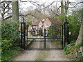
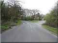
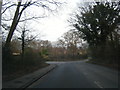
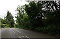
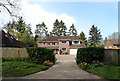
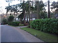
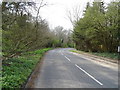
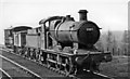
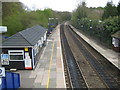
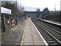
Please click the More button for more images, licensing and image copyright information.
Police
This area is policed by Thames Valley Police.
Thames Valley Police split their policing area into 108 separate neighbourhoods and this postcode is in the Chalfonts neighbourhood.

Chalfonts Neighbourhood Crime
Top 3 Categories
For full details of all categories together with more crime information, click on the Details button.
Member of UK Parliament
This postcode is in the Chesham and Amersham parliamentary constituency.
Chesham and Amersham is a constituency in the South East region of England. The seat has been held by Sarah Green (Liberal Democrat) since June 2021.

Most Recent House Sales for School Lane, HP9 2UN
26 Jun 2017
Local Petrol Station Prices
Coordinates for HP9 2UN
Residents at HP9 2UN
Sunrise and Sunset at HP9 2UN
Traffic Emission and Congestion Zones
Historical Weather Summary
| Clear | 20.58% |
| Cloudy | 58.70% |
| Rain | 6.34% |
| Windy | 14.27% |
| Other | 0.11% |
Deprivation Index
the more deprived the postcode
Average Energy Performance
Companies Registered at HP9 2UN
Postcode Details for HP9 2UN
Recent Updates
|
15 Apr 2024 Schools Data updated for April 2024 |
|
10 Apr 2024 Companies Data updated for March 2024 |
|
7 Apr 2024 New option to receive automatic updates to roadworks that affect you |
|
7 Apr 2024 Police and Crime data updated for February 2024 |
|
3 Apr 2024 Sold House Price data updated for February 2024 |
|
30 Mar 2024 Energy Performance Certificates (England and Wales) updated February 2024 |
|
28 Mar 2024 New feature to use Geolocating functions to detect your current location |
|
17 Mar 2024 Schools Data updated for March 2024 |
Random Postcodes
Want an idea of what is in our extensive website? Try somewhere completely random!
The Rural/Urban classification is based upon data collected during the 2011 Census and released in August 2013 and is categorised into 6 distinct classes.
[A] Urban Major conurbation: A built up area with a population of 10,000 (3,000 in Scotland) or more and is assigned to the major conurbation settlement category.
[B] Urban Minor conurbation: A built up area with a population of 10,000 (3,000 in Scotland) or more and is assigned to the minor conurbation settlement category.
[C] Urban City and town: A built up area with a population of 10,000 (3,000 in Scotland) or more and is assigned to the city and town settlement category.
[D] Rural Town and fringe
[E] Rural Village
[F] Rural Hamlet and isolated dwelling
The Index of Multiple Deprivation (IMD) is the official measure of relative deprivation.
The index is based on 39 separate indicators across seven distinct domains (Income; Employment; Health and Disability; Education, Skills and Training; Crime; Barriers to Housing and Services; Living Environment) to provide an overall measure of multiple deprivation and is calculated for every neighbourhood.
The index is relative rather than an absolute scale and so a neighbourhood with a score of 10 is more deprived than one rated 20, but this does not equate to being twice as deprived.
Please note: Different indices are used in England, Scotland, Wales and Northern Ireland and so comparison of scores from neighbourhoods in different countries should not be undertaken.
These figures report on incorporated UK companies only that are registered at this postcode and do not include sole-traders, partnerships or overseas organisations.
The population figure shown for your area are an estimate provided by the Office for National Statistics and is rounded to the nearest 1,000.
The estimates are derived from the Annual Population Survey (APS) which is the Labour Force Survey (LFS) plus various sample boosts.
There are 55 unitary authorities. They provide all local government services in their areas. These are mainly in the cities, urban areas and larger towns although there are now 6 shire county councils that are unitary (ie have no district councils beneath them).