Overview for Turners Walk, CHESHAM, HP5 3BT
Introduction
Chesham is a market town and civil parish in Buckinghamshire, England, United Kingdom 11 miles (18 km) south-east of the county town of Aylesbury, 25.8 miles (41.5 km) north-west of central London, and part of the London commuter belt. It is in the Chess Valley, surrounded by farmland. The earliest records of Chesham as a settlement are from the second half of the 10th century, although there is archaeological evidence of people in this area from around 8000 BC. Henry III granted a royal charter for a weekly market in 1257.
Chesham is known for its four Bs — boots, beer, brushes and Baptists. In the face of fierce competition from both home and abroad during the later 19th and early 20th centuries, the three traditional industries rapidly declined. The ready availability of skilled labour encouraged new industries to the town both before and after the Second World War. Today, employment in the town is provided mainly by small businesses engaged in light industry, technology and professional services.
From the early part of the 20th century, Chesham has experienced a considerable expansion, with new housing developments and civic infrastructure. Chesham has become a commuter town with improved connection to London via the London Underground and road networks. The town centre has been progressively redeveloped since the 1960s and has been pedestrianised since the 1990s. The population at the 2021 census was 23,008.
Summary for Turners Walk, CHESHAM, HP5 3BT
Roadworks near HP5 3BT
Road Safety near HP5 3BT
Details of personal injury accidents in and around Turners Walk, HP5 3BT that have been reported to Thames Valley Police over the past 20 years.
Traffic Levels near HP5 3BT
View traffic levels near Turners Walk, HP5 3BT from official Department for Transport counts.
Images taken near to Turners Walk, HP5 3BT and the surrounding area
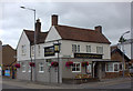
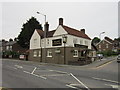
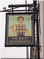
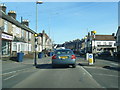
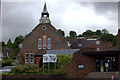
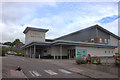
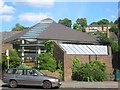
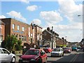
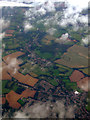
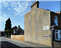
Please click the More button for more images, licensing and image copyright information.
Police
This area is policed by Thames Valley Police.
Thames Valley Police split their policing area into 108 separate neighbourhoods and this postcode is in the Chesham neighbourhood.

Chesham Neighbourhood Crime
Top 3 Categories
For full details of all categories together with more crime information, click on the Details button.
Member of UK Parliament
This postcode is in the Chesham and Amersham parliamentary constituency.
Chesham and Amersham is a constituency in the South East region of England. The seat has been held by Sarah Green (Liberal Democrat) since June 2021.

Most Recent House Sales for Turners Walk, HP5 3BT
15 Sep 2022
21 Aug 2020
14 May 2019
14 Sep 2018
Local Petrol Station Prices
Coordinates for HP5 3BT
Residents at HP5 3BT
Sunrise and Sunset at HP5 3BT
Traffic Emission and Congestion Zones
Historical Weather Summary
| Clear | 20.58% |
| Cloudy | 57.58% |
| Rain | 6.37% |
| Windy | 15.25% |
| Other | 0.22% |
Deprivation Index
the more deprived the postcode
Average Energy Performance
Companies Registered at HP5 3BT
Postcode Details for HP5 3BT
Recent Updates
|
18 Apr 2024 Added Traffic Camera Views from Traffic Scotland to Roadworks within Scotland |
|
15 Apr 2024 Schools Data updated for April 2024 |
|
10 Apr 2024 Companies Data updated for March 2024 |
|
7 Apr 2024 New option to receive automatic updates to roadworks that affect you |
|
7 Apr 2024 Police and Crime data updated for February 2024 |
|
3 Apr 2024 Sold House Price data updated for February 2024 |
|
30 Mar 2024 Energy Performance Certificates (England and Wales) updated February 2024 |
|
28 Mar 2024 New feature to use Geolocating functions to detect your current location |
Random Postcodes
Want an idea of what is in our extensive website? Try somewhere completely random!
The Rural/Urban classification is based upon data collected during the 2011 Census and released in August 2013 and is categorised into 6 distinct classes.
[A] Urban Major conurbation: A built up area with a population of 10,000 (3,000 in Scotland) or more and is assigned to the major conurbation settlement category.
[B] Urban Minor conurbation: A built up area with a population of 10,000 (3,000 in Scotland) or more and is assigned to the minor conurbation settlement category.
[C] Urban City and town: A built up area with a population of 10,000 (3,000 in Scotland) or more and is assigned to the city and town settlement category.
[D] Rural Town and fringe
[E] Rural Village
[F] Rural Hamlet and isolated dwelling
The Index of Multiple Deprivation (IMD) is the official measure of relative deprivation.
The index is based on 39 separate indicators across seven distinct domains (Income; Employment; Health and Disability; Education, Skills and Training; Crime; Barriers to Housing and Services; Living Environment) to provide an overall measure of multiple deprivation and is calculated for every neighbourhood.
The index is relative rather than an absolute scale and so a neighbourhood with a score of 10 is more deprived than one rated 20, but this does not equate to being twice as deprived.
Please note: Different indices are used in England, Scotland, Wales and Northern Ireland and so comparison of scores from neighbourhoods in different countries should not be undertaken.
These figures report on incorporated UK companies only that are registered at this postcode and do not include sole-traders, partnerships or overseas organisations.
The population figure shown for your area are an estimate provided by the Office for National Statistics and is rounded to the nearest 1,000.
The estimates are derived from the Annual Population Survey (APS) which is the Labour Force Survey (LFS) plus various sample boosts.
There are 55 unitary authorities. They provide all local government services in their areas. These are mainly in the cities, urban areas and larger towns although there are now 6 shire county councils that are unitary (ie have no district councils beneath them).