Overview for Queens Road, PRINCES RISBOROUGH, HP27 0JR
Introduction
Princes Risborough is a market town and civil parish in Buckinghamshire, England, about 9 miles (14 km) south of Aylesbury and 8 miles (13 km) north west of High Wycombe. It lies at the foot of the Chiltern Hills, at the north end of a gap or pass through the Chilterns, the south end of which is at West Wycombe. The A4010 road follows this route from West Wycombe through the town and then on to Aylesbury.
Historically it was both a manor and an ecclesiastical parish, of the same extent as the manor, which comprised the present ecclesiastical parish of Princes Risborough (excluding Ilmer) and also the present ecclesiastical parish of Lacey Green, which became a separate parish in the 19th century. It was long and narrow (a "strip parish"), taking in land below the Chiltern scarp, the slope of the scarp itself and also land above the scarp extending into the Chiltern hills. The manor and the parish extended from Longwick in the north through Alscot, the town of Princes Risborough, Loosley Row and Lacey Green to Speen and Walters Ash in the south.
Since 1934 the civil parish of Princes Risborough (formerly the same as the ecclesiastical parish) has included the town of Princes Risborough, the village of Monks Risborough (but not the outlying parts) and part of Horsenden but has excluded Longwick. It is within the Wycombe district of Buckinghamshire and operates as a town council within Wycombe district.
The town is overlooked by the Whiteleaf Cross, a chalk cross carved into the hillside that's just northeast of the town. Though the cross itself lies just above the village with the same name, the landmark is located within the area of Monks Risborough.
Summary for Queens Road, PRINCES RISBOROUGH, HP27 0JR
Roadworks near HP27 0JR
Road Safety near HP27 0JR
Details of personal injury accidents in and around Queens Road, HP27 0JR that have been reported to Thames Valley Police over the past 20 years.
Traffic Levels near HP27 0JR
View traffic levels near Queens Road, HP27 0JR from official Department for Transport counts.
Images taken near to Queens Road, HP27 0JR and the surrounding area
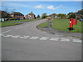
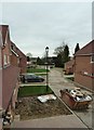
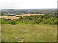
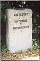
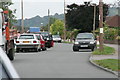
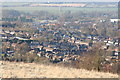
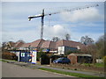
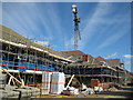
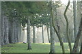
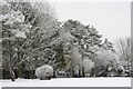
Please click the More button for more images, licensing and image copyright information.
Police
This area is policed by Thames Valley Police.
Thames Valley Police split their policing area into 108 separate neighbourhoods and this postcode is in the Princes Risborough neighbourhood.

Princes Risborough Neighbourhood Crime
Top 3 Categories
For full details of all categories together with more crime information, click on the Details button.
Member of UK Parliament
This postcode is in the Buckingham parliamentary constituency.
Buckingham is a constituency in the South East region of England. The seat has been held by Greg Smith (Conservative) since December 2019.

Most Recent House Sales for Queens Road, HP27 0JR
4 Jan 2023
1 Feb 2019
16 Nov 2017
19 May 2016
Local Petrol Station Prices
Coordinates for HP27 0JR
Residents at HP27 0JR
Sunrise and Sunset at HP27 0JR
Traffic Emission and Congestion Zones
Historical Weather Summary
| Clear | 22.26% |
| Cloudy | 68.75% |
| Rain | 6.35% |
| Windy | 2.50% |
| Other | 0.14% |
Deprivation Index
the more deprived the postcode
Average Energy Performance
Companies Registered at HP27 0JR
Postcode Details for HP27 0JR
Recent Updates
|
18 Apr 2024 Added Traffic Camera Views from Traffic Scotland to Roadworks within Scotland |
|
15 Apr 2024 Schools Data updated for April 2024 |
|
10 Apr 2024 Companies Data updated for March 2024 |
|
7 Apr 2024 New option to receive automatic updates to roadworks that affect you |
|
7 Apr 2024 Police and Crime data updated for February 2024 |
|
3 Apr 2024 Sold House Price data updated for February 2024 |
|
30 Mar 2024 Energy Performance Certificates (England and Wales) updated February 2024 |
|
28 Mar 2024 New feature to use Geolocating functions to detect your current location |
Random Postcodes
Want an idea of what is in our extensive website? Try somewhere completely random!
The Rural/Urban classification is based upon data collected during the 2011 Census and released in August 2013 and is categorised into 6 distinct classes.
[A] Urban Major conurbation: A built up area with a population of 10,000 (3,000 in Scotland) or more and is assigned to the major conurbation settlement category.
[B] Urban Minor conurbation: A built up area with a population of 10,000 (3,000 in Scotland) or more and is assigned to the minor conurbation settlement category.
[C] Urban City and town: A built up area with a population of 10,000 (3,000 in Scotland) or more and is assigned to the city and town settlement category.
[D] Rural Town and fringe
[E] Rural Village
[F] Rural Hamlet and isolated dwelling
The Index of Multiple Deprivation (IMD) is the official measure of relative deprivation.
The index is based on 39 separate indicators across seven distinct domains (Income; Employment; Health and Disability; Education, Skills and Training; Crime; Barriers to Housing and Services; Living Environment) to provide an overall measure of multiple deprivation and is calculated for every neighbourhood.
The index is relative rather than an absolute scale and so a neighbourhood with a score of 10 is more deprived than one rated 20, but this does not equate to being twice as deprived.
Please note: Different indices are used in England, Scotland, Wales and Northern Ireland and so comparison of scores from neighbourhoods in different countries should not be undertaken.
These figures report on incorporated UK companies only that are registered at this postcode and do not include sole-traders, partnerships or overseas organisations.
The population figure shown for your area are an estimate provided by the Office for National Statistics and is rounded to the nearest 1,000.
The estimates are derived from the Annual Population Survey (APS) which is the Labour Force Survey (LFS) plus various sample boosts.
There are 55 unitary authorities. They provide all local government services in their areas. These are mainly in the cities, urban areas and larger towns although there are now 6 shire county councils that are unitary (ie have no district councils beneath them).