Overview for The Hydons, Salt Lane, GODALMING, GU8 4DD
Introduction
Godalming is a market town and civil parish in southwest Surrey, England, around 30 miles (49 km) southwest of central London. It is in the Borough of Waverley, at the confluence of the Rivers Wey and Ock. The civil parish covers 3.74 sq mi (9.7 km2) and includes the settlements of Farncombe, Binscombe and Aaron's Hill. Much of the area lies on the strata of the Lower Greensand Group and Bargate stone was quarried locally until the Second World War.
The earliest evidence of human activity is from the Paleolithic and land above the Wey floodplain at Charterhouse was first settled in the middle Iron Age. The modern town is believed to have its origins in the 6th or early 7th centuries and its name is thought to derive from that of a Saxon landowner. Kersey, a woollen cloth, dyed blue, was produced at Godalming for much of the Middle Ages, but the industry declined in the early modern period. In the 17th century, the town began to specialise in the production of knitted textiles and in the manufacture of hosiery in particular.
Throughout its history, Godalming has benefitted from its location on the main route from London to Portsmouth Dockyard. Local transport links were improved from the early 18th century with the opening of the turnpike road through the town in 1749 and the construction of the Godalming Navigation in 1764. Expansion of the settlement began in the mid-19th century, stimulated by the opening of the first railway station in 1849 and the relocation of Charterhouse School from London in 1872. The town has a claim to be the first place in the world to have a combined public and private electricity supply.
Several buildings in the town centre date from the 16th and 17th centuries. The distinctive Pepperpot was built in 1814 to replace the medieval market house and to house the council chamber. Among the notable former residents of the civil parish were Jack Phillips, the senior wireless operator on the RMS Titanic, and the mountaineer George Mallory. James Oglethorpe, the founder of the Colony of Georgia, was born in Godalming in 1696 and the town maintains a friendship with the U.
S. state and the cities of Savannah and Augusta in particular.
Summary for The Hydons, Salt Lane, GODALMING, GU8 4DD
Roadworks near GU8 4DD
Road Safety near GU8 4DD
Details of personal injury accidents in and around The Hydons, Salt Lane, GU8 4DD that have been reported to Surrey Police over the past 20 years.
Traffic Levels near GU8 4DD
View traffic levels near The Hydons, Salt Lane, GU8 4DD from official Department for Transport counts.
Images taken near to The Hydons, Salt Lane, GU8 4DD and the surrounding area
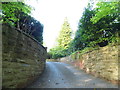

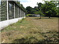
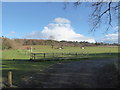
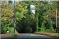
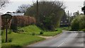
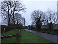

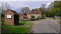
Please click the More button for more images, licensing and image copyright information.
Member of UK Parliament
This postcode is in the South West Surrey parliamentary constituency.
South West Surrey is a constituency in the South East region of England. The seat has been held by Jeremy Hunt (Conservative) since May 2010.

Most Recent House Sales for The Hydons, Salt Lane, GU8 4DD
31 Mar 2022
13 Jan 2021
20 Feb 2020
16 Dec 2016
Local Petrol Station Prices
Coordinates for GU8 4DD
Residents at GU8 4DD
Sunrise and Sunset at GU8 4DD
Traffic Emission and Congestion Zones
Historical Weather Summary
| Clear | 23.28% |
| Cloudy | 68.05% |
| Rain | 7.13% |
| Windy | 1.33% |
| Other | 0.21% |
Population
Deprivation Index
the more deprived the postcode
Average Energy Performance
Companies Registered at GU8 4DD
Postcode Details for GU8 4DD
Recent Updates
|
18 Apr 2024 Added Traffic Camera Views from Traffic Scotland to Roadworks within Scotland |
|
15 Apr 2024 Schools Data updated for April 2024 |
|
10 Apr 2024 Companies Data updated for March 2024 |
|
7 Apr 2024 New option to receive automatic updates to roadworks that affect you |
|
7 Apr 2024 Police and Crime data updated for February 2024 |
|
3 Apr 2024 Sold House Price data updated for February 2024 |
|
30 Mar 2024 Energy Performance Certificates (England and Wales) updated February 2024 |
|
28 Mar 2024 New feature to use Geolocating functions to detect your current location |
Random Postcodes
Want an idea of what is in our extensive website? Try somewhere completely random!
The Rural/Urban classification is based upon data collected during the 2011 Census and released in August 2013 and is categorised into 6 distinct classes.
[A] Urban Major conurbation: A built up area with a population of 10,000 (3,000 in Scotland) or more and is assigned to the major conurbation settlement category.
[B] Urban Minor conurbation: A built up area with a population of 10,000 (3,000 in Scotland) or more and is assigned to the minor conurbation settlement category.
[C] Urban City and town: A built up area with a population of 10,000 (3,000 in Scotland) or more and is assigned to the city and town settlement category.
[D] Rural Town and fringe
[E] Rural Village
[F] Rural Hamlet and isolated dwelling
The Index of Multiple Deprivation (IMD) is the official measure of relative deprivation.
The index is based on 39 separate indicators across seven distinct domains (Income; Employment; Health and Disability; Education, Skills and Training; Crime; Barriers to Housing and Services; Living Environment) to provide an overall measure of multiple deprivation and is calculated for every neighbourhood.
The index is relative rather than an absolute scale and so a neighbourhood with a score of 10 is more deprived than one rated 20, but this does not equate to being twice as deprived.
Please note: Different indices are used in England, Scotland, Wales and Northern Ireland and so comparison of scores from neighbourhoods in different countries should not be undertaken.
These figures report on incorporated UK companies only that are registered at this postcode and do not include sole-traders, partnerships or overseas organisations.
The population figure shown for your area are an estimate provided by the Office for National Statistics and is rounded to the nearest 1,000.
The estimates are derived from the Annual Population Survey (APS) which is the Labour Force Survey (LFS) plus various sample boosts.
There are 26 county councils in 2-tier areas, providing services such as education, social services and waste disposal.
In 2-tier areas, each county council area is subdivided into districts, for which there is an independent district council. There are 192 district councils.
District councils are responsible for local services such as rubbish collection, housing and planning applications.