Overview for Jopling Road, WOKING, GU24 9FN
Introduction
Woking (WOH-king) is a town and borough in northwest Surrey, England, around 22 mi (35 km) from central London. It appears in Domesday Book as Wochinges and its name probably derives from that of a Saxon landowner. The earliest evidence of human activity is from the Paleolithic, but the low fertility of the sandy, local soils meant that the area was the least populated part of the county in 1086. Between the mid-17th and mid-19th centuries, new transport links were constructed, including the Wey Navigation, Basingstoke Canal and London to Southampton railway line. The modern town was established in the mid-1860s, as the London Necropolis Company began to sell surplus land surrounding the railway station for development.
Modern local government in Woking began with the creation of the Woking Local Board in 1893, which became Woking Urban District Council (UDC) in 1894. The urban district was significantly enlarged in 1907, when it took in the parish of Horsell, and again in 1933 when it took in the parishes of Byfleet and Pyrford. The UDC was granted a coat of arms in 1930 and Woking gained borough status in the 1974 reorganisation of local government. In 2022, a total of 30 elected representatives serves on the council, each with a term length of four years.
The Borough of Woking covers an area of 64 km2 (25 sq mi) and had a population of 103,900 in 2021. The main urban centre stretches from Knaphill in the west to Byfleet in the east, but the satellite villages of Brookwood, Mayford, Pyrford and Old Woking retain strong individual identities. Around 60% of the borough is protected by the Metropolitan Green Belt, which severely limits the potential for further housebuilding. Recent developments have included the construction of two residential tower blocks in the town centre and the conversion of former industrial buildings to apartments. There are six Sites of Special Scientific Interest within the borough boundaries, of which three form part of the Thames Basin Heaths Special Protection Area.
Almost all of the town centre dates from the 20th and 21st centuries. Elsewhere in the borough there are several historic buildings, including the ruins of Woking Palace, a royal residence of Henry VII and Henry VIII. Parts of St Peter's Church in Old Woking date from the reign of William I and Sutton Place, built for Richard Weston c. 1525, is one of the earliest unfortified houses in England. The Shah Jahan Mosque, constructed in 1889, was the first purpose-built Muslim place of worship in the UK. There are numerous works of public art in the town centre, including a statue of the author, H. G. Wells, who wrote The War of the Worlds while living in Maybury Road. Much of the novel is set in the Woking area.
Summary for Jopling Road, WOKING, GU24 9FN
Roadworks near GU24 9FN
Road Safety near GU24 9FN
Details of personal injury accidents in and around Jopling Road, GU24 9FN that have been reported to Surrey Police over the past 20 years.
Traffic Levels near GU24 9FN
View traffic levels near Jopling Road, GU24 9FN from official Department for Transport counts.
Images taken near to Jopling Road, GU24 9FN and the surrounding area
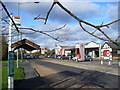
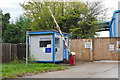

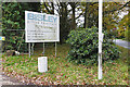
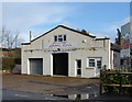
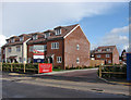
Please click the More button for more images, licensing and image copyright information.
Member of UK Parliament
This postcode is in the Surrey Heath parliamentary constituency.
Surrey Heath is a constituency in the South East region of England. The seat has been held by Michael Gove (Conservative) since May 2010.

Most Recent House Sales for Jopling Road, GU24 9FN
30 Aug 2023
12 Dec 2022
26 Sep 2022
12 Feb 2021
Local Petrol Station Prices
Coordinates for GU24 9FN
Residents at GU24 9FN
Sunrise and Sunset at GU24 9FN
Traffic Emission and Congestion Zones
Historical Weather Summary
| Clear | 22.34% |
| Cloudy | 69.95% |
| Rain | 6.72% |
| Windy | 0.80% |
| Other | 0.19% |
Population
Deprivation Index
the more deprived the postcode
Average Energy Performance
Companies Registered at GU24 9FN
Postcode Details for GU24 9FN
Recent Updates
|
18 Apr 2024 Added Traffic Camera Views from Traffic Scotland to Roadworks within Scotland |
|
15 Apr 2024 Schools Data updated for April 2024 |
|
10 Apr 2024 Companies Data updated for March 2024 |
|
7 Apr 2024 New option to receive automatic updates to roadworks that affect you |
|
7 Apr 2024 Police and Crime data updated for February 2024 |
|
3 Apr 2024 Sold House Price data updated for February 2024 |
|
30 Mar 2024 Energy Performance Certificates (England and Wales) updated February 2024 |
|
28 Mar 2024 New feature to use Geolocating functions to detect your current location |
Random Postcodes
Want an idea of what is in our extensive website? Try somewhere completely random!
The Rural/Urban classification is based upon data collected during the 2011 Census and released in August 2013 and is categorised into 6 distinct classes.
[A] Urban Major conurbation: A built up area with a population of 10,000 (3,000 in Scotland) or more and is assigned to the major conurbation settlement category.
[B] Urban Minor conurbation: A built up area with a population of 10,000 (3,000 in Scotland) or more and is assigned to the minor conurbation settlement category.
[C] Urban City and town: A built up area with a population of 10,000 (3,000 in Scotland) or more and is assigned to the city and town settlement category.
[D] Rural Town and fringe
[E] Rural Village
[F] Rural Hamlet and isolated dwelling
The Index of Multiple Deprivation (IMD) is the official measure of relative deprivation.
The index is based on 39 separate indicators across seven distinct domains (Income; Employment; Health and Disability; Education, Skills and Training; Crime; Barriers to Housing and Services; Living Environment) to provide an overall measure of multiple deprivation and is calculated for every neighbourhood.
The index is relative rather than an absolute scale and so a neighbourhood with a score of 10 is more deprived than one rated 20, but this does not equate to being twice as deprived.
Please note: Different indices are used in England, Scotland, Wales and Northern Ireland and so comparison of scores from neighbourhoods in different countries should not be undertaken.
These figures report on incorporated UK companies only that are registered at this postcode and do not include sole-traders, partnerships or overseas organisations.
The population figure shown for your area are an estimate provided by the Office for National Statistics and is rounded to the nearest 1,000.
The estimates are derived from the Annual Population Survey (APS) which is the Labour Force Survey (LFS) plus various sample boosts.
There are 26 county councils in 2-tier areas, providing services such as education, social services and waste disposal.
In 2-tier areas, each county council area is subdivided into districts, for which there is an independent district council. There are 192 district councils.
District councils are responsible for local services such as rubbish collection, housing and planning applications.