Overview for Nettlestead Court, Burford Road, LECHLADE, GL7 3GF
Introduction
Lechlade is a town at the southern edge of the Cotswolds in Gloucestershire, England, 55 miles (89 km) south of Birmingham and 68 miles (109 km) west of London. It is the highest point at which the River Thames is navigable, although there is a right of navigation that continues south-west into Cricklade, in the neighbouring county of Wiltshire. The town is named after the River Leach that joins the Thames near the Trout Inn and St. John's Bridge.
The low-lying land is alluvium, Oxford Clay and river gravels and the town is surrounded by lakes created from disused gravel extraction sites, forming parts of the Cotswold Water Park; several have now been designated as Sites of Special Scientific Interest and nature reserves. Human occupation dates from the neolithic, Iron Age and Roman periods and it developed as a trading centre served by river, canal, roads and railway, although the station closed in 1962.
The Anglican Church of St Lawrence is a Grade I listed building dating from the 15th century. The development of the nearby RAF Fairford and RAF Brize Norton after World War II contributed to the expansion of the town.
Summary for Nettlestead Court, Burford Road, LECHLADE, GL7 3GF
Roadworks near GL7 3GF
Road Safety near GL7 3GF
Details of personal injury accidents in and around Nettlestead Court, Burford Road, GL7 3GF that have been reported to Gloucestershire Constabulary over the past 20 years.
Traffic Levels near GL7 3GF
View traffic levels near Nettlestead Court, Burford Road, GL7 3GF from official Department for Transport counts.
Images taken near to Nettlestead Court, Burford Road, GL7 3GF and the surrounding area
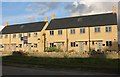
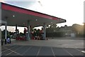
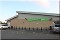
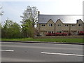
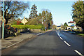
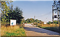


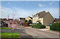
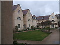
Please click the More button for more images, licensing and image copyright information.
Police
This area is policed by Gloucestershire Constabulary.
Gloucestershire Constabulary split their policing area into 55 separate neighbourhoods and this postcode is in the Fairford and Lechlade neighbourhood.

Fairford and Lechlade Neighbourhood Crime
Top 3 Categories
For full details of all categories together with more crime information, click on the Details button.
Member of UK Parliament
This postcode is in the The Cotswolds parliamentary constituency.
The Cotswolds is a constituency in the South West region of England. The seat has been held by Sir Geoffrey Clifton-Brown (Conservative) since May 2010.

Most Recent House Sales for Nettlestead Court, Burford Road, GL7 3GF
20 Jan 2023
29 Jun 2021
26 Feb 2021
29 Jan 2021
Local Petrol Station Prices
Coordinates for GL7 3GF
Residents at GL7 3GF
Sunrise and Sunset at GL7 3GF
Traffic Emission and Congestion Zones
Historical Weather Summary
| Clear | 20.48% |
| Cloudy | 69.72% |
| Rain | 6.58% |
| Windy | 3.11% |
| Other | 0.11% |
Population
Deprivation Index
the more deprived the postcode
Average Energy Performance
Companies Registered at GL7 3GF
Postcode Details for GL7 3GF
Recent Updates
|
18 Apr 2024 Added Traffic Camera Views from Traffic Scotland to Roadworks within Scotland |
|
15 Apr 2024 Schools Data updated for April 2024 |
|
10 Apr 2024 Companies Data updated for March 2024 |
|
7 Apr 2024 New option to receive automatic updates to roadworks that affect you |
|
7 Apr 2024 Police and Crime data updated for February 2024 |
|
3 Apr 2024 Sold House Price data updated for February 2024 |
|
30 Mar 2024 Energy Performance Certificates (England and Wales) updated February 2024 |
|
28 Mar 2024 New feature to use Geolocating functions to detect your current location |
Random Postcodes
Want an idea of what is in our extensive website? Try somewhere completely random!
The Rural/Urban classification is based upon data collected during the 2011 Census and released in August 2013 and is categorised into 6 distinct classes.
[A] Urban Major conurbation: A built up area with a population of 10,000 (3,000 in Scotland) or more and is assigned to the major conurbation settlement category.
[B] Urban Minor conurbation: A built up area with a population of 10,000 (3,000 in Scotland) or more and is assigned to the minor conurbation settlement category.
[C] Urban City and town: A built up area with a population of 10,000 (3,000 in Scotland) or more and is assigned to the city and town settlement category.
[D] Rural Town and fringe
[E] Rural Village
[F] Rural Hamlet and isolated dwelling
The Index of Multiple Deprivation (IMD) is the official measure of relative deprivation.
The index is based on 39 separate indicators across seven distinct domains (Income; Employment; Health and Disability; Education, Skills and Training; Crime; Barriers to Housing and Services; Living Environment) to provide an overall measure of multiple deprivation and is calculated for every neighbourhood.
The index is relative rather than an absolute scale and so a neighbourhood with a score of 10 is more deprived than one rated 20, but this does not equate to being twice as deprived.
Please note: Different indices are used in England, Scotland, Wales and Northern Ireland and so comparison of scores from neighbourhoods in different countries should not be undertaken.
These figures report on incorporated UK companies only that are registered at this postcode and do not include sole-traders, partnerships or overseas organisations.
The population figure shown for your area are an estimate provided by the Office for National Statistics and is rounded to the nearest 1,000.
The estimates are derived from the Annual Population Survey (APS) which is the Labour Force Survey (LFS) plus various sample boosts.
There are 26 county councils in 2-tier areas, providing services such as education, social services and waste disposal.
In 2-tier areas, each county council area is subdivided into districts, for which there is an independent district council. There are 192 district councils.
District councils are responsible for local services such as rubbish collection, housing and planning applications.