Overview for Kemerton, TEWKESBURY, GL20 7JD
Introduction
Tewkesbury (TEWKS-bər-ee) is a medieval market town and civil parish in the north of Gloucestershire, England. The town grew following the construction of Tewkesbury Abbey in the twelfth century and played a significant role in the Wars of the Roses. It stands at the confluence of the River Severn and the River Avon, and thus became an important trading point, which continued as railways and, later, the M5 and M50 motorway connections were established.
The town gives its name to the Borough of Tewkesbury, a local government district of Gloucestershire. The town lies on the border with Worcestershire, marked largely by the Carrant Brook (a tributary of the River Avon).
The name Tewkesbury is thought to come from Theoc, the name of a Saxon who founded a hermitage there in the 7th century, and in the Old English language was called Theocsbury. An erroneous derivation from Theotokos (the Greek title of Mary, mother of God) enjoyed currency in the monastic period of the town's history.
The Battle of Tewkesbury, which took place on 4 May 1471, was one of the decisive battles of the Wars of the Roses and is marked annually by a medieval festival in the town, including historical re-enactment.
Summary for Kemerton, TEWKESBURY, GL20 7JD
Roadworks near GL20 7JD
Road Safety near GL20 7JD
Details of personal injury accidents in and around GL20 7JD that have been reported to West Mercia Police over the past 20 years.
Traffic Levels near GL20 7JD
View traffic levels near GL20 7JD from official Department for Transport counts.
Images taken in and around the gl207jd area
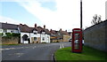
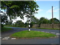
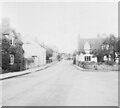
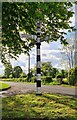
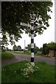
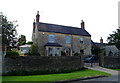
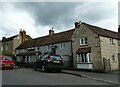
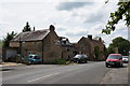
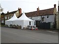
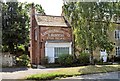
Please click the More button for more images, licensing and image copyright information.
Police
This area is policed by West Mercia Police.
West Mercia Police split their policing area into 82 separate neighbourhoods and this postcode is in the Pershore Rural South and Rural North neighbourhood.

Pershore Rural South and Rural North Neighbourhood Crime
Top 3 Categories
For full details of all categories together with more crime information, click on the Details button.
Member of UK Parliament
This postcode is in the West Worcestershire parliamentary constituency.
West Worcestershire is a constituency in the West Midlands region of England. The seat has been held by Dame Harriett Baldwin (Conservative) since May 2010.

Most Recent House Sales for GL20 7JD
20 Jul 2012
17 Apr 2012
16 Dec 2011
4 Aug 2004
Local Petrol Station Prices
Coordinates for GL20 7JD
Residents at GL20 7JD
Sunrise and Sunset at GL20 7JD
Traffic Emission and Congestion Zones
Historical Weather Summary
| Clear | 19.46% |
| Cloudy | 67.58% |
| Rain | 6.38% |
| Windy | 6.47% |
| Other | 0.11% |
Population
Deprivation Index
the more deprived the postcode
Average Energy Performance
Companies Registered at GL20 7JD
Postcode Details for GL20 7JD
Recent Updates
|
18 Apr 2024 Added Traffic Camera Views from Traffic Scotland to Roadworks within Scotland |
|
15 Apr 2024 Schools Data updated for April 2024 |
|
10 Apr 2024 Companies Data updated for March 2024 |
|
7 Apr 2024 New option to receive automatic updates to roadworks that affect you |
|
7 Apr 2024 Police and Crime data updated for February 2024 |
|
3 Apr 2024 Sold House Price data updated for February 2024 |
|
30 Mar 2024 Energy Performance Certificates (England and Wales) updated February 2024 |
|
28 Mar 2024 New feature to use Geolocating functions to detect your current location |
Random Postcodes
Want an idea of what is in our extensive website? Try somewhere completely random!
The Rural/Urban classification is based upon data collected during the 2011 Census and released in August 2013 and is categorised into 6 distinct classes.
[A] Urban Major conurbation: A built up area with a population of 10,000 (3,000 in Scotland) or more and is assigned to the major conurbation settlement category.
[B] Urban Minor conurbation: A built up area with a population of 10,000 (3,000 in Scotland) or more and is assigned to the minor conurbation settlement category.
[C] Urban City and town: A built up area with a population of 10,000 (3,000 in Scotland) or more and is assigned to the city and town settlement category.
[D] Rural Town and fringe
[E] Rural Village
[F] Rural Hamlet and isolated dwelling
The Index of Multiple Deprivation (IMD) is the official measure of relative deprivation.
The index is based on 39 separate indicators across seven distinct domains (Income; Employment; Health and Disability; Education, Skills and Training; Crime; Barriers to Housing and Services; Living Environment) to provide an overall measure of multiple deprivation and is calculated for every neighbourhood.
The index is relative rather than an absolute scale and so a neighbourhood with a score of 10 is more deprived than one rated 20, but this does not equate to being twice as deprived.
Please note: Different indices are used in England, Scotland, Wales and Northern Ireland and so comparison of scores from neighbourhoods in different countries should not be undertaken.
These figures report on incorporated UK companies only that are registered at this postcode and do not include sole-traders, partnerships or overseas organisations.
The population figure shown for your area are an estimate provided by the Office for National Statistics and is rounded to the nearest 1,000.
The estimates are derived from the Annual Population Survey (APS) which is the Labour Force Survey (LFS) plus various sample boosts.
There are 26 county councils in 2-tier areas, providing services such as education, social services and waste disposal.
In 2-tier areas, each county council area is subdivided into districts, for which there is an independent district council. There are 192 district councils.
District councils are responsible for local services such as rubbish collection, housing and planning applications.