Overview for Ingol Lane, POULTON-LE-FYLDE, FY6 9BJ
Introduction
Poulton-le-Fylde, commonly shortened to Poulton, is a market town in Lancashire, England, situated on the coastal plain called the Fylde. In the 2021 United Kingdom census, it had a population of 18,115.
There is evidence of human habitation in the area from 12,000 years ago, and several archaeological finds from Roman settlement in England have been found in the area.
At the time of the Norman conquest, Poulton was a small agricultural settlement in the hundred of Amounderness.
The church of St Chad was recorded in 1094, when it was endowed to Lancaster Priory.
By the post-Medieval period, the town had become an important commercial centre for the region with weekly and triannual markets. Goods were imported and exported through two harbours on the River Wyre.
In 1837, the town was described as the "metropolis of the Fylde", but its commercial importance waned from the mid-19th century with the development of the nearby coastal towns of Fleetwood and Blackpool.
Poulton has the administrative centre of the Borough of Wyre and is in the parliamentary constituency of Wyre and Preston North. It is part of the Blackpool Urban Area and approximately 5 miles (8 km) from Blackpool town centre.
There are rail links to Blackpool and Preston, and bus routes to the larger towns and villages of the Fylde.
Poulton has a library and two secondary schools: Baines School and Hodgson Academy.
There is a farmers' market once a month. and since October 2011 there has been a weekly market on Mondays in the centre of the town.
Summary for Ingol Lane, POULTON-LE-FYLDE, FY6 9BJ
Roadworks near FY6 9BJ
Road Safety near FY6 9BJ
Details of personal injury accidents in and around Ingol Lane, FY6 9BJ that have been reported to Lancashire Constabulary over the past 20 years.
Traffic Levels near FY6 9BJ
View traffic levels near Ingol Lane, FY6 9BJ from official Department for Transport counts.
Images taken near to Ingol Lane, FY6 9BJ and the surrounding area
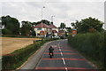
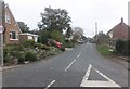

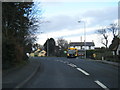
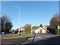

Please click the More button for more images, licensing and image copyright information.
Police
This area is policed by Lancashire Constabulary.
Lancashire Constabulary split their policing area into 236 separate neighbourhoods and this postcode is in the Over Wyre, Preesall, Pilling, Hambleton and Stalmine neighbourhood.

Over Wyre, Preesall, Pilling, Hambleton and Stalmine Neighbourhood Crime
Top 3 Categories
For full details of all categories together with more crime information, click on the Details button.
Member of UK Parliament
This postcode is in the Wyre and Preston North parliamentary constituency.
Wyre and Preston North is a constituency in the North West region of England. The seat has been held by Mr Ben Wallace (Conservative) since May 2010.

Most Recent House Sales for Ingol Lane, FY6 9BJ
25 Jul 2023
2 Sep 2022
29 Mar 2022
28 May 2021
Local Petrol Station Prices
Coordinates for FY6 9BJ
Residents at FY6 9BJ
Sunrise and Sunset at FY6 9BJ
Traffic Emission and Congestion Zones
Historical Weather Summary
| Clear | 18.26% |
| Cloudy | 57.87% |
| Rain | 8.50% |
| Windy | 15.31% |
| Other | 0.06% |
Population
Deprivation Index
the more deprived the postcode
Average Energy Performance
Companies Registered at FY6 9BJ
Postcode Details for FY6 9BJ
Recent Updates
|
18 Apr 2024 Added Traffic Camera Views from Traffic Scotland to Roadworks within Scotland |
|
15 Apr 2024 Schools Data updated for April 2024 |
|
10 Apr 2024 Companies Data updated for March 2024 |
|
7 Apr 2024 New option to receive automatic updates to roadworks that affect you |
|
7 Apr 2024 Police and Crime data updated for February 2024 |
|
3 Apr 2024 Sold House Price data updated for February 2024 |
|
30 Mar 2024 Energy Performance Certificates (England and Wales) updated February 2024 |
|
28 Mar 2024 New feature to use Geolocating functions to detect your current location |
Random Postcodes
Want an idea of what is in our extensive website? Try somewhere completely random!
The Rural/Urban classification is based upon data collected during the 2011 Census and released in August 2013 and is categorised into 6 distinct classes.
[A] Urban Major conurbation: A built up area with a population of 10,000 (3,000 in Scotland) or more and is assigned to the major conurbation settlement category.
[B] Urban Minor conurbation: A built up area with a population of 10,000 (3,000 in Scotland) or more and is assigned to the minor conurbation settlement category.
[C] Urban City and town: A built up area with a population of 10,000 (3,000 in Scotland) or more and is assigned to the city and town settlement category.
[D] Rural Town and fringe
[E] Rural Village
[F] Rural Hamlet and isolated dwelling
The Index of Multiple Deprivation (IMD) is the official measure of relative deprivation.
The index is based on 39 separate indicators across seven distinct domains (Income; Employment; Health and Disability; Education, Skills and Training; Crime; Barriers to Housing and Services; Living Environment) to provide an overall measure of multiple deprivation and is calculated for every neighbourhood.
The index is relative rather than an absolute scale and so a neighbourhood with a score of 10 is more deprived than one rated 20, but this does not equate to being twice as deprived.
Please note: Different indices are used in England, Scotland, Wales and Northern Ireland and so comparison of scores from neighbourhoods in different countries should not be undertaken.
These figures report on incorporated UK companies only that are registered at this postcode and do not include sole-traders, partnerships or overseas organisations.
The population figure shown for your area are an estimate provided by the Office for National Statistics and is rounded to the nearest 1,000.
The estimates are derived from the Annual Population Survey (APS) which is the Labour Force Survey (LFS) plus various sample boosts.
There are 26 county councils in 2-tier areas, providing services such as education, social services and waste disposal.
In 2-tier areas, each county council area is subdivided into districts, for which there is an independent district council. There are 192 district councils.
District councils are responsible for local services such as rubbish collection, housing and planning applications.