Overview for Park Crescent, STIRLING, FK7 0EL
Introduction
Stirling is a city in central Scotland, 26 miles (42 km) northeast of Glasgow and 37 miles (60 km) north-west of Edinburgh. The market town, surrounded by rich farmland, grew up connecting the royal citadel, the medieval old town with its merchants and tradesmen, the Old Bridge and the port. Located on the River Forth, Stirling is the administrative centre for the Stirling council area, and is traditionally the county town of Stirlingshire. Proverbially it is the strategically important "Gateway to the Highlands".
It has been said that "Stirling, like a huge brooch clasps Highlands and Lowlands together". Similarly "he who holds Stirling, holds Scotland" is sometimes attributed to Robert the Bruce.
Stirling's key position as the lowest bridging point of the River Forth before it broadens towards the Firth of Forth made it a focal point for travel north or south.
When Stirling was temporarily under Anglo-Saxon sway, according to a 9th-century legend, it was attacked by Danish invaders. The sound of a wolf roused a sentry, however, who alerted his garrison, which forced a Viking retreat. This led to the wolf being adopted as a symbol of the town as is shown on the 1511 Stirling Jug. The area is today known as Wolfcraig. Even today the wolf appears with a goshawk on the council's coat of arms along with the recently chosen motto: "Steadfast as the Rock".
Once the capital of Scotland, Stirling is visually dominated by Stirling Castle. Stirling also has a medieval parish church, the Church of the Holy Rude, where, on 29 July 1567, the infant James VI was anointed King of Scots by Adam Bothwell, the Bishop of Orkney, with the service concluding after a sermon by John Knox. The poet King was educated by George Buchanan and grew up in Stirling. He was later also crowned King of England and Ireland on 25 July 1603, bringing closer the countries of the United Kingdom. Modern Stirling is a centre for local government, higher education, tourism, retail, and industry. The mid-2012 census estimate for the population of the city is 36,440; the wider Stirling council area has a population of about 93,750.
One of the principal royal strongholds of the Kingdom of Scotland, Stirling was created a royal burgh by King David I in 1130. In 2002, as part of Queen Elizabeth's Golden Jubilee, Stirling was granted city status.
Summary for Park Crescent, STIRLING, FK7 0EL
Roadworks near FK7 0EL
Road Safety near FK7 0EL
Details of personal injury accidents in and around Park Crescent, FK7 0EL that have been reported to over the past 20 years.
Traffic Levels near FK7 0EL
View traffic levels near Park Crescent, FK7 0EL from official Department for Transport counts.
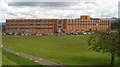
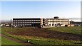
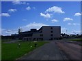
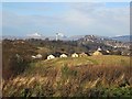
Images taken near to Park Crescent, FK7 0EL and the surrounding area
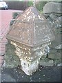
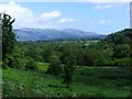
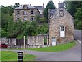
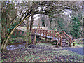
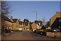
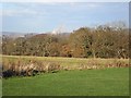
Please click the More button for more images, licensing and image copyright information.
Member of UK Parliament
This postcode is in the Stirling parliamentary constituency.
Stirling is a constituency in Scotland. The seat has been held by Alyn Smith (Scottish National Party) since December 2019.

Most Recent House Sales for Park Crescent, FK7 0EL
No recorded house sales or transfers for this postcode.
Local Petrol Station Prices
Coordinates for FK7 0EL
Sunrise and Sunset at FK7 0EL
Traffic Emission and Congestion Zones
Historical Weather Summary
| Clear | 6.96% |
| Cloudy | 57.64% |
| Rain | 13.24% |
| Windy | 21.16% |
| Other | 1.00% |
Average Energy Performance
Companies Registered at FK7 0EL
Postcode Details for FK7 0EL
Recent Updates
|
18 Apr 2024 Added Traffic Camera Views from Traffic Scotland to Roadworks within Scotland |
|
15 Apr 2024 Schools Data updated for April 2024 |
|
10 Apr 2024 Companies Data updated for March 2024 |
|
7 Apr 2024 New option to receive automatic updates to roadworks that affect you |
|
7 Apr 2024 Police and Crime data updated for February 2024 |
|
3 Apr 2024 Sold House Price data updated for February 2024 |
|
30 Mar 2024 Energy Performance Certificates (England and Wales) updated February 2024 |
|
28 Mar 2024 New feature to use Geolocating functions to detect your current location |
Random Postcodes
Want an idea of what is in our extensive website? Try somewhere completely random!
The Rural/Urban classification is based upon data collected during the 2011 Census and released in August 2013 and is categorised into 6 distinct classes.
[A] Urban Major conurbation: A built up area with a population of 10,000 (3,000 in Scotland) or more and is assigned to the major conurbation settlement category.
[B] Urban Minor conurbation: A built up area with a population of 10,000 (3,000 in Scotland) or more and is assigned to the minor conurbation settlement category.
[C] Urban City and town: A built up area with a population of 10,000 (3,000 in Scotland) or more and is assigned to the city and town settlement category.
[D] Rural Town and fringe
[E] Rural Village
[F] Rural Hamlet and isolated dwelling
The Index of Multiple Deprivation (IMD) is the official measure of relative deprivation.
The index is based on 39 separate indicators across seven distinct domains (Income; Employment; Health and Disability; Education, Skills and Training; Crime; Barriers to Housing and Services; Living Environment) to provide an overall measure of multiple deprivation and is calculated for every neighbourhood.
The index is relative rather than an absolute scale and so a neighbourhood with a score of 10 is more deprived than one rated 20, but this does not equate to being twice as deprived.
Please note: Different indices are used in England, Scotland, Wales and Northern Ireland and so comparison of scores from neighbourhoods in different countries should not be undertaken.
These figures report on incorporated UK companies only that are registered at this postcode and do not include sole-traders, partnerships or overseas organisations.
The population figure shown for your area are an estimate provided by the Office for National Statistics and is rounded to the nearest 1,000.
The estimates are derived from the Annual Population Survey (APS) which is the Labour Force Survey (LFS) plus various sample boosts.
There are 55 unitary authorities. They provide all local government services in their areas. These are mainly in the cities, urban areas and larger towns although there are now 6 shire county councils that are unitary (ie have no district councils beneath them).