Overview for Morwenstow, BUDE, EX23 9SG
Introduction
Bude (Standard Written Form: Porthbud) is a seaside town in north east Cornwall, England, United Kingdom, in the civil parish of Bude-Stratton and at the mouth of the River Neet . It was sometimes formerly known as Bude Haven. It lies southwest of Stratton, south of Flexbury and Poughill, and north of Widemouth Bay, located along the A3073 road off the A39. Bude is twinned with Ergué-Gabéric in Brittany, France. Bude's coast faces Bude Bay in the Celtic Sea, part of the Atlantic Ocean. The population of the civil parish can be found under Bude-Stratton.
Its earlier importance was as a harbour, and then a source of sea sand useful for improving the inland soil. This was transported on the Bude Canal. The Victorians favoured it as a seaside resort. With new rail links, it became a popular seaside destination in the 20th century. Bradshaw's Guide of 1866, Section 2, described Bude as: "a small port and picturesque village in the north-eastern extremity of Cornwall". It described the town as having the dignity of a fashionable marine resort with excellent facilities for bathers. The harbour bed consists of fine bright yellow sand consisting of small shells. "The sea view is of a striking, bold and sublime description – the rocks rising on every side to lofty broken elevations". It also describes Bude as a romantic retreat.
Summary for Morwenstow, BUDE, EX23 9SG
Roadworks near EX23 9SG
Road Safety near EX23 9SG
Details of personal injury accidents in and around EX23 9SG that have been reported to Devon & Cornwall Police over the past 20 years.
Traffic Levels near EX23 9SG
View traffic levels near EX23 9SG from official Department for Transport counts.
Images taken in and around the ex239sg area
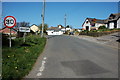
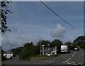
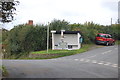
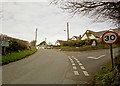
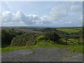
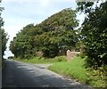
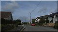
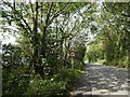
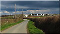
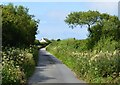
Please click the More button for more images, licensing and image copyright information.
Member of UK Parliament
This postcode is in the North Cornwall parliamentary constituency.
North Cornwall is a constituency in the South West region of England. The seat has been held by Scott Mann (Conservative) since May 2015.

Most Recent House Sales for EX23 9SG
14 Jan 2019
19 Jul 2016
19 Oct 2005
13 Dec 2004
Local Petrol Station Prices
Coordinates for EX23 9SG
Residents at EX23 9SG
Sunrise and Sunset at EX23 9SG
Traffic Emission and Congestion Zones
Historical Weather Summary
| Clear | 19.05% |
| Cloudy | 62.63% |
| Rain | 9.19% |
| Windy | 8.80% |
| Other | 0.33% |
Population
Deprivation Index
the more deprived the postcode
Average Energy Performance
Companies Registered at EX23 9SG
Postcode Details for EX23 9SG
Recent Updates
|
15 Apr 2024 Schools Data updated for April 2024 |
|
10 Apr 2024 Companies Data updated for March 2024 |
|
7 Apr 2024 New option to receive automatic updates to roadworks that affect you |
|
7 Apr 2024 Police and Crime data updated for February 2024 |
|
3 Apr 2024 Sold House Price data updated for February 2024 |
|
30 Mar 2024 Energy Performance Certificates (England and Wales) updated February 2024 |
|
28 Mar 2024 New feature to use Geolocating functions to detect your current location |
|
17 Mar 2024 Schools Data updated for March 2024 |
Random Postcodes
Want an idea of what is in our extensive website? Try somewhere completely random!
The Rural/Urban classification is based upon data collected during the 2011 Census and released in August 2013 and is categorised into 6 distinct classes.
[A] Urban Major conurbation: A built up area with a population of 10,000 (3,000 in Scotland) or more and is assigned to the major conurbation settlement category.
[B] Urban Minor conurbation: A built up area with a population of 10,000 (3,000 in Scotland) or more and is assigned to the minor conurbation settlement category.
[C] Urban City and town: A built up area with a population of 10,000 (3,000 in Scotland) or more and is assigned to the city and town settlement category.
[D] Rural Town and fringe
[E] Rural Village
[F] Rural Hamlet and isolated dwelling
The Index of Multiple Deprivation (IMD) is the official measure of relative deprivation.
The index is based on 39 separate indicators across seven distinct domains (Income; Employment; Health and Disability; Education, Skills and Training; Crime; Barriers to Housing and Services; Living Environment) to provide an overall measure of multiple deprivation and is calculated for every neighbourhood.
The index is relative rather than an absolute scale and so a neighbourhood with a score of 10 is more deprived than one rated 20, but this does not equate to being twice as deprived.
Please note: Different indices are used in England, Scotland, Wales and Northern Ireland and so comparison of scores from neighbourhoods in different countries should not be undertaken.
These figures report on incorporated UK companies only that are registered at this postcode and do not include sole-traders, partnerships or overseas organisations.
The population figure shown for your area are an estimate provided by the Office for National Statistics and is rounded to the nearest 1,000.
The estimates are derived from the Annual Population Survey (APS) which is the Labour Force Survey (LFS) plus various sample boosts.
There are 55 unitary authorities. They provide all local government services in their areas. These are mainly in the cities, urban areas and larger towns although there are now 6 shire county councils that are unitary (ie have no district councils beneath them).