Overview for Culmstock, CULLOMPTON, EX15 3HL
Introduction
Cullompton is a town and civil parish in the district of Mid Devon and the county of Devon, England. It is 13 miles (21 km) north-east of Exeter and lies on the River Culm. In 2011 the parish as a whole had a population of 8,499 while the built-up area of the town had a population of 7,439.
The earliest evidence of occupation is from the Roman period – there was a fort on the hill above the town and occupation in the current town centre. Columtune was mentioned in Alfred the Great's will which left it to his youngest son Æthelweard (c. 880–922).
In the past the town's economy had a large component of wool and cloth manufacture, then later leather working and paper manufacture.
A large proportion of town's inhabitants are commuters but there is some local manufacturing, including flour and paper mills. It has a monthly farmers' market held on the second Saturday of every month which is the oldest event of its kind in the South West. It is home to two grade I listed buildings: the fifteenth-century St Andrew's parish church and the seventeenth-century house known as The Walronds. The centre of the town is a conservation area and there are seven grade II* listed buildings and ninety grade II listed buildings in the parish.
Summary for Culmstock, CULLOMPTON, EX15 3HL
Roadworks near EX15 3HL
Road Safety near EX15 3HL
Details of personal injury accidents in and around EX15 3HL that have been reported to Devon & Cornwall Police over the past 20 years.
Traffic Levels near EX15 3HL
View traffic levels near EX15 3HL from official Department for Transport counts.
Images taken in and around the ex153hl area
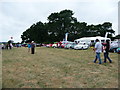
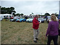
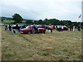
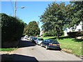
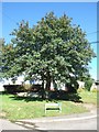
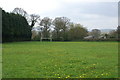
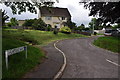
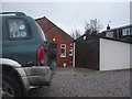
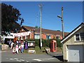
Please click the More button for more images, licensing and image copyright information.
Member of UK Parliament
This postcode is in the Tiverton and Honiton parliamentary constituency.
Tiverton and Honiton is a constituency in the South West region of England. The seat has been held by Richard Foord (Liberal Democrat) since June 2022.

Most Recent House Sales for EX15 3HL
No recorded house sales or transfers for this postcode.
Local Petrol Station Prices
Coordinates for EX15 3HL
Residents at EX15 3HL
Sunrise and Sunset at EX15 3HL
Traffic Emission and Congestion Zones
Historical Weather Summary
| Clear | 20.91% |
| Cloudy | 61.50% |
| Rain | 7.68% |
| Windy | 9.64% |
| Other | 0.27% |
Population
Deprivation Index
the more deprived the postcode
Companies Registered at EX15 3HL
Postcode Details for EX15 3HL
Recent Updates
|
18 Apr 2024 Added Traffic Camera Views from Traffic Scotland to Roadworks within Scotland |
|
15 Apr 2024 Schools Data updated for April 2024 |
|
10 Apr 2024 Companies Data updated for March 2024 |
|
7 Apr 2024 New option to receive automatic updates to roadworks that affect you |
|
7 Apr 2024 Police and Crime data updated for February 2024 |
|
3 Apr 2024 Sold House Price data updated for February 2024 |
|
30 Mar 2024 Energy Performance Certificates (England and Wales) updated February 2024 |
|
28 Mar 2024 New feature to use Geolocating functions to detect your current location |
Random Postcodes
Want an idea of what is in our extensive website? Try somewhere completely random!
The Rural/Urban classification is based upon data collected during the 2011 Census and released in August 2013 and is categorised into 6 distinct classes.
[A] Urban Major conurbation: A built up area with a population of 10,000 (3,000 in Scotland) or more and is assigned to the major conurbation settlement category.
[B] Urban Minor conurbation: A built up area with a population of 10,000 (3,000 in Scotland) or more and is assigned to the minor conurbation settlement category.
[C] Urban City and town: A built up area with a population of 10,000 (3,000 in Scotland) or more and is assigned to the city and town settlement category.
[D] Rural Town and fringe
[E] Rural Village
[F] Rural Hamlet and isolated dwelling
The Index of Multiple Deprivation (IMD) is the official measure of relative deprivation.
The index is based on 39 separate indicators across seven distinct domains (Income; Employment; Health and Disability; Education, Skills and Training; Crime; Barriers to Housing and Services; Living Environment) to provide an overall measure of multiple deprivation and is calculated for every neighbourhood.
The index is relative rather than an absolute scale and so a neighbourhood with a score of 10 is more deprived than one rated 20, but this does not equate to being twice as deprived.
Please note: Different indices are used in England, Scotland, Wales and Northern Ireland and so comparison of scores from neighbourhoods in different countries should not be undertaken.
These figures report on incorporated UK companies only that are registered at this postcode and do not include sole-traders, partnerships or overseas organisations.
The population figure shown for your area are an estimate provided by the Office for National Statistics and is rounded to the nearest 1,000.
The estimates are derived from the Annual Population Survey (APS) which is the Labour Force Survey (LFS) plus various sample boosts.
There are 26 county councils in 2-tier areas, providing services such as education, social services and waste disposal.
In 2-tier areas, each county council area is subdivided into districts, for which there is an independent district council. There are 192 district councils.
District councils are responsible for local services such as rubbish collection, housing and planning applications.