Overview for Nursery Close, ENFIELD, EN3 5JZ
Introduction
Enfield is a large town in north London, England, 10.1 miles (16.3 km) north of Charing Cross. It had a population of 156,858 in 2018. It includes the areas of Botany Bay, Brimsdown, Bulls Cross, Bullsmoor, Bush Hill Park, Clay Hill, Crews Hill, Enfield Highway, Enfield Lock, Enfield Town, Enfield Wash, Forty Hill, Freezywater, Gordon Hill, Grange Park, Hadley Wood, Ponders End, and World's End.
South of the Hertfordshire border and M25 motorway, it borders Waltham Cross to the north, Winchmore Hill and Edmonton to the south, Chingford and Waltham Abbey, across the River Lea, to the east and north-east, with Cockfosters, Monken Hadley and Oakwood to the west.
Historically an ancient parish in the Edmonton Hundred of Middlesex, it was granted urban district status in 1894 and municipal borough status in 1955. In 1965, it merged with the municipal boroughs of Southgate and Edmonton to create the London Borough of Enfield, a local government district of Greater London, of which Enfield is the administrative centre.
Enfield Town, a market town chartered by Edward I in 1303, is the commercial centre of Enfield and the location of St Andrew's Enfield, the original parish church. The area is identified in the London Plan as one of 35 major centres in Greater London. The east of Enfield, adjacent to the River Lea and Lee Navigation, is renowned for its industrial heritage. The Royal Small Arms Factory, at Enfield Lock, produced the famous Enfield rifles. The Brimsdown Industrial Estate is home to heavy industry, warehousing and retail, and Wright's Flour Mill, at Ponders End, is Enfield's oldest running industrial building. Forty Hall, on the site of the Tudor Elsyng Palace, is in the north, with Enfield Chase, the former royal hunting ground, and Chase Farm Hospital, in the west. The New River runs through Enfield from north to south, with the bypassed New River Loop encircling the town centre, through Enfield Town Park.
Summary for Nursery Close, ENFIELD, EN3 5JZ
Roadworks near EN3 5JZ
Road Safety near EN3 5JZ
Details of personal injury accidents in and around Nursery Close, EN3 5JZ that have been reported to Metropolitan Police Service over the past 20 years.
Traffic Levels near EN3 5JZ
View traffic levels near Nursery Close, EN3 5JZ from official Department for Transport counts.
Images taken near to Nursery Close, EN3 5JZ and the surrounding area
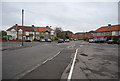
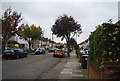
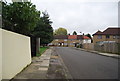
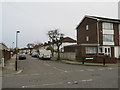
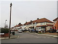
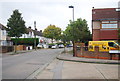
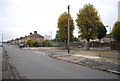
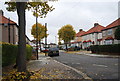
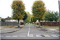
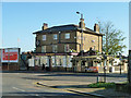
Please click the More button for more images, licensing and image copyright information.
Member of UK Parliament
This postcode is in the Enfield North parliamentary constituency.
Enfield North is a constituency in London, England. The seat has been held by Feryal Clark (Labour) since December 2019.

Most Recent House Sales for Nursery Close, EN3 5JZ
23 Sep 2022
14 Jun 2022
22 Dec 2016
21 Nov 2016
Local Petrol Station Prices
Coordinates for EN3 5JZ
Residents at EN3 5JZ
Sunrise and Sunset at EN3 5JZ
Traffic Emission Zones
Historical Weather Summary
| Clear | 8.92% |
| Cloudy | 82.08% |
| Rain | 7.97% |
| Windy | 0.99% |
| Other | 0.04% |
Population
Deprivation Index
the more deprived the postcode
Average Energy Performance
Companies Registered at EN3 5JZ
Postcode Details for EN3 5JZ
Recent Updates
|
18 Apr 2024 Added Traffic Camera Views from Traffic Scotland to Roadworks within Scotland |
|
15 Apr 2024 Schools Data updated for April 2024 |
|
10 Apr 2024 Companies Data updated for March 2024 |
|
7 Apr 2024 New option to receive automatic updates to roadworks that affect you |
|
7 Apr 2024 Police and Crime data updated for February 2024 |
|
3 Apr 2024 Sold House Price data updated for February 2024 |
|
30 Mar 2024 Energy Performance Certificates (England and Wales) updated February 2024 |
|
28 Mar 2024 New feature to use Geolocating functions to detect your current location |
Random Postcodes
Want an idea of what is in our extensive website? Try somewhere completely random!
The Rural/Urban classification is based upon data collected during the 2011 Census and released in August 2013 and is categorised into 6 distinct classes.
[A] Urban Major conurbation: A built up area with a population of 10,000 (3,000 in Scotland) or more and is assigned to the major conurbation settlement category.
[B] Urban Minor conurbation: A built up area with a population of 10,000 (3,000 in Scotland) or more and is assigned to the minor conurbation settlement category.
[C] Urban City and town: A built up area with a population of 10,000 (3,000 in Scotland) or more and is assigned to the city and town settlement category.
[D] Rural Town and fringe
[E] Rural Village
[F] Rural Hamlet and isolated dwelling
The Index of Multiple Deprivation (IMD) is the official measure of relative deprivation.
The index is based on 39 separate indicators across seven distinct domains (Income; Employment; Health and Disability; Education, Skills and Training; Crime; Barriers to Housing and Services; Living Environment) to provide an overall measure of multiple deprivation and is calculated for every neighbourhood.
The index is relative rather than an absolute scale and so a neighbourhood with a score of 10 is more deprived than one rated 20, but this does not equate to being twice as deprived.
Please note: Different indices are used in England, Scotland, Wales and Northern Ireland and so comparison of scores from neighbourhoods in different countries should not be undertaken.
These figures report on incorporated UK companies only that are registered at this postcode and do not include sole-traders, partnerships or overseas organisations.
The population figure shown for your area are an estimate provided by the Office for National Statistics and is rounded to the nearest 1,000.
The estimates are derived from the Annual Population Survey (APS) which is the Labour Force Survey (LFS) plus various sample boosts.
There are 32 London boroughs. They provide nearly all the services in their area. However, the Greater London Authority (GLA) provides London-wide government, including special responsibility for police, fire, strategic planning and transport.