Overview for Gloucester Road, DORCHESTER, DT1 2NJ
Introduction
Dorchester (DOR-ches-tər) is the county town of Dorset, England. It is situated between Poole and Bridport on the A35 trunk route. A historic market town, Dorchester is on the banks of the River Frome to the south of the Dorset Downs and north of the South Dorset Ridgeway that separates the area from Weymouth, 7 miles (11 km) to the south. The civil parish includes the experimental community of Poundbury and the suburb of Fordington.
The area around the town was first settled in prehistoric times. The Romans established a garrison there after defeating the Durotriges tribe, calling the settlement that grew up nearby Durnovaria; they built an aqueduct to supply water and an amphitheatre on an ancient British earthwork. After the departure of the Romans, the town diminished in significance, but during the medieval period became an important commercial and political centre. It was the site of the "Bloody Assizes" presided over by Judge Jeffreys after the Monmouth Rebellion, and later the trial of the Tolpuddle Martyrs.
In the 2011 census, the population of Dorchester was 19,060, with further people coming from surrounding areas to work in the town which has six industrial estates. The Brewery Square redevelopment project is taking place in phases, with other development projects planned. The town has a land-based college, Kingston Maurward College, The Thomas Hardye School, three middle schools and thirteen first schools. The Dorset County Hospital offers an accident and emergency service, and the town is served by two railway stations. Through vehicular traffic is routed round the town by means of a bypass. The town has a football club and a rugby union club, several museums and the biannual Dorchester Festival. It is twinned with three towns in Europe. As well as having many listed buildings, a number of notable people have been associated with the town. It was for many years the home and inspiration of the author Thomas Hardy, whose novel The Mayor of Casterbridge uses a fictionalised version of Dorchester as its setting.
Summary for Gloucester Road, DORCHESTER, DT1 2NJ
Roadworks near DT1 2NJ
Road Safety near DT1 2NJ
Details of personal injury accidents in and around Gloucester Road, DT1 2NJ that have been reported to Dorset Police over the past 20 years.
Traffic Levels near DT1 2NJ
View traffic levels near Gloucester Road, DT1 2NJ from official Department for Transport counts.
Images taken near to Gloucester Road, DT1 2NJ and the surrounding area
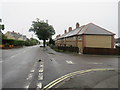
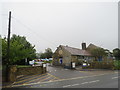
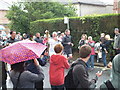
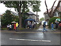
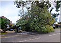
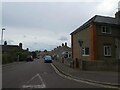
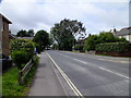
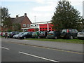
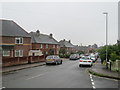
Please click the More button for more images, licensing and image copyright information.
Police
This area is policed by Dorset Police.
Dorset Police split their policing area into 21 separate neighbourhoods and this postcode is in the Dorchester neighbourhood.

Dorchester Neighbourhood Crime
Top 3 Categories
For full details of all categories together with more crime information, click on the Details button.
Member of UK Parliament
This postcode is in the West Dorset parliamentary constituency.
West Dorset is a constituency in the South West region of England. The seat has been held by Chris Loder (Conservative) since December 2019.

Most Recent House Sales for Gloucester Road, DT1 2NJ
15 Oct 2021
2 Mar 2017
15 May 2014
2 Mar 2006
Local Petrol Station Prices
Coordinates for DT1 2NJ
Residents at DT1 2NJ
Sunrise and Sunset at DT1 2NJ
Traffic Emission and Congestion Zones
Historical Weather Summary
| Clear | 20.87% |
| Cloudy | 44.93% |
| Rain | 7.61% |
| Windy | 26.18% |
| Other | 0.41% |
Deprivation Index
the more deprived the postcode
Average Energy Performance
Companies Registered at DT1 2NJ
Postcode Details for DT1 2NJ
Recent Updates
|
18 Apr 2024 Added Traffic Camera Views from Traffic Scotland to Roadworks within Scotland |
|
15 Apr 2024 Schools Data updated for April 2024 |
|
10 Apr 2024 Companies Data updated for March 2024 |
|
7 Apr 2024 New option to receive automatic updates to roadworks that affect you |
|
7 Apr 2024 Police and Crime data updated for February 2024 |
|
3 Apr 2024 Sold House Price data updated for February 2024 |
|
30 Mar 2024 Energy Performance Certificates (England and Wales) updated February 2024 |
|
28 Mar 2024 New feature to use Geolocating functions to detect your current location |
Random Postcodes
Want an idea of what is in our extensive website? Try somewhere completely random!
The Rural/Urban classification is based upon data collected during the 2011 Census and released in August 2013 and is categorised into 6 distinct classes.
[A] Urban Major conurbation: A built up area with a population of 10,000 (3,000 in Scotland) or more and is assigned to the major conurbation settlement category.
[B] Urban Minor conurbation: A built up area with a population of 10,000 (3,000 in Scotland) or more and is assigned to the minor conurbation settlement category.
[C] Urban City and town: A built up area with a population of 10,000 (3,000 in Scotland) or more and is assigned to the city and town settlement category.
[D] Rural Town and fringe
[E] Rural Village
[F] Rural Hamlet and isolated dwelling
The Index of Multiple Deprivation (IMD) is the official measure of relative deprivation.
The index is based on 39 separate indicators across seven distinct domains (Income; Employment; Health and Disability; Education, Skills and Training; Crime; Barriers to Housing and Services; Living Environment) to provide an overall measure of multiple deprivation and is calculated for every neighbourhood.
The index is relative rather than an absolute scale and so a neighbourhood with a score of 10 is more deprived than one rated 20, but this does not equate to being twice as deprived.
Please note: Different indices are used in England, Scotland, Wales and Northern Ireland and so comparison of scores from neighbourhoods in different countries should not be undertaken.
These figures report on incorporated UK companies only that are registered at this postcode and do not include sole-traders, partnerships or overseas organisations.
The population figure shown for your area are an estimate provided by the Office for National Statistics and is rounded to the nearest 1,000.
The estimates are derived from the Annual Population Survey (APS) which is the Labour Force Survey (LFS) plus various sample boosts.
There are 55 unitary authorities. They provide all local government services in their areas. These are mainly in the cities, urban areas and larger towns although there are now 6 shire county councils that are unitary (ie have no district councils beneath them).