Overview for Leyland Avenue, DONCASTER, DN7 6RG
Introduction
Doncaster (DONK-ə-stər, DONK-ast-ər) is a city in South Yorkshire, England. Named after the River Don, it is the administrative centre of the larger City of Doncaster. The city is the second largest settlement in South Yorkshire after Sheffield. It is situated in the Don Valley on the western edge of the Humberhead Levels and east of the Pennines. The urban subdivision had a population of 113,566 at the 2021 census, whilst the City of Doncaster metropolitan borough had a population of 308,106.
The city's suburbs include Armthorpe, Bessacarr, Sprotbrough among others. Adjacent to Doncaster to its east is the Isle of Axholme in Lincolnshire, which contains the towns of Haxey, Epworth and Crowle, and directly south is Harworth Bircotes in Nottinghamshire. Also, within the city's vicinity are Barnsley, Wakefield, Pontefract, Selby, Goole, Scunthorpe, Gainsborough, Retford, Worksop and Rotherham, to which Doncaster is linked by road and rail.
As part of the Platinum Jubilee Civic Honours, Doncaster received city status by Letters Patent. A ceremony to confer city status took place at Mansion House on 9 November 2022 as part of a tour of Yorkshire by King Charles III and Queen Camilla.
Summary for Leyland Avenue, DONCASTER, DN7 6RG
Roadworks near DN7 6RG
Road Safety near DN7 6RG
Details of personal injury accidents in and around Leyland Avenue, DN7 6RG that have been reported to South Yorkshire Police over the past 20 years.
Traffic Levels near DN7 6RG
View traffic levels near Leyland Avenue, DN7 6RG from official Department for Transport counts.
Images taken near to Leyland Avenue, DN7 6RG and the surrounding area
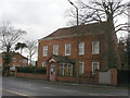
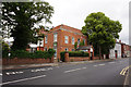
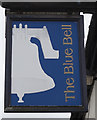
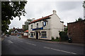
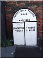
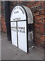
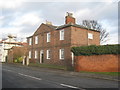
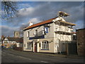
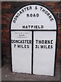
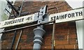
Please click the More button for more images, licensing and image copyright information.
Doncaster and nearby Videos From YouTube
GAINSBOROUGH | Tour of Gainsborough Town Centre, Lincolnshire [Plus Riverside Walk!]
GAINSBOROUGH | In todays full tour of Gainsborough, Lincolnshire we have a look around this market town and head to ...
Channel: Gimbal Walk TV (View Channel)
Published: 25 May 2022
Police
This area is policed by South Yorkshire Police.
South Yorkshire Police split their policing area into 18 separate neighbourhoods and this postcode is in the Doncaster East neighbourhood.

Doncaster East Neighbourhood Crime
Top 3 Categories
For full details of all categories together with more crime information, click on the Details button.
Member of UK Parliament
This postcode is in the Don Valley parliamentary constituency.
Don Valley is a constituency in the Yorkshire and The Humber region of England. The seat has been held by Nick Fletcher (Conservative) since December 2019.

Most Recent House Sales for Leyland Avenue, DN7 6RG
15 Feb 2019
12 Mar 2007
24 Jun 2005
31 Oct 1997
Local Petrol Station Prices
Coordinates for DN7 6RG
Residents at DN7 6RG
Sunrise and Sunset at DN7 6RG
Traffic Emission and Congestion Zones
Historical Weather Summary
| Clear | 10.06% |
| Cloudy | 64.11% |
| Rain | 8.34% |
| Windy | 17.40% |
| Other | 0.09% |
Population
Deprivation Index
the more deprived the postcode
Average Energy Performance
Companies Registered at DN7 6RG
Postcode Details for DN7 6RG
Recent Updates
|
18 Apr 2024 Added Traffic Camera Views from Traffic Scotland to Roadworks within Scotland |
|
15 Apr 2024 Schools Data updated for April 2024 |
|
10 Apr 2024 Companies Data updated for March 2024 |
|
7 Apr 2024 New option to receive automatic updates to roadworks that affect you |
|
7 Apr 2024 Police and Crime data updated for February 2024 |
|
3 Apr 2024 Sold House Price data updated for February 2024 |
|
30 Mar 2024 Energy Performance Certificates (England and Wales) updated February 2024 |
|
28 Mar 2024 New feature to use Geolocating functions to detect your current location |
Random Postcodes
Want an idea of what is in our extensive website? Try somewhere completely random!
The Rural/Urban classification is based upon data collected during the 2011 Census and released in August 2013 and is categorised into 6 distinct classes.
[A] Urban Major conurbation: A built up area with a population of 10,000 (3,000 in Scotland) or more and is assigned to the major conurbation settlement category.
[B] Urban Minor conurbation: A built up area with a population of 10,000 (3,000 in Scotland) or more and is assigned to the minor conurbation settlement category.
[C] Urban City and town: A built up area with a population of 10,000 (3,000 in Scotland) or more and is assigned to the city and town settlement category.
[D] Rural Town and fringe
[E] Rural Village
[F] Rural Hamlet and isolated dwelling
The Index of Multiple Deprivation (IMD) is the official measure of relative deprivation.
The index is based on 39 separate indicators across seven distinct domains (Income; Employment; Health and Disability; Education, Skills and Training; Crime; Barriers to Housing and Services; Living Environment) to provide an overall measure of multiple deprivation and is calculated for every neighbourhood.
The index is relative rather than an absolute scale and so a neighbourhood with a score of 10 is more deprived than one rated 20, but this does not equate to being twice as deprived.
Please note: Different indices are used in England, Scotland, Wales and Northern Ireland and so comparison of scores from neighbourhoods in different countries should not be undertaken.
These figures report on incorporated UK companies only that are registered at this postcode and do not include sole-traders, partnerships or overseas organisations.
The population figure shown for your area are an estimate provided by the Office for National Statistics and is rounded to the nearest 1,000.
The estimates are derived from the Annual Population Survey (APS) which is the Labour Force Survey (LFS) plus various sample boosts.
There are 36 metropolitan district councils which together cover 6 large urban areas: the counties of Greater Manchester, Merseyside, South Yorkshire, Tyne and Wear, West Midlands, and West Yorkshire.
Metropolitan districts are responsible for all services in their area, although certain conurbation wide services such as fire and civil defence, police, waste disposal and passenger transport are provided through joint authorities (the districts acting jointly).