Overview for Turnberry Approach, GRIMSBY, DN37 0UQ
Introduction
Grimsby or Great Grimsby is a port town and the administrative centre of North East Lincolnshire, Lincolnshire, England. Grimsby adjoins the town of Cleethorpes directly to the south-east forming a conurbation. Grimsby is 45 mi (72 km) north-east of Lincoln, 33 mi (53 km) (via the Humber Bridge) south-south-east of Hull, 28 mi (45 km) south-east of Scunthorpe, 50 mi (80 km) east of Doncaster and 80 mi (130 km) south-east of Leeds. In 2021 it had a population of 86,138.
Grimsby has notable landmarks including Grimsby Minster, Port of Grimsby, Cleethorpes Beach and Grimsby Fishing Heritage Centre. Grimsby was once the home port for the world's largest fishing fleet around the mid-20th century, but fishing then fell sharply. The Cod Wars denied UK access to Icelandic fishing grounds and the European Union used its Common Fisheries Policy to parcel out fishing quotas to other European countries in waters within 200 nmi (370 km) of the UK coast. Grimsby suffered post-industrial decline like most other post-industrial towns and cities. Food production has been on the rise
in the town since the 1990s. The Grimsby–Cleethorpes conurbation acts as a cultural and economic centre for much of north and east Lincolnshire. Grimsby people are called Grimbarians; the term codhead is also used jokingly, often for football supporters. Great Grimsby Day is 22 January. Grimsby is the second largest settlement by population in Lincolnshire after Lincoln.
Summary for Turnberry Approach, GRIMSBY, DN37 0UQ
Roadworks near DN37 0UQ
Road Safety near DN37 0UQ
Details of personal injury accidents in and around Turnberry Approach, DN37 0UQ that have been reported to Humberside Police over the past 20 years.
Traffic Levels near DN37 0UQ
View traffic levels near Turnberry Approach, DN37 0UQ from official Department for Transport counts.
Images taken near to Turnberry Approach, DN37 0UQ and the surrounding area
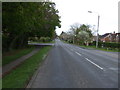
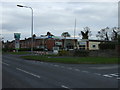
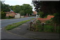
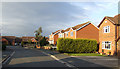

Please click the More button for more images, licensing and image copyright information.
Grimsby and nearby Videos From YouTube
Cleethorpes - Summer 2020 - QHD
Cleethorpes - Summer 2020 - QHD - Drone Footage.
Channel: Drone Footage (View Channel)
Published: 15 Aug 2020
Police
This area is policed by Humberside Police.
Humberside Police split their policing area into 81 separate neighbourhoods and this postcode is in the Waltham neighbourhood.

Waltham Neighbourhood Crime
Top 3 Categories
For full details of all categories together with more crime information, click on the Details button.
Member of UK Parliament
This postcode is in the Cleethorpes parliamentary constituency.
Cleethorpes is a constituency in the Yorkshire and The Humber region of England. The seat has been held by Martin Vickers (Conservative) since May 2010.

Most Recent House Sales for Turnberry Approach, DN37 0UQ
8 Jul 2022
26 Nov 2020
13 Aug 2020
25 Jan 2019
Local Petrol Station Prices
Coordinates for DN37 0UQ
Residents at DN37 0UQ
Sunrise and Sunset at DN37 0UQ
Traffic Emission and Congestion Zones
Historical Weather Summary
| Clear | 10.24% |
| Cloudy | 48.37% |
| Rain | 7.88% |
| Windy | 33.51% |
| Other | 0.00% |
Population
Deprivation Index
the more deprived the postcode
Average Energy Performance
Companies Registered at DN37 0UQ
Postcode Details for DN37 0UQ
Recent Updates
|
18 Apr 2024 Added Traffic Camera Views from Traffic Scotland to Roadworks within Scotland |
|
15 Apr 2024 Schools Data updated for April 2024 |
|
10 Apr 2024 Companies Data updated for March 2024 |
|
7 Apr 2024 New option to receive automatic updates to roadworks that affect you |
|
7 Apr 2024 Police and Crime data updated for February 2024 |
|
3 Apr 2024 Sold House Price data updated for February 2024 |
|
30 Mar 2024 Energy Performance Certificates (England and Wales) updated February 2024 |
|
28 Mar 2024 New feature to use Geolocating functions to detect your current location |
Random Postcodes
Want an idea of what is in our extensive website? Try somewhere completely random!
The Rural/Urban classification is based upon data collected during the 2011 Census and released in August 2013 and is categorised into 6 distinct classes.
[A] Urban Major conurbation: A built up area with a population of 10,000 (3,000 in Scotland) or more and is assigned to the major conurbation settlement category.
[B] Urban Minor conurbation: A built up area with a population of 10,000 (3,000 in Scotland) or more and is assigned to the minor conurbation settlement category.
[C] Urban City and town: A built up area with a population of 10,000 (3,000 in Scotland) or more and is assigned to the city and town settlement category.
[D] Rural Town and fringe
[E] Rural Village
[F] Rural Hamlet and isolated dwelling
The Index of Multiple Deprivation (IMD) is the official measure of relative deprivation.
The index is based on 39 separate indicators across seven distinct domains (Income; Employment; Health and Disability; Education, Skills and Training; Crime; Barriers to Housing and Services; Living Environment) to provide an overall measure of multiple deprivation and is calculated for every neighbourhood.
The index is relative rather than an absolute scale and so a neighbourhood with a score of 10 is more deprived than one rated 20, but this does not equate to being twice as deprived.
Please note: Different indices are used in England, Scotland, Wales and Northern Ireland and so comparison of scores from neighbourhoods in different countries should not be undertaken.
These figures report on incorporated UK companies only that are registered at this postcode and do not include sole-traders, partnerships or overseas organisations.
The population figure shown for your area are an estimate provided by the Office for National Statistics and is rounded to the nearest 1,000.
The estimates are derived from the Annual Population Survey (APS) which is the Labour Force Survey (LFS) plus various sample boosts.
There are 55 unitary authorities. They provide all local government services in their areas. These are mainly in the cities, urban areas and larger towns although there are now 6 shire county councils that are unitary (ie have no district councils beneath them).