Overview for Silver Street, BISHOP AUCKLAND, DL13 3EJ
Introduction
Bishop Auckland (AWK-lənd) is a market town and civil parish at the confluence of the River Wear and the River Gaunless in County Durham, England. It is 12 miles (19 km) northwest of Darlington and 12 miles (19 km) southwest of Durham.
Much of the town's early history surrounds the Bishops of Durham and the establishment of Auckland Castle's predecessor, a hunting lodge, which became the main residence of Durham Bishops. This is reflected in the first part of the town's name. During the Industrial Revolution, the town grew rapidly as coal mining became its largest industry. Decline in the coal mining industry during the late twentieth century has changed the town's largest sector to manufacturing.
Since 1 April 2009, the town's local authority has been Durham County Council. The unitary authority replaced the previous Wear Valley District and Durham County councils. The parliamentary constituency of Bishop Auckland is named after the town. It is currently held by Dehenna Davison of the Conservative Party. The town is twinned with the French town of Ivry-sur-Seine.
Summary for Silver Street, BISHOP AUCKLAND, DL13 3EJ
Roadworks near DL13 3EJ
Road Safety near DL13 3EJ
Details of personal injury accidents in and around Silver Street, DL13 3EJ that have been reported to Durham Constabulary over the past 20 years.
Traffic Levels near DL13 3EJ
View traffic levels near Silver Street, DL13 3EJ from official Department for Transport counts.
Images taken near to Silver Street, DL13 3EJ and the surrounding area
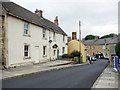
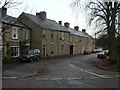
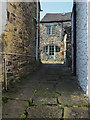
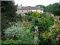
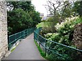
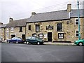
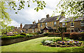
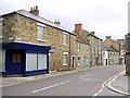
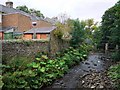
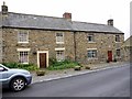
Please click the More button for more images, licensing and image copyright information.
Police
This area is policed by Durham Constabulary.
Durham Constabulary split their policing area into 71 separate neighbourhoods and this postcode is in the Crook (Weardale) neighbourhood.

Crook (Weardale) Neighbourhood Crime
Top 3 Categories
For full details of all categories together with more crime information, click on the Details button.
Member of UK Parliament
This postcode is in the North West Durham parliamentary constituency.
North West Durham is a constituency in the North East region of England. The seat has been held by Mr Richard Holden (Conservative) since December 2019.

Most Recent House Sales for Silver Street, DL13 3EJ
19 Feb 2024
28 Apr 2022
7 Apr 2021
26 May 2017
Local Petrol Station Prices
Coordinates for DL13 3EJ
Residents at DL13 3EJ
Sunrise and Sunset at DL13 3EJ
Traffic Emission and Congestion Zones
Historical Weather Summary
| Clear | 6.75% |
| Cloudy | 51.57% |
| Rain | 9.30% |
| Windy | 30.43% |
| Other | 1.95% |
Population
Deprivation Index
the more deprived the postcode
Average Energy Performance
Companies Registered at DL13 3EJ
Postcode Details for DL13 3EJ
Recent Updates
|
18 Apr 2024 Added Traffic Camera Views from Traffic Scotland to Roadworks within Scotland |
|
15 Apr 2024 Schools Data updated for April 2024 |
|
10 Apr 2024 Companies Data updated for March 2024 |
|
7 Apr 2024 New option to receive automatic updates to roadworks that affect you |
|
7 Apr 2024 Police and Crime data updated for February 2024 |
|
3 Apr 2024 Sold House Price data updated for February 2024 |
|
30 Mar 2024 Energy Performance Certificates (England and Wales) updated February 2024 |
|
28 Mar 2024 New feature to use Geolocating functions to detect your current location |
Random Postcodes
Want an idea of what is in our extensive website? Try somewhere completely random!
The Rural/Urban classification is based upon data collected during the 2011 Census and released in August 2013 and is categorised into 6 distinct classes.
[A] Urban Major conurbation: A built up area with a population of 10,000 (3,000 in Scotland) or more and is assigned to the major conurbation settlement category.
[B] Urban Minor conurbation: A built up area with a population of 10,000 (3,000 in Scotland) or more and is assigned to the minor conurbation settlement category.
[C] Urban City and town: A built up area with a population of 10,000 (3,000 in Scotland) or more and is assigned to the city and town settlement category.
[D] Rural Town and fringe
[E] Rural Village
[F] Rural Hamlet and isolated dwelling
The Index of Multiple Deprivation (IMD) is the official measure of relative deprivation.
The index is based on 39 separate indicators across seven distinct domains (Income; Employment; Health and Disability; Education, Skills and Training; Crime; Barriers to Housing and Services; Living Environment) to provide an overall measure of multiple deprivation and is calculated for every neighbourhood.
The index is relative rather than an absolute scale and so a neighbourhood with a score of 10 is more deprived than one rated 20, but this does not equate to being twice as deprived.
Please note: Different indices are used in England, Scotland, Wales and Northern Ireland and so comparison of scores from neighbourhoods in different countries should not be undertaken.
These figures report on incorporated UK companies only that are registered at this postcode and do not include sole-traders, partnerships or overseas organisations.
The population figure shown for your area are an estimate provided by the Office for National Statistics and is rounded to the nearest 1,000.
The estimates are derived from the Annual Population Survey (APS) which is the Labour Force Survey (LFS) plus various sample boosts.
There are 55 unitary authorities. They provide all local government services in their areas. These are mainly in the cities, urban areas and larger towns although there are now 6 shire county councils that are unitary (ie have no district councils beneath them).