Overview for Bullion Lane, CHESTER LE STREET, DH2 2AL
Introduction
Chester-le-Street, is a market town on Wearside in the County Durham district, in the ceremonial county of Durham, England, around six miles (ten kilometres) north of Durham and also close to Sunderland and Newcastle upon Tyne. It is located on the River Wear, which runs out to sea at Sunderland to the east. The town holds markets on Tuesdays, Fridays and Saturdays. In 2011 it had a population of 24,227.
The town's history is ancient, records go back to a Roman-built fort called Concangis. The Roman fort is the "Chester" (from the Latin castra) of the town's name; the "Street" refers to the paved Roman road that ran north–south through the town, now the route called Front Street. The parish church of St Mary and St Cuthbert is where the body of Anglo-Saxon St Cuthbert remained for 112 years before being transferred to Durham Cathedral and site of the first Gospels translation into English, Aldred writing the Old English gloss between the lines of the Lindisfarne Gospels there.
From 1894 until 2009, local government districts were governed from the town. From 1894 to 1974 it had a rural district, which covered the town and outlying villages. In 1909 the inner rural district formed an urban district, which covered the town as it was at that time. By 1974 the town expanded out of the urban district, during that year's reforms the urban and rural districts as well as other areas formed a non-metropolitan district. It was abolished in 2009 reforms when the non-metropolitan county became a unitary authority.
Summary for Bullion Lane, CHESTER LE STREET, DH2 2AL
Roadworks near DH2 2AL
Road Safety near DH2 2AL
Details of personal injury accidents in and around Bullion Lane, DH2 2AL that have been reported to Durham Constabulary over the past 20 years.
Traffic Levels near DH2 2AL
View traffic levels near Bullion Lane, DH2 2AL from official Department for Transport counts.
Images taken near to Bullion Lane, DH2 2AL and the surrounding area
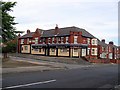
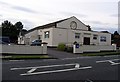
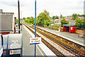
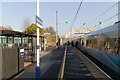
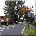
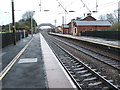
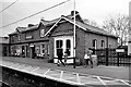

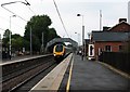
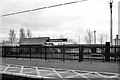
Please click the More button for more images, licensing and image copyright information.
Police
This area is policed by Durham Constabulary.
Durham Constabulary split their policing area into 71 separate neighbourhoods and this postcode is in the Chester-le-Street (Town South) neighbourhood.

Chester-le-Street (Town South) Neighbourhood Crime
Top 3 Categories
For full details of all categories together with more crime information, click on the Details button.
Member of UK Parliament
This postcode is in the North Durham parliamentary constituency.
North Durham is a constituency in the North East region of England. The seat has been held by Mr Kevan Jones (Labour) since May 2010.

Most Recent House Sales for Bullion Lane, DH2 2AL
5 Oct 2018
2 Jun 2017
9 Dec 2016
23 Aug 2016
Local Petrol Station Prices
Coordinates for DH2 2AL
Residents at DH2 2AL
Sunrise and Sunset at DH2 2AL
Traffic Emission and Congestion Zones
Historical Weather Summary
| Clear | 13.45% |
| Cloudy | 73.01% |
| Rain | 9.12% |
| Windy | 3.56% |
| Other | 0.86% |
Population
Deprivation Index
the more deprived the postcode
Average Energy Performance
Companies Registered at DH2 2AL
Postcode Details for DH2 2AL
Recent Updates
|
18 Apr 2024 Added Traffic Camera Views from Traffic Scotland to Roadworks within Scotland |
|
15 Apr 2024 Schools Data updated for April 2024 |
|
10 Apr 2024 Companies Data updated for March 2024 |
|
7 Apr 2024 New option to receive automatic updates to roadworks that affect you |
|
7 Apr 2024 Police and Crime data updated for February 2024 |
|
3 Apr 2024 Sold House Price data updated for February 2024 |
|
30 Mar 2024 Energy Performance Certificates (England and Wales) updated February 2024 |
|
28 Mar 2024 New feature to use Geolocating functions to detect your current location |
Random Postcodes
Want an idea of what is in our extensive website? Try somewhere completely random!
The Rural/Urban classification is based upon data collected during the 2011 Census and released in August 2013 and is categorised into 6 distinct classes.
[A] Urban Major conurbation: A built up area with a population of 10,000 (3,000 in Scotland) or more and is assigned to the major conurbation settlement category.
[B] Urban Minor conurbation: A built up area with a population of 10,000 (3,000 in Scotland) or more and is assigned to the minor conurbation settlement category.
[C] Urban City and town: A built up area with a population of 10,000 (3,000 in Scotland) or more and is assigned to the city and town settlement category.
[D] Rural Town and fringe
[E] Rural Village
[F] Rural Hamlet and isolated dwelling
The Index of Multiple Deprivation (IMD) is the official measure of relative deprivation.
The index is based on 39 separate indicators across seven distinct domains (Income; Employment; Health and Disability; Education, Skills and Training; Crime; Barriers to Housing and Services; Living Environment) to provide an overall measure of multiple deprivation and is calculated for every neighbourhood.
The index is relative rather than an absolute scale and so a neighbourhood with a score of 10 is more deprived than one rated 20, but this does not equate to being twice as deprived.
Please note: Different indices are used in England, Scotland, Wales and Northern Ireland and so comparison of scores from neighbourhoods in different countries should not be undertaken.
These figures report on incorporated UK companies only that are registered at this postcode and do not include sole-traders, partnerships or overseas organisations.
The population figure shown for your area are an estimate provided by the Office for National Statistics and is rounded to the nearest 1,000.
The estimates are derived from the Annual Population Survey (APS) which is the Labour Force Survey (LFS) plus various sample boosts.
There are 55 unitary authorities. They provide all local government services in their areas. These are mainly in the cities, urban areas and larger towns although there are now 6 shire county councils that are unitary (ie have no district councils beneath them).