Overview for Cavendish Close, DERBY, DE74 2NE
Introduction
Derby (DAR-bee) is a city and unitary authority area on the River Derwent in Derbyshire, England. The county is named after Derby, which was its original county town. As a unitary authority, Derby is administratively independent from Derbyshire County Council. The city's population was 261,400 in 2021.
The Romans established the town of Derventio, which was later captured by the Anglo-Saxons and then by the Vikings who made Djúra-bý one of the Five Boroughs of the Danelaw. Initially a market town, Derby grew rapidly in the industrial era and was home to Lombe's Mill, an early British factory, Derby contains the southern part of the Derwent Valley Mills World Heritage Site. With the arrival of the railways in the 19th century, Derby became a centre of the British rail industry. Despite having a cathedral since 1927, Derby did not gain city status until 1977.
Derby is a centre for advanced transport manufacturing. It is home to engine manufacturer Rolls-Royce and Alstom (formerly Bombardier Transportation) has a production facility at the Derby Litchurch Lane Works; Toyota's UK headquarters is located in the south-west of the city at Burnaston.
Summary for Cavendish Close, DERBY, DE74 2NE
Roadworks near DE74 2NE
Road Safety near DE74 2NE
Details of personal injury accidents in and around Cavendish Close, DE74 2NE that have been reported to Leicestershire Police over the past 20 years.
Traffic Levels near DE74 2NE
View traffic levels near Cavendish Close, DE74 2NE from official Department for Transport counts.
Images taken near to Cavendish Close, DE74 2NE and the surrounding area
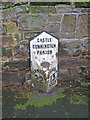
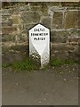
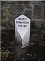
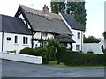

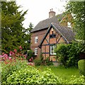
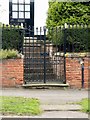

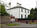
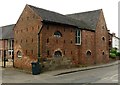
Please click the More button for more images, licensing and image copyright information.
Derby and nearby Videos From YouTube
Mists over Mackworth, Derby - Sept 2021 | 4K
Even seeing mists is often a rare thing as its takes specific combination of things to happed for it to form and hang around so I was ...
Channel: comedyhunter (View Channel)
Published: 2 Oct 2021
Police
This area is policed by Leicestershire Police.
Leicestershire Police split their policing area into 67 separate neighbourhoods and this postcode is in the Valley neighbourhood.

Valley Neighbourhood Crime
Top 3 Categories
For full details of all categories together with more crime information, click on the Details button.
Member of UK Parliament
This postcode is in the North West Leicestershire parliamentary constituency.
North West Leicestershire is a constituency in the East Midlands region of England. The seat has been held by Andrew Bridgen (Independent) since May 2010.

Most Recent House Sales for Cavendish Close, DE74 2NE
21 Dec 2022
8 Dec 2020
29 Jan 2016
29 Jan 2016
Local Petrol Station Prices
Coordinates for DE74 2NE
Residents at DE74 2NE
Sunrise and Sunset at DE74 2NE
Traffic Emission and Congestion Zones
Historical Weather Summary
| Clear | 18.75% |
| Cloudy | 58.89% |
| Rain | 6.74% |
| Windy | 15.50% |
| Other | 0.12% |
Population
Deprivation Index
the more deprived the postcode
Average Energy Performance
Companies Registered at DE74 2NE
Postcode Details for DE74 2NE
Recent Updates
|
18 Apr 2024 Added Traffic Camera Views from Traffic Scotland to Roadworks within Scotland |
|
15 Apr 2024 Schools Data updated for April 2024 |
|
10 Apr 2024 Companies Data updated for March 2024 |
|
7 Apr 2024 New option to receive automatic updates to roadworks that affect you |
|
7 Apr 2024 Police and Crime data updated for February 2024 |
|
3 Apr 2024 Sold House Price data updated for February 2024 |
|
30 Mar 2024 Energy Performance Certificates (England and Wales) updated February 2024 |
|
28 Mar 2024 New feature to use Geolocating functions to detect your current location |
Random Postcodes
Want an idea of what is in our extensive website? Try somewhere completely random!
The Rural/Urban classification is based upon data collected during the 2011 Census and released in August 2013 and is categorised into 6 distinct classes.
[A] Urban Major conurbation: A built up area with a population of 10,000 (3,000 in Scotland) or more and is assigned to the major conurbation settlement category.
[B] Urban Minor conurbation: A built up area with a population of 10,000 (3,000 in Scotland) or more and is assigned to the minor conurbation settlement category.
[C] Urban City and town: A built up area with a population of 10,000 (3,000 in Scotland) or more and is assigned to the city and town settlement category.
[D] Rural Town and fringe
[E] Rural Village
[F] Rural Hamlet and isolated dwelling
The Index of Multiple Deprivation (IMD) is the official measure of relative deprivation.
The index is based on 39 separate indicators across seven distinct domains (Income; Employment; Health and Disability; Education, Skills and Training; Crime; Barriers to Housing and Services; Living Environment) to provide an overall measure of multiple deprivation and is calculated for every neighbourhood.
The index is relative rather than an absolute scale and so a neighbourhood with a score of 10 is more deprived than one rated 20, but this does not equate to being twice as deprived.
Please note: Different indices are used in England, Scotland, Wales and Northern Ireland and so comparison of scores from neighbourhoods in different countries should not be undertaken.
These figures report on incorporated UK companies only that are registered at this postcode and do not include sole-traders, partnerships or overseas organisations.
The population figure shown for your area are an estimate provided by the Office for National Statistics and is rounded to the nearest 1,000.
The estimates are derived from the Annual Population Survey (APS) which is the Labour Force Survey (LFS) plus various sample boosts.
There are 26 county councils in 2-tier areas, providing services such as education, social services and waste disposal.
In 2-tier areas, each county council area is subdivided into districts, for which there is an independent district council. There are 192 district councils.
District councils are responsible for local services such as rubbish collection, housing and planning applications.